Creston currently has approximately 7,500 residents serviced by the Canada Post.
Rotary park was built and donated by Creston Rotary Club and is maintained by the Town of Creston.
In the park is an irregularly shaped boulder, upon which are mounted a plaque and a pair of Rotary Markers. The plaque (below) indicates that Creston's beginnings occurred in 1891. The park was opened in April of 1991, the month in 1891 that the first property within the present town of Creston was staked and filed.
Featured below, this pair of old depression era wooden elevators stands beside the highway which passes through Creston, near the western edge of town.
These two now defunct and decrepit elevators are all that ever were in Creston. The Creston Valley, being the only area in south central BC enjoying a flat, fertile valley bottom of any size, still sees cultivation of wheat, oats, barley, and canola. Even though it's not Saskatchewan or Alberta, one should not be surprised to see grain elevators here.
The southerly (red) one of the two was, through its operational life, an Alberta Wheat Pool Elevator, built in 1936 beside a United Grain Growers (white) elevator which was erected the previous year. The UGG elevator, when built, was operated by the Midland & Pacific Grain Company. They both remained in use, though privately in later years, until the early 1990s.
In 1971, as local farmers shifted to the cultivation of non-grain crops, the UGG elevator closed and was sold into private hands, while the Wheat Pool elevator remained open until its closing in 1982.
Creston, British Columbia
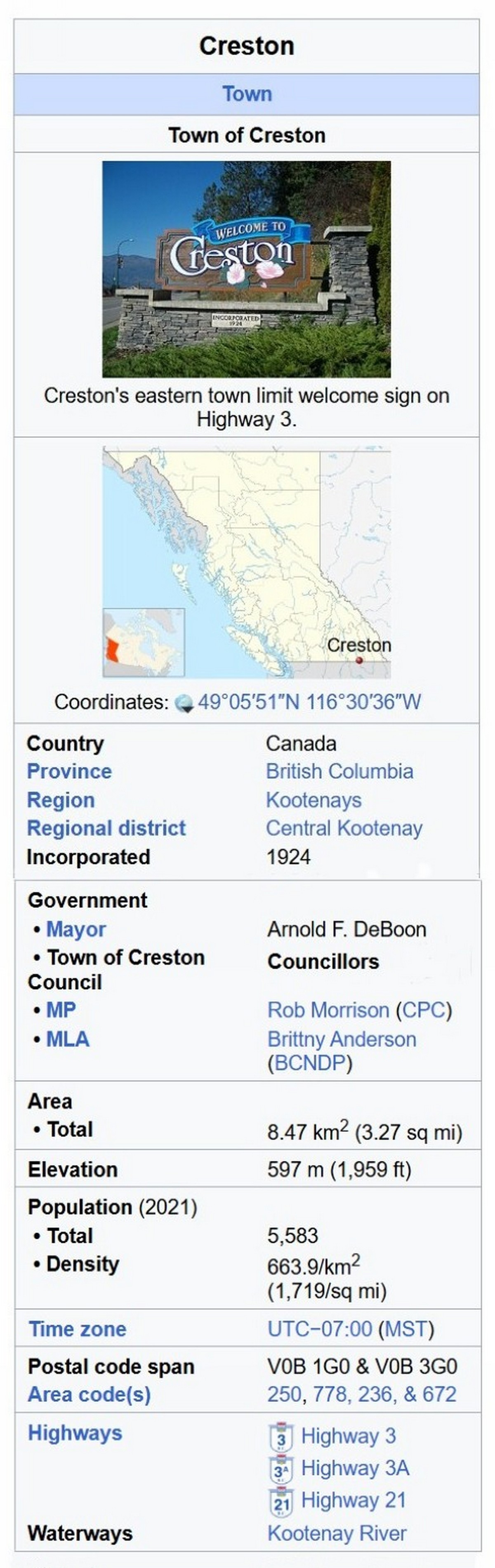
Creston is a town in the Kootenay region of southeastern British Columbia, Canada.
Geography
By road, Creston is roughly equidistant between Cranbrook (105 km (65 mi) to the east), Castlegar km (77 mi) to the west) along the Crowsnest Highway, and Nelson (123 km (76 mi) to the north-northwest). Creston is approximately 12 km (7.5 mi) north of the Porthill-Rykerts Border Crossing on the Canada–US border. Defining Creston's place as being within either the East or West Kootenays can be contentious, as some locals regard it as being in a transition space between them.
East Kootenay
The 1860 survey defined the Purcell Mountains as the east–west divide, which geographically places Creston in East Kootenay, but conversely the nearby community of Crawford Bay in West Kootenay. Prior to the opening of the highway over the Kootenay Pass from Salmo in 1963, allowing westward travel, Creston had tended to develop cultural links eastward via the only major highway of the time. Minor sports groups and teams, such as in hockey and baseball, belonged to East Kootenay leagues.
West Kootenay
An 1899 advertisement described the Creston Townsite Co. as West Kootenay Valley. Since the highest passes of the Purcells are north-northeast, Creston might be considered in the west of them.
Central Kootenay
The Creston Review, first published in 1908, took a neutral stance on which Kootenay descriptor applied best. However, for several years, a front-page banner stated: "All roads in East Kootenay and West Kootenay lead to Creston." Prior to the creation of the Regional District of Central Kootenay in 1965, Central Kootenay did not exist as a geographic concept.
History
The Lower Kootenay Band of the Ktunaxa Nation has occupied the region from time immemorial. Members would paddle their canoes across the flooded flats to harvest wild rice, one of the staples of their diet. The people called the Creston area Yaqan Nukiy, meaning "where the rock stands". The Kutenai language is noted for its uniqueness, as were the distinctive sturgeon-nosed canoes. Members reside in several local reserves
Europeans referred to this area as the Goat River district. Established in 1865, the section of the Dewdney Trail travelled southeast via present-day Wynndel and Creston, before following the Goat River valley northeastward. On an 1882 hunting trip, William A. Baillie-Grohman and Teddy Roosevelt camped in the vicinity of today's Creston. Baillie-Grohman noted the agricultural potential of the flats if protected from flooding.
Name origin
In 1891, three settlers obtained 65-hectare (160-acre) lots. Of today's town, John Wilson Dow owned the northern portion, Fred. G. Little, the centre, and John Arrowsmith, the southwestern corner. The Columbia and Kootenay Steam Navigation Company's twice-weekly sailings between Nelson and Bonners Ferry served the growing community on the edge of the flats.
The place was formerly known as Fred Little's Ranch and then as the Eighth Siding during the construction of the Canadian Pacific Railway. The name of Fisher was chosen for the initial timetable published in August 1898, assumedly after Sydney Arthur Fisher, a politician friendly to the railway.
Some confusion existed as to whether a rename to Sirdar would be adopted. Sirdar was the rank assigned to the commander-in-chief of the British-controlled Egyptian Army in the late 19th to early 20th centuries. Lord Kitchener, who had held this position, was equally honoured by the CP station of Kitchener 19 km (12 mi) northeast. Sirdar, an existing CP station 24 km (15 mi) northwest, would also have needed to be renamed in such circumstances.
Residents preferred the name Creston, which appears to have been in popular use. Fred Little selected the name after Creston, Iowa, where he had worked for the Chicago, Burlington and Quincy Railroad, which also stood at the outlet of a major water body. The residents petitioned CP to change the name from Fisher to Creston, a request CP granted before late 1899
Agriculture
About 1884, likely associated with the Baillie-Grohman reclamation plan, the first settlers arrived, cleared the slopes around today's Creston, and planted orchards, but obtained no preemptions. In the early 1890s, William Rodger and Jane Huscroft, with their large family and cattle, squatted on the flats. During 1893, crews dyked the river, but the exceptional flooding during the following spring destroyed much of the work. In partnership with the Kootenay Valley Power and Development Co., settlers completed reconstruction that year, reclaiming 3,100 ha (7,700 acres). Later deterioration of the dykes resumed annual flooding, leaving the land suitable only for hay harvests.
Apple and cherry orchards were well established by 1920s. As returning World War I veterans developed farms on the flat lands to the south, grain harvests increased. Grain elevators were built in Creston by the Midland Pacific Grain Corporation in 1935 and the Alberta Wheat Pool in 1936 and 1949. Rebuilt dyking of a few years earlier succumbed to floods in 1938 and 1948. The first annual Blossom Festival was held in 1942. In 2018, the Columbia Basin Trust acquired the two remaining abandoned elevators (1935 and 1936) with a view to restoration.
Lumber
Small sawmills were established in 1898 and around 1903. In 1907, C.O. Rodgers erected a mill at the mouth of the Goat River gorge. In partnership with D.W. Briggs, he reorganized as the Canyon City Lumber Co. in 1911. After a 1923 fire destroyed the mill, the rebuild, known as Creston Sawmills, opened in 1924. The specialized Rodgers Box Factory catered to the fruit and berry trade. The sawmill closed in 1981 and the buildings torn down. The veneer and planer mills, which closed a decade later, were also demolished.
Later community
Creston offers an infrastructure typical of a town of this size, including brewery tours, a shopping mall, golf course and a large selection of motels, hotels, and three campsites. The Ramada hotel (2012) was the first new hotel in Creston in decades
The Creston-based Kokanee Beer movie entry won a Gold Lion at the 2013 Cannes Lions International Festival of Creativity. That year, Budweiser production began at the Columbia Brewery.
The Art Deco style Tivoli Theatre (1938) and many of these 1930-ish wood-framed structures in the downtown area seek to mimic this architectural style. The long-vacant Kootenay Hotel has been transformed into a wine bar, tap-house and restaurant. The Creston Hotel has also been extensively modernized.
Climate
Creston has either an inland oceanic climate (Köppen - Cfb) or a humid continental climate (Dfb), depending on the isotherm used (0 or -3 °C (32 or 27 °F)), though rainfall patterns are such that it just barely avoids being classified as a Mediterranean climate (Csb or Dsb). Creston's climate is often modified by air masses of the Pacific Ocean origin, especially in winter. Daily maximum temperatures are usually above freezing even in January except when air masses of Arctic origin move over the area. The worst cold outbreaks may send temperatures below -30 °C (-22 °F) on rare occasions. Spring comes early by Canadian standards; trees usually start to leaf out before the end of April. A clear summer day is likely to have a mean daily maximum near or above 28 °C (82 °F); the record maximum is 41.4 °C (106.5 °F). The last spring frost typically occurs by April 22, and frost usually holds off until around October 18 where air drainage is good.
Flora and fauna
The moisture-loving western hemlock grows near the town's northern boundary; another wet-belt indicator, the western red cedar, is common in the area. The sun-loving ponderosa pine forms a larger proportion of the vegetation near Creston's southern boundary. Douglas-fir is the most common native tree throughout; other large conifers include grand fir, western larch, western white pine and lodgepole pine. Large pines other than the ponderosa are seldom seen in town, but are common in some of the woods nearby. The only native deciduous tree which matches the conifers in size is the black cottonwood. White birch and trembling aspen grow to medium size; smaller trees include the Rocky Mountain maple and bitter cherry. Prominent among the non-native trees are blue spruce, horse-chestnut, Norway maple, silver maple, and several species of walnut, including the butternut. There also are occasional examples of catalpa, chestnut, London plane, and tulip tree.
Large mammals at Creston include cougar, bear, beaver, coyote, deer, elk, moose, muskrat and river otter. More than 265 bird species occur in the Creston Valley, which is in a migration corridor for waterfowl such as geese and swans; the valley is also a wintering area for birds of prey.The Creston area hosts British Columbia's only remaining population of northern leopard frog.
Notable current and former residents
William Munroe Archibald, aviator
Johnny Bucyk, former NHL hockey player (Detroit Red Wings, Boston Bruins)
Irwin Crosthwait, painter
Aaron Douglas, actor
Jamie Huscroft, former NHL hockey player
Pascale Hutton, actress
Darren Jensen, former NHL goalie (Philadelphia Flyers)
John Gordon Perrin, volleyball player
Duncan Regehr, actor
Randy Rota, former NHL hockey player
Francis Henry Shepherd, politician and engineer
Jayli Wolf, musician and actress
From Wikipedia, the free encyclopedia