
Haynes Ranch Preservation Project - Osoyoos, British Columbia
Posted by:  T0SHEA
N 49° 05.310 W 119° 32.121
11U E 314895 N 5440389
Haynes Ranch Barn is at the junction of Road 22 / Black Sage Road and Radio Tower Road. As you continue down Road 22, cross the bridge, the signs are located near the parking area.
Waymark Code: WM17RZM
Location: British Columbia, Canada
Date Posted: 03/31/2023
Views: 0
Beginning around 1865 John Carmichael Haynes began to acquire large amounts of ranch land in the Osoyoos and Oliver areas. It was one of the first cattle ranches in the Okanagan Valley and he eventually amassed about 22,000 acres. Haynes also was judge as well as customs officer for the Osoyoos/US border crossing.
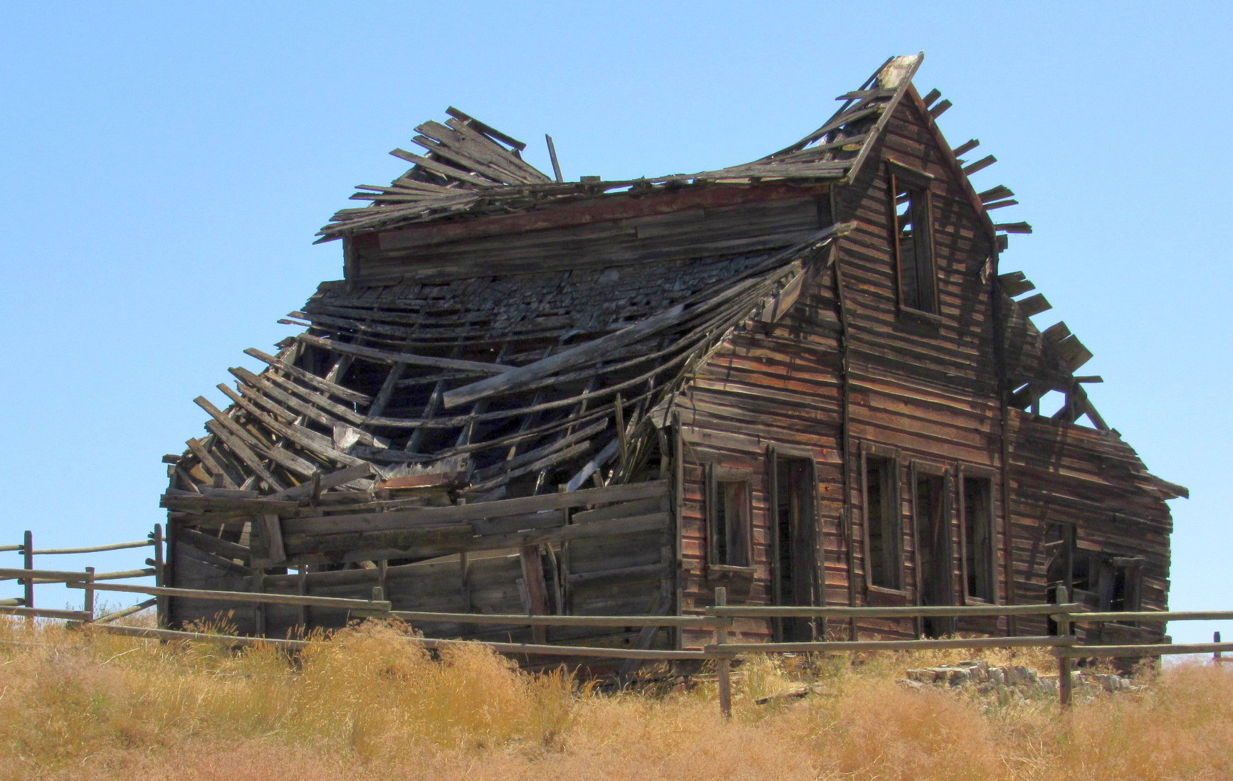
This was a very enjoyable trip down Black Sage Road and finding this old barn.
There are two other buildings across the road. The smaller the root house and the larger one possibly the bunk house. If you continue down Road 22 there is the Oxbow preservation area where the sign is located. Take time to enjoy this beautiful area.

HAYNES RANCH BUILDINGS PRESERVATION PROJECT
These buildings, on the east side of the Okanagan River date from the pioneer cattle ranching era - ongoing, as some Haynes descendants still herd Herefords!
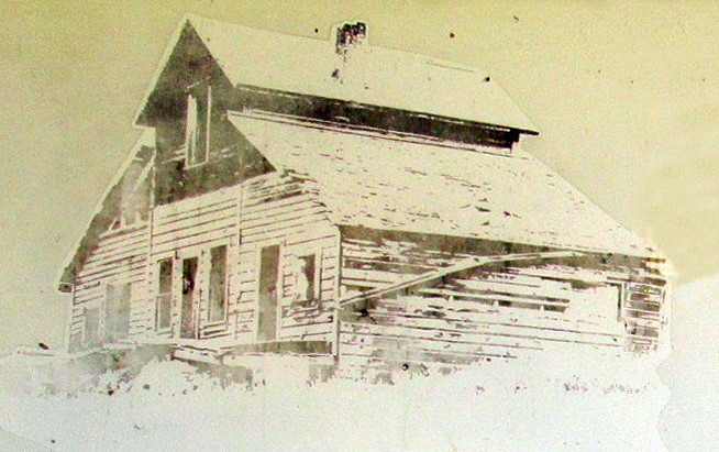
The house dates from 1860, built for Judge John Carmichael Haynes, who died in 1888. A later addition in 1875, and again in the last years of use, it was last inhabited in 1963.
* The bunkhouse was built for son, Valentine (Val) Haynes, in 1911 for work crews, etc.
* The barn was built in approximately 1906, burned down in 1914, and was rebuilt again in 1916.
* Other sheds and the ice house have long since given in to the ravage of time.
* The root house - now fallen in, is home to some of our more exotic creatures.
* The attic is now home to long-eared bats.
Okanagan Historical Society (Oliver/Osoyoos Branch)
Sign Donated By Claudia Lajeunesse
Ministry of Water. Land and Air Protection
Transcribed from sign<