
Nojoqui Falls - Advancing Falls
Posted by:  TerryDad2
N 34° 31.935 W 120° 10.578
10S E 759162 N 3824795
This unusuall water fall is actually building out from face of the cliff instead of eroding back into the cliff. The coordinates are at the parking area at the trail head.
Waymark Code: WM16H3
Location: California, United States
Date Posted: 01/31/2007
Views: 88
This is also Nojoqui Falls - Advancing Falls Earthcache.
Nojoqui (pronounced NAH-ho-wee according to a
park employee) fall is located at the transition from shale to
sandstone in the Jalama Formation. The canyon walls from the
parking lot to the falls are composed of the shale. It is a
relatively weak, easily eroded rock as can be seen by the many
small rock slides. The sandstone of the Jalama Formation is
much more resistant to erosion, so it forms the high steep
cliff of the falls.
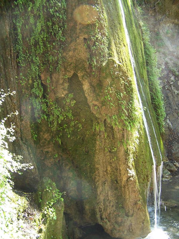 The falls form here
because there is a contact from hard sandstone to the weaker
shale at this point. Over time, the shale eroded down faster
than the sandstone, leaving the high cliff for the water to
cascade over.
The falls form here
because there is a contact from hard sandstone to the weaker
shale at this point. Over time, the shale eroded down faster
than the sandstone, leaving the high cliff for the water to
cascade over.
Typically, water flowing over rocks will erode them slowly
moving the fall upstream. However, in this case, the water is
actually depositing material on the face of the falls, moving the
falls downstream. The sandstone in the Jalama Formation is cemented
together with calcium and/or magnesium carbonate. The water in the
stream dissolves the calcium and/or magnesium carbonate in the
sandstone and then as it cascades down the falls deposits some of
it on the face of the falls as a little of the water evaporates.
This is the same process that creates stalactites in caves.
At the base of the falls is an educational panel that gives a
bit more information on the formation of the Jalama Formation and
some graphics that will be useful answering the logging
requirements.
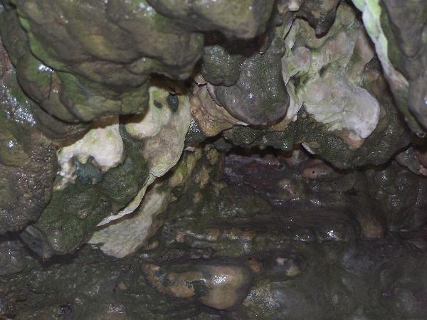 Have a look at the side of
the falls to see how the falls have been building up. A look
underneath will give you a better look at the new rock that is
being formed, but be careful if you don’t want to get wet.
Have a look at the side of
the falls to see how the falls have been building up. A look
underneath will give you a better look at the new rock that is
being formed, but be careful if you don’t want to get wet.
The above information was compiled from the following
sources:
- Santa Barbara County Parks Informational
Pannel
- Geologic Map of the Solvang Quadrangle, Thomas
W. Diblee, Jr., 1981