Church of the Good Shepherd - Taylor, British Columbia
Posted by: Groundspeak Premium Member T0SHEA
N 56° 10.040 W 120° 41.373
10V E 643459 N 6227106
Church of the Good Shepherd is next to the Peace Valley Memorial Gardens on Spruce Street N.
Waymark Code: WM14ZGN
Location: British Columbia, Canada
Date Posted: 09/18/2021
Views: 0

The Church of the Good Shepherd was built in August XCMXXXII (1932) as an Anglican Church of the Diocese of Caledonia, and remains so today. It a small white Gothic Revival church with a small bell tower over the narthex. Over the double wooden doors of the narthex is a Gothic transom bearing the name of the church and its year of construction. Atop the bell tower is a tall spire with flared eaves, topped with an Anglican cross. Gothic arched vents on three sides of the tower are covered by wooden slats.

Down each side of the nave are a pair of Gothic arched windows, at least one of which contains stained glass. At the rear of the nave is a small vestry with a Gothic arched window, now covered over.

The building rests on a concrete foundation with at least a partial basement.

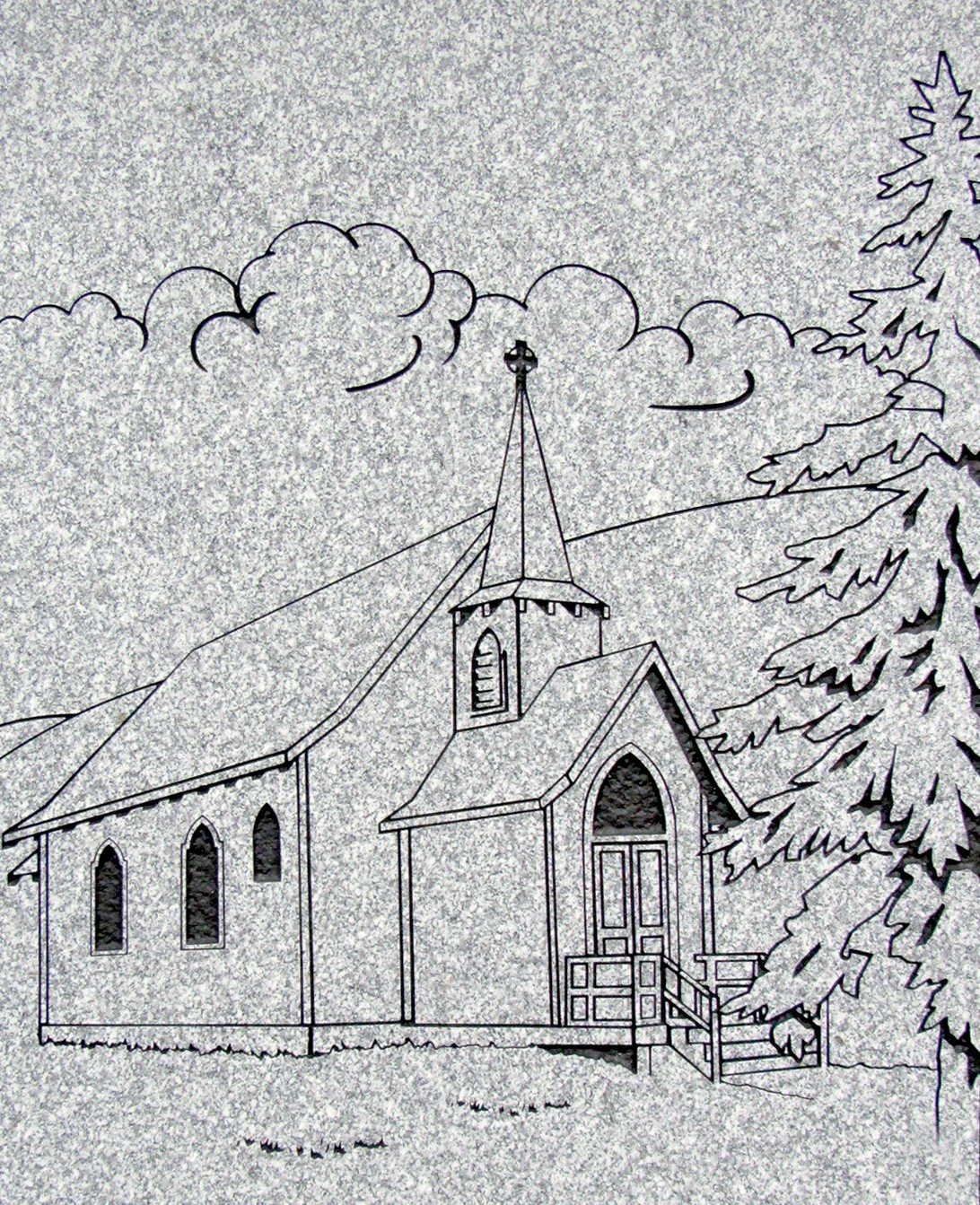
Peace Valley Memorial Gardens is in Peace River Regional District and is AKA Peace Valley Cemetery. There are approximately 242 known interments. The cemetery is very well maintained by the District of Taylor. Most of the grave marker are upright some older style intermixed with newer black markers. There is a fairly new columbarium with a granite inscription and a drawing of the nearby Church of the Good Shepherd.


The Church of the Good Shepherd
is a Memorial from Louise and Otto Hoffstrom
to their four young daughters:
Lillian, Florence, Olga, and Agnes,
who drowned accidently in the Peace River
in 1932.

Otto's car slipped from the ferry into the Peace River


Taylor, British Columbia


Taylor is in the Peace River region of beautiful British Columbia. It has approximately 1,375 residents in this small community. The town was named after Donald Herbert Taylor. It is home to the World's Invitational Gold Panning Championships held the first week in August. 2021 marks the 49th annual event, with a parade and other festivities. At the Lone wolf Golf Course is the World's Largest Golf Ball.

Type of Marker: Cultural

Type of Sign: Historic Site or Building Marker

Describe the parking that is available nearby: Street parking

What Agency placed the marker?: Taylor Historical and Archival Society

Visit Instructions:
When entering a new log for visiting a waymark please provide a picture of your visit to the location and if you have an interesting alternate area or sign photo include that.

Please include any thoughts or historic information about the area that the marker may represent.
Search for...
Geocaching.com Google Map
Google Maps
MapQuest
Bing Maps
Nearest Waymarks
Nearest British Columbia Heritage Markers
Nearest Geocaches
Create a scavenger hunt using this waymark as the center point
Recent Visits/Logs:
There are no logs for this waymark yet.