South Magnetawan 219 Bridge 3 - Armour Twp, ON
Posted by:  13acres
N 45° 37.053 W 079° 23.398
17T E 625524 N 5052816
Third of three bridges over the South Magnetawan River
Waymark Code: WM12Z4M
Location: Ontario, Canada
Date Posted: 08/11/2020
Views: 9
At mile marker 170.95 from Toronto (58.59 on the original Huntsville Sub) in the Township of Armour is the third of three bridges on the line that crosses the south branch of the Magnetawan river. This bridge is a steel 5 panel riveted Warren pony truss style with stone abutments. It is listed in the 1907 Grand Trunk Railroad Buildings & Bridges Inventory as bridge number 219 with a single span of 100 feet one half inches and was built in 1895. The abutments look like they have both had some concrete work done but some of the original stonework remains.
With information from cnr-in-ontario.com and railwaypages.com

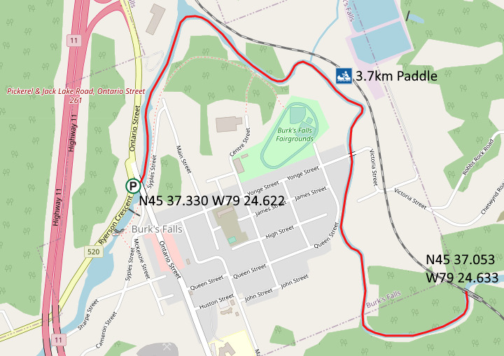
The coordinates N45° 37.053 W079° 23.398 were taken right under the centre of the west side as I was in my kayak to access this bridge.
Access
To access the bridge, make your way down Highway 520 in the village of Burk's Falls, Ontario with your paddle craft stowed. Just past the Rotary Parkette there is a widened shoulder at N45° 37.330 W079° 24.622 and a gravel path to a culvert on the river. I launched just north of the path under the Ontario Street bridge. A leisurely 3.7km paddle will bring you to where the bridge can be viewed.