79C626 - Lempriere, BC
Posted by:  T0SHEA
N 52° 28.721 W 119° 07.938
11U E 355190 N 5816417
This is where the Yellowhead Highway leaves the North Thompson River behind, trading North Thompson River Valley scenery here for Albreda River Valley scenery.
Waymark Code: WM11833
Location: British Columbia, Canada
Date Posted: 09/03/2019
Views: 1
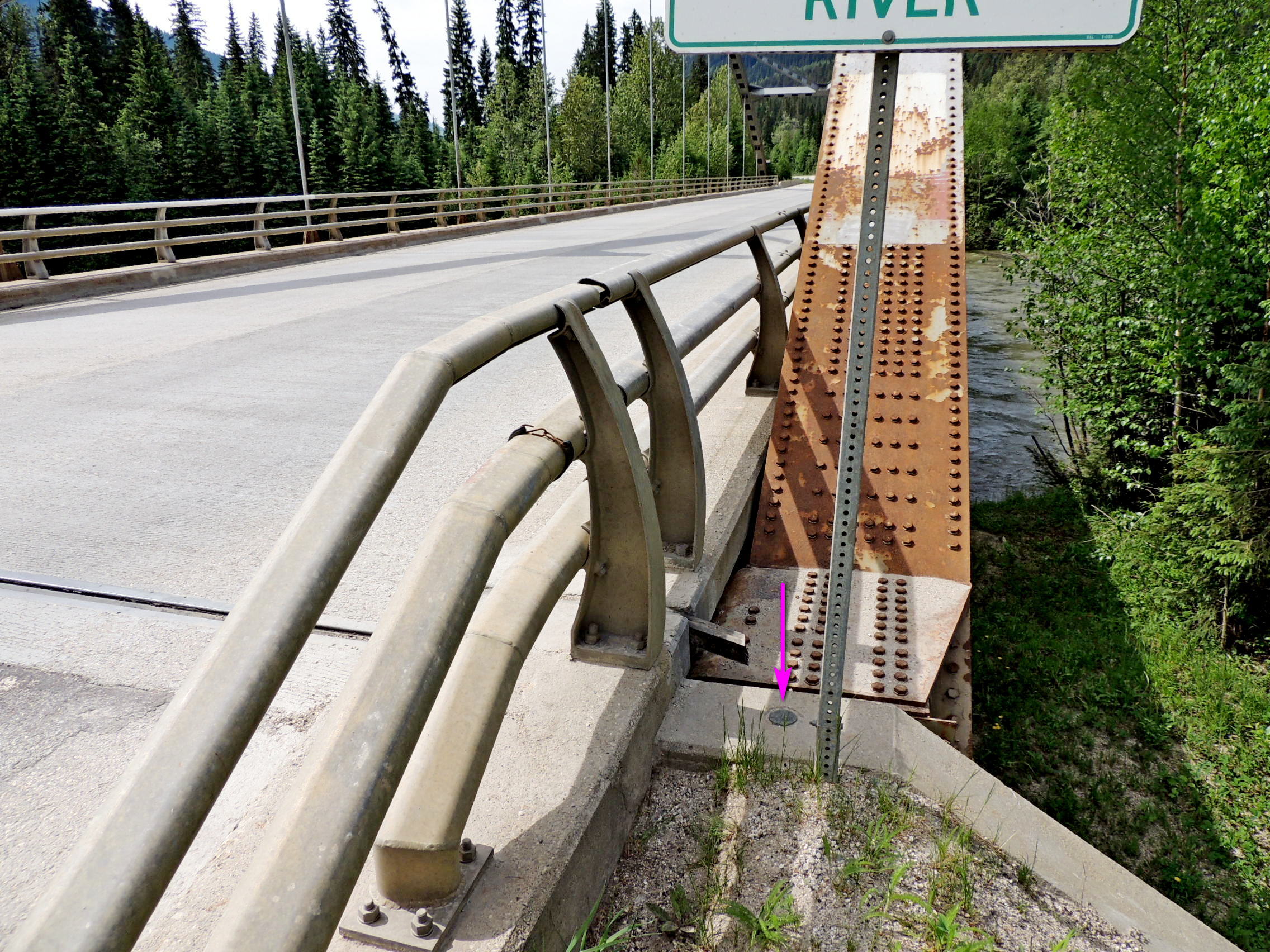
The North Thompson makes an abrupt right turn here, joins the Albreda River and begins its southward journey to meet with the South Thompson at Kamloops. Just before the river turns south, the Yellowhead crosses over on this bridge, one of the handful of steel arch bridges to be found along the Thompson River. 79C626 is monumented in the top of the west abutment of the bridge, at its north end.
Name	Province 		NTS map sheet	Unique Number
79C626	British Columbia	083D06		79C626
Lempriere
Bridge over thompson river along highway no. 5, 45.8 km southeasterly of main intersection at valemount, 11.9 km south of clemina siding access road, 3.1 km north of siding access road, 0.2 km south of a logging road, tablet in top of west abutment at north end of bridge.
From NRCAN