
01019790384 - Net Lake, ON
Posted by:  13acres
N 47° 05.936 W 079° 45.976
17T E 593621 N 5216896
Square iron bar with bronze disk marked 010790384 on an island in Net Lake
Waymark Code: WM116TB
Location: Ontario, Canada
Date Posted: 08/26/2019
Views: 1
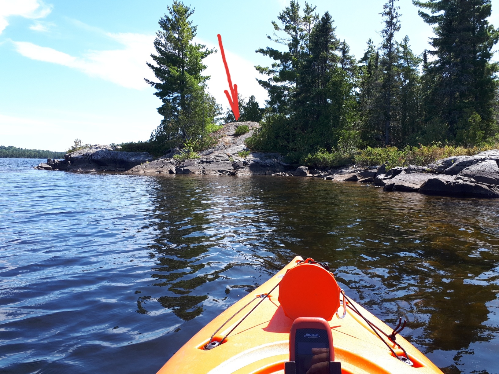
A Ministry of Natural Resources marker from 1979 located on a small rock island in Net Lake south east of the town of Temagami North. The marker is set atop the highest point of rock on the island.
Access
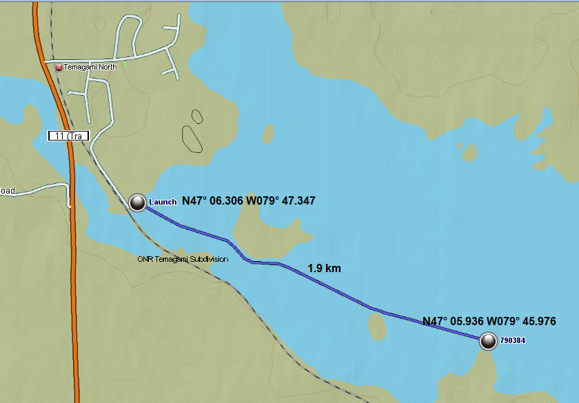
From highway 11 turn on Spruce Drive in the town of Temagami North. Turn right on Goward Avenue and left on Hillcrest Drive. Hillcrest drive becomes a trail but is quite passable in a 2wd vehicle. Follow to the boat launch at N47° 06.306 W079° 47.347 and launch your small craft. A 1.9 km paddle will get you to north side of the island where there is a good spot to disembark.
Report
Click here to go to COSINE
To get the report you will have to click on TEXT SEARCH in the lower right corner. Enter the designation 01019790384 and click search. Check the station, scroll down and click view report.