CNR Nicoamen River Bridge - Lytton, BC
Posted by:  T0SHEA
N 50° 16.069 W 121° 24.114
10U E 613890 N 5569630
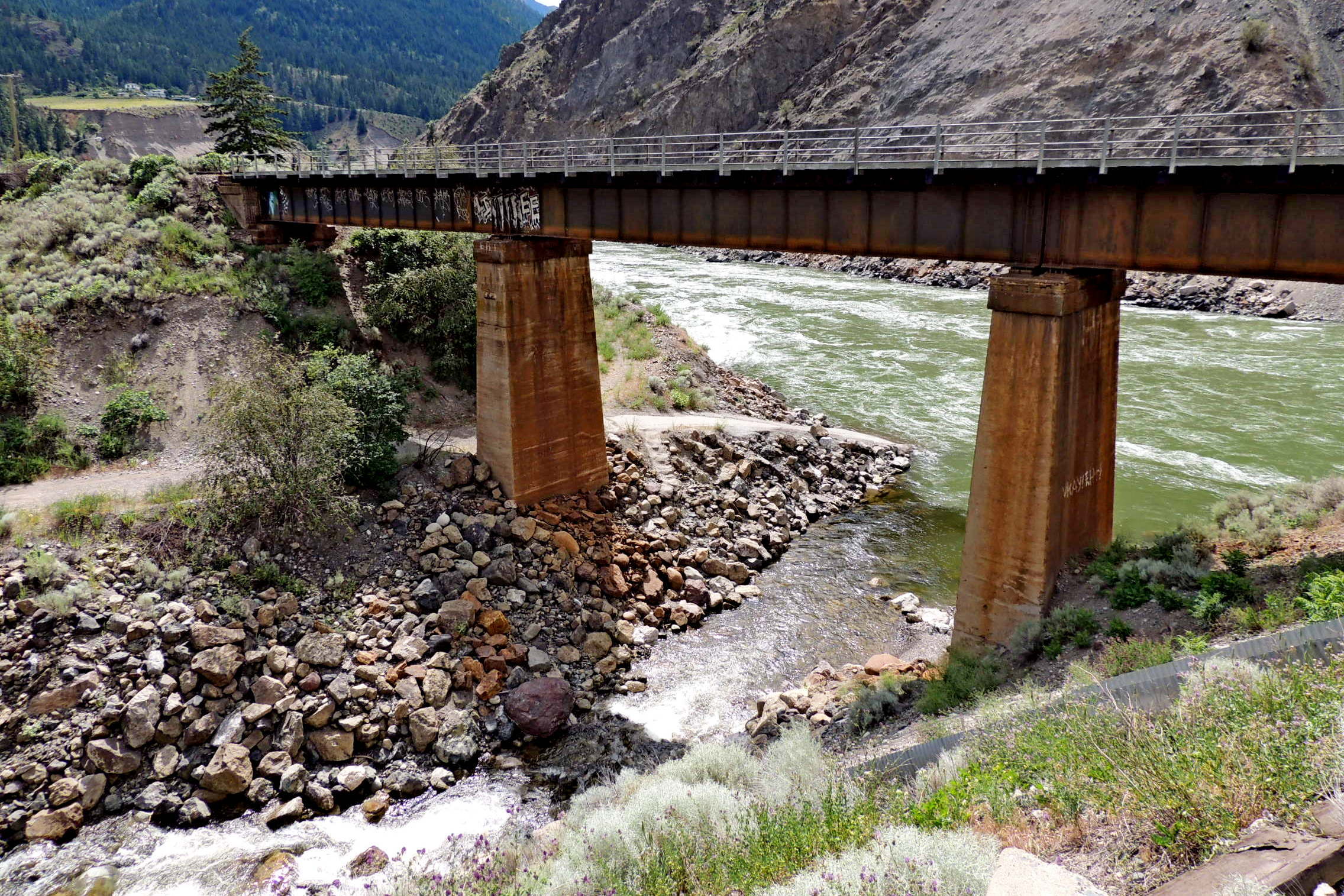
As it approaches the town of Lytton from the north, the Canadian National crosses the Nicoamen River and the TransCanada Highway almost simultaneously.
Waymark Code: WM11485
Location: British Columbia, Canada
Date Posted: 08/13/2019
Views: 1
A steel girder bridge, this may or may not be the original bridge on the site. The Canadian National Railway (CNR) was completed through the Fraser Canyon in 1913-1914. From here it heads north, runs through Kamloops then across the country to the east. About 15 kilometers to the southwest, it meets the Fraser River, crosses it at Lytton then heads down the Fraser Canyon to the coast and Vancouver.
While the Nicoamen River is smaller than some that the CNR must cross in Southern British Columbia, the bridge is nonetheless a fairly substantial one. About 135 (440 feet) in length, from north to south, it first crosses the Nicoamen River, then the TransCanada Highway, the highway crossing being a separate girder section supported both ends by concrete abutments.
Consisting of three roughly equal steel girder spans, the bridge rests on a concrete pier on each bank of the Nicoamen and heavy concrete abutments on each end. The section which crosses over the highway is considered part of the bridge.