Thompson River CNR Bridge - Lytton, BC
Posted by:  T0SHEA
N 50° 14.244 W 121° 34.860
10U E 601192 N 5565989
The Canadian National Mainline runs down the Fraser Canyon on its way to the coast and Vancouver.
Waymark Code: WM11480
Location: British Columbia, Canada
Date Posted: 08/13/2019
Views: 1
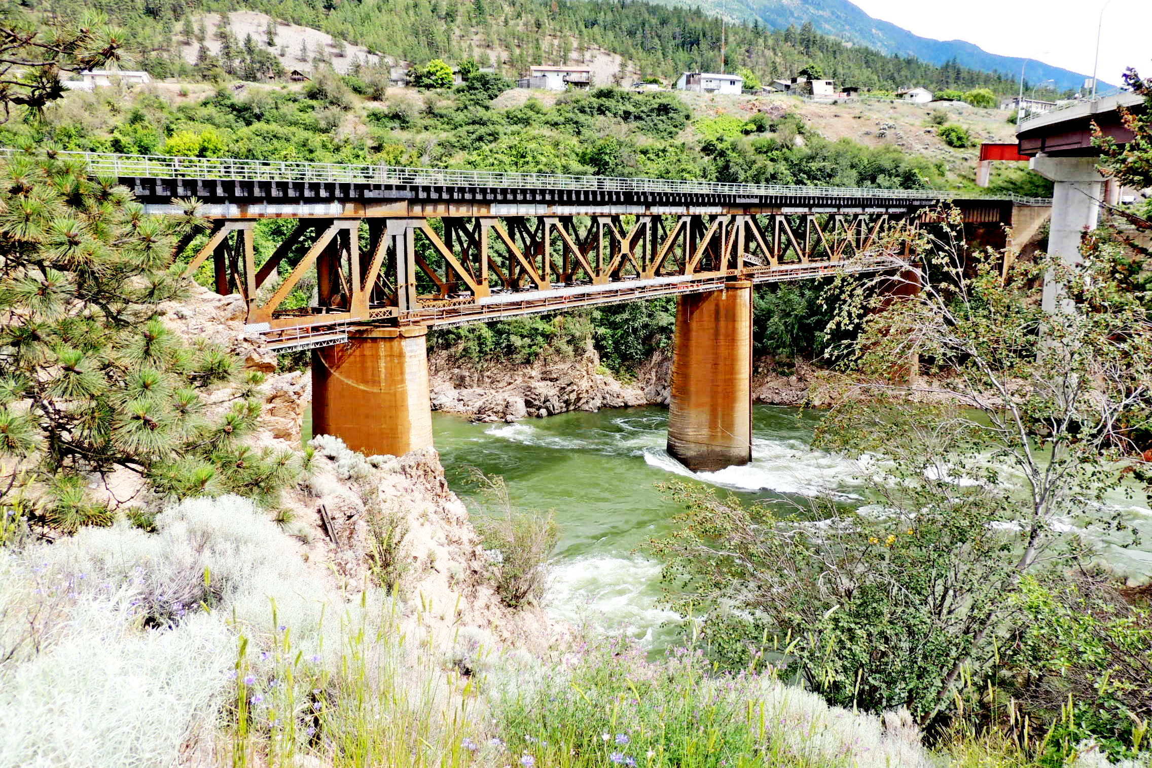
Here the Canadian National Railway (CNR) crosses one of its larger obstacles, the Thompson River, just before the Thompson empties into the Fraser, the largest river in British Columbia.
A steel Deck Truss bridge, it rests on two concrete piers in the Thompson River and two shorter piers on land at the north and south ends of the truss sections. Outboard of the three truss sections are two steel girder approach span, their outer ends resting on
massive concrete abutments. In total the bridge spans just short of 200 metres, (~660 ft).
This appears to be one of the original bridges on the CNR line, which was completed through the Fraser Canyon in 1913-1914.