|
 Bridger Rest Area - Bridger, MT Posted by:  T0SHEA T0SHEA
N 45° 20.279 W 108° 54.974
12T E 663263 N 5022609
A large pull out, or a small side road, the Bridger Rest Area is about 2.5 miles north of Bridger along Highway 310, at Reference Post 29.10.
Waymark Code: WM10G5G
Location: Montana, United States
Date Posted: 05/02/2019
Views: 2
With quite a few large trees and expanses of grass, the Bridger Rest Area is designed to accommodate both cars and RVs, as well as trucks. There is a separate, though not large, parking area for large vehicles behind an "on leash" dog walking area. Facilities at the rest area include men's and women's restrooms, two concrete picnic pavilions, the dog walking area tree shaded grassy areas and a couple of informational plaques, one relating the story of the nearby Pryor Mountains and another entity The Pryor Mountains and Raptor Country, which apprises us of the fearsome reptilian beasts which once roamed the area. See that story below.
The Montana state webpage for rest areas lists the available amenities as: Restrooms, Handicap Accessible, Historical Marker, Picnic Area, Drinking Water, Pet Area, Geological Marker.
The Pryor Mountains and Raptor Country
he Pryor Mountains are located on the horizon to the southeast. The prominent cliffs and dip slopes are Madison Limestone, which was deposited in shallow seas over 300 million years ago. Along the margins of the mountains, younger tan-colored Tensleep sandstone and brick-red Chugwater Formation crop out. Canyons in the range expose older rocks, including Precambrian basement rock more than two billion years old. Crustal blocks that form the Pryor Mountains were uplifted along reverse faults about 65-55 million years ago.
Over millions of years, water dissolved deep caves in the limestone. Some open vertically to the surface, allowing cold dense air to sink down into the cave. The rock acts as an insulator, trapping the dense air and moisture underground, resulting in spectacular ice caves, such as Big Ice Cave. Other caves in the mountains have fantastic formations of stalagmites and stalactites.
About 115 million years ago, a 10-foot long dinosaur with razor-sharp claws and teeth and retractable slashing talons on its hind feet hunted in packs in this area. Lightly-built, agile and quick, this intelligent carnivore could run at speeds up to 25 miles per hour and was the perfect killing machine of its time. In 1964, on a wind-swept hill in the badlands near here, Yale professor John Ostrom discovered the fossil remains of just such a creature. Called Deinonychus ("Terrible Claw"), the discovery of this animal revolutionized the study of paleontology and changed our understanding of dinosaurs. Because of its unique skeletal structure, Deinonychus had more in common with birds than it did reptiles. The great amount of energy needed for it to survive has also led some to believe that it was warm-blooded rather than cold-blooded like its reptilian cousins. Because of Deinonychus, paleontologists now consider dinosaurs to have been agile, smart, and social animals rather than slow-moving and dull-witted. Fortunately for us, Deinonychus died out millions of years ago and no longer scours these hills for prey.
From the plaque at the rest area 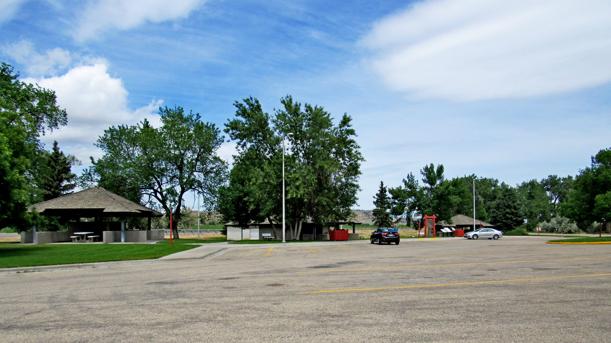
Highway Number: 310

Highway Access Direction: Either Direction
Rest Area Name: Bridger Rest Area
Facilities:
Restrooms, Handicap Accessible, Historical Marker, Picnic Area, Drinking Water, Pet Area, Geological Marker.
Services:
None
Special Features:
THE PRYOR MOUNTAINS
The Pryor Mountains to the east cover roughly 300,000 acres. Once entirely Crow Indian territory, now only the north end of the range is on the Crow Reservation. The south end is in the Custer National Forest. The range is bound on the east by Bighorn Reservoir and on the south by the Pryor Mountain National Wild Horse Range. The mountains came by their name indirectly from Pryor Creek, which Captain William Clark named for Lewis and Clark Expedition member Sergeant Nathaniel Pryor.
The Pryors hold many intriguing features, including ice caves, sinks, and caverns, and archeological finds, such as Clovis Points indicating human occupation as long as 10,000 years ago. In the south end at the range, remains of log and frame houses and barns attest to the homesteads staked after passage of the Forest Homestead Act in 1906. Most of the settlers came from this area Though they cultivated some crops, for many homesteading was a pretense for mountain grazing on adjacent forest and reservation ranges One forest ranger observed that some claimants had applied for places where it would be impossible to winter over, though to hear them talk "one would think that Pryor Mountain contained the biggest part of the Banana Belt and that pineapples grew wild."
Common Name for the Highway: Not listed
WiFi: Not Listed
|
Visit Instructions:
Since the cleanliness of a facility can change over time, log entries can include your impression of the cleanliness of the facility.
Log entries can also include additional pictures of the facility and/or associated special features (e.g., vistas or historical markers) and facilities or services not mentioned in the original description.
The same prohibitions from new entries apply to log entries.
Recent Visits/Logs:
| There are no logs for this waymark yet. |
|
|
|
|