|
 J. Harlen Bretz - Dry Falls State Park - Coulee City, WA Posted by:  T0SHEA T0SHEA
N 47° 36.398 W 119° 21.878
11T E 322277 N 5275290
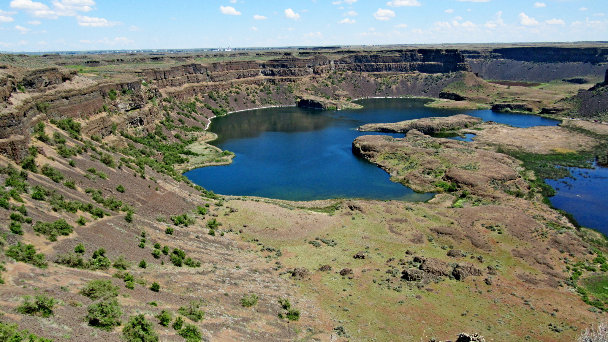
In central Washington, Grand Coulee was once the site of the world's largest waterfall.
Waymark Code: WMZTXF
Location: Washington, United States
Date Posted: 01/05/2019
Views: 1
At the end of the last ice age, huge lakes formed behind dams of ice, eventually breaking through the dams, releasing their water in vast floods. One of the most notable of these was Glacial Lake Missoula, which, when it unleashed its water, flooded a large portion of Washington and Oregon states. The huge volume of water, travelling at up to 60 miles per hour, scoured the countryside, carving out many large valleys and canyons, the Grand Coulee being one.
One of the more notable features left by the floods is Dry Falls in Washington's Grant County. A 3.5-mile wide and 400-foot tall waterfall, it is shown in the photo below. Surrounding Dry Falls is Dry Falls State Park. As well as a showcase of natural wonder, this is a recreational park, a 3,774-acre camping park with 73,640 feet of freshwater shoreline and 15 miles of hiking trails.
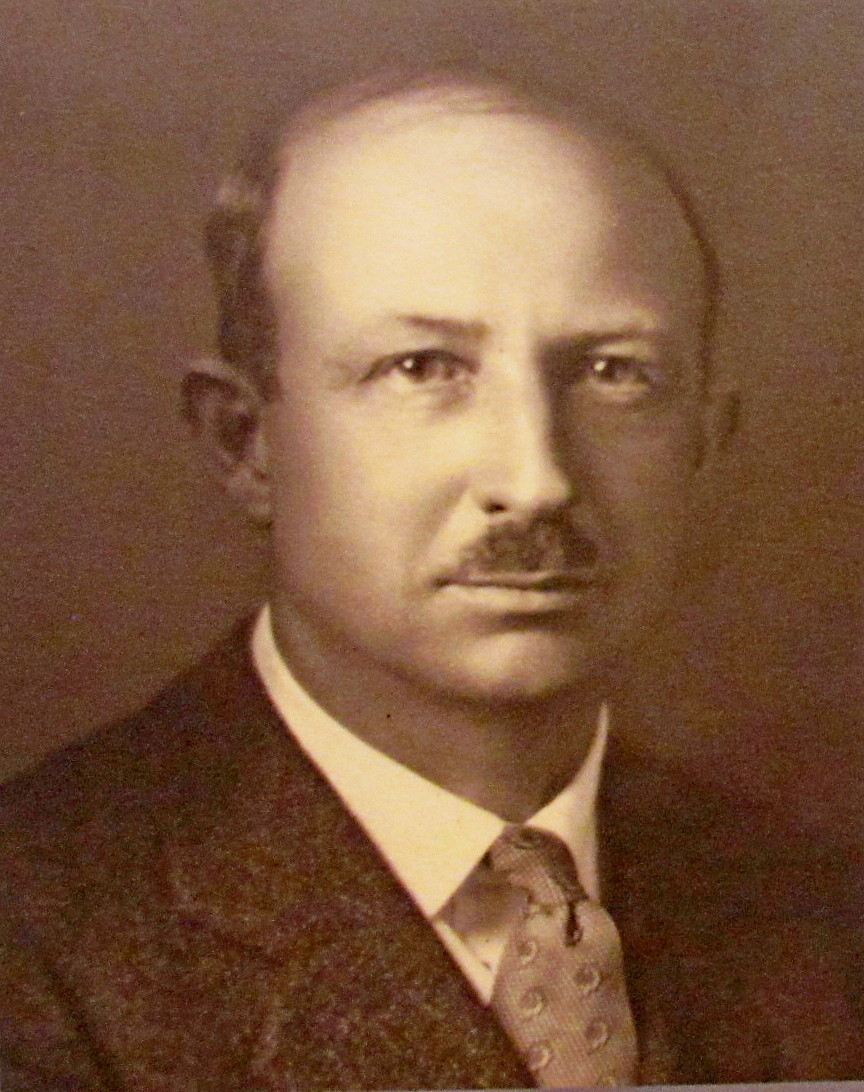
In the park is the Dry Falls Visitor Center, an interpretive centre relating the story of the creation of Dry Falls and Grand Coulee itself. Within are several plaques and signs telling the Dry Falls story, a diorama of the local topography, tourism and other informational brochures and a well stocked gift and souvenir shop. Outside the building's entrance is an ice cream stand which does a landslide business on hot days. At the northeast corner of the visitor centre is a low stone plinth, behind which is a flagpole. Mounted on the upper face of the plinth is a bronze plaque dedicated to one J. Harlen Bretz, the man who put all the pieces together and deduced the theory of the Great Missoula Lake Floods.
After studying the Washington scablands for several years, flying in the face of "conventional wisdom", Bretz proposed the theory of ice age floods as the only reasonable explanation for what he had seen there. While he initially faced great opposition to his theory, it eventually came to be accepted as correct. For his breakthrough work in geology, in 1979, at age 96, he received the Penrose Medal, geology's highest honor.
Excerpts from a very comprehensive biography of Harlen Bretz follow.
DEDICATED TO
J. HARLEN BRETZ
WHO PATIENTLY TAUGHT US THAT
CATASTROPHIC FLOODS MAY SOMETIMES
PLAY A ROLE IN NATURE'S UNFOLDING DRAMA
"IDEAS WITHOUT PRECEDENT
ARE SOMETIMES LOOKED UPON
WITH DISFAVOR AND MEN ARE SHOCKED
IF THEIR CONCEPTIONS OF
AN ORDERLY WORLD ARE CHALLENGED."
J. HARLEN BRETZ
1994
Bretz, J. Harlen (1882-1981), Geologist
Harlen Bretz was a geologist who launched one of the great controversies of modern science by arguing, in the 1920s, that the deep canyons and pockmarked buttes of the arid "scablands" of Eastern Washington had been created by a sudden, catastrophic flood -- not, as most of his peers believed, by eons of gradual erosion. It was a bold challenge to the prevailing principle of "uniformitarianism," which held that the earth was shaped by processes that can be observed in the present. Since a flood of the almost Biblical proportions envisioned by Bretz had never been seen, the idea was dismissed as a throwback to the pre-scientific doctrine of "catastrophism." Not until the 1940s did other geologists begin to present new evidence supporting the flood theory. Satellite imagery in the 1970s provided the final vindication. Bretz had the satisfaction of living long enough to see his once heretical ideas become the new orthodoxy. In 1979, at age 96, he received the Penrose Medal, geology's highest honor. He later reportedly told his son: "All my enemies are dead, so I have no one to gloat over" ( Smithsonian)...
...Bretz began to explore the scablands -- so named because parts resemble partially healed wounds cut deep into the epidermis of earth -- in the summer of 1922. He returned every summer for the next seven years, usually accompanied by his wife, their two young children (Rudolph, born in Seattle in 1914, and Rhoda, born in Chicago in 1918), a collie dog, and several students. They traveled west in a Dodge sedan, with a tent on the front bumper, a grub box on the back, and bedrolls tied to the sides. It was gumshoe geology, much of it done on foot because the terrain was too rugged for motor vehicles, trying to unlock the mysteries of one of the most unusual places on earth.
" Outrageous Hypothesis"
Bretz had built a modest reputation as an expert on stream and glacial erosion by the time he turned his attention to the scablands. He quickly became convinced that neither kind of erosion could account for what he saw there: huge, dry channels; great chunks of prairie stripped down to bare basalt; massive boulders of granite scattered in places far from any natural source of granite; circular divots in the earth that were so big, cattle could be hidden in them; cataracts -- one five times as wide as Niagara -- that had once clearly been waterfalls, in an area that gets less rainfall in a year than Seattle does in a month. The depth of the channels, the fact that the channel bottoms were filled with coarse gravel carried in from outside the area, the scouring of the basalt bedrock: to Bretz, all this suggested a sudden, violent flood.
Bretz introduced his flood theory in a paper published in late 1923. He included a detailed geomorphic map of what he called "the Channeled Scabland," showing a network of branching and interconnecting channels that he concluded could only have been carved by a fast and furious inundation. "All other hypotheses meet fatal objections," he wrote. "These remarkable records of running water on the Columbia Plateau and in the valleys of the Snake and Columbia Rivers cannot be interpreted in terms of ordinary river action and ordinary valley development." He concluded with a simple statement: "It was a debacle which swept the Columbia Plateau" (Bretz, 1923, pp. 621, 649).
The reaction from the geologic community was, in a word, glacial. Since the 1790s, the science of geology had been framed by the principle of "uniformitarianism": the idea that geologic change in the past resulted from the same slow, steady processes at work today. Bretz's flood, with elements that suggested the Biblical story of Noah, seemed like a reversion to a pre-scientific era. It was, said one critic, an "outrageous hypothesis."
From History Link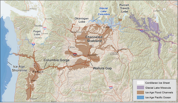
Website with more information on either the memorial or the person(s) it is dedicated to: [Web Link]

Location: Dry Falls State Park
|
Visit Instructions:
Add another photo of the memorial. You and/or your GPS can be in the photo, but this isn't necessary.
Recent Visits/Logs:
| There are no logs for this waymark yet. |
|
|
|
|