|
Etang de Comte
Fr: L'étang de Comte, à 1 726 mètres d'altitude dans les Pyrénées ariégeoises, fait surtout l'objet d'une formidable randonnée en famille.
(1480 m).Le sentier balisé en jaune remonte la hêtraie et prend un vieux chemin dallé, parfois raide. Il s'adoucit ensuite et continue le long d'un ruisseau .
On traverse la magnifique jasse de Mourguillou : des pâturages où l'on rencontre les chevaux de Mérens, près du petit étang Estagnol (1 652 m) .
De la suivre le chemin balisé en jaune qui longe le ruisseau et escalade un petit verrou. Arrivé à l'étang de Comte (1 726 m) dont l'on peut faire le tour.
Pour le retour descendre par le même itinéraire jusqu à un passage à gué (1 645 m), en contre bas de l’Estagnol .Suivre les balises jaunes rive droite.Le sentier en sous-bois suit ensuite le ruisseau et retrouve le sous-bois.
Au pont de pierres (1 538 m). On retrouve le sentier emprunté à l’aller pour rejoindre le parking.
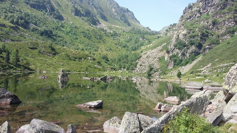
En:The pond of Comte, to 1726 meters of altitude in the Ariège Pyrenees, is especially the object of a formidable hike in family.
(1480 m).The trail marked in yellow goes up the beech forest and takes an old paved road, sometimes steep. It then softens and continues along a stream.
We cross the magnificent jasse Mourguillou: pastures where we meet the horses Mérens, near the small pond Estagnol (1 652 m).
To follow the path marked in yellow along the stream and climbing a small lock. Arrived at the pond of Comte (1726 m) which one can make the turn.
For the return down the same route to a crossing (1 645 m), against the bottom of the Estagnol. Follow the yellow markers right bank. The path in the undergrowth then follows the stream and find the undergrowth.
At the stone bridge (1,538 m). We find the path taken to go to the parking lot.
|