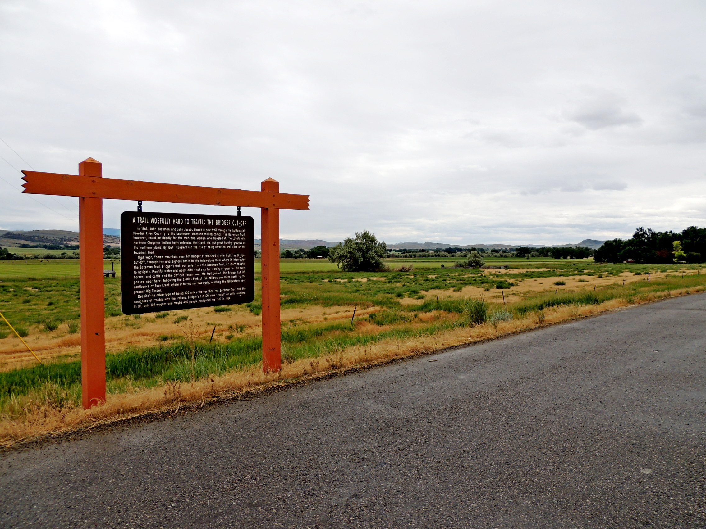
A Trail Woefully Hard To Travel: The Bridger Cutoff - Bridger MT
Posted by: Groundspeak Premium Member T0SHEA
N 45° 16.742 W 108° 55.079
12T E 663296 N 5016056
At a small pullout on the east side of Highway 310 just south of Peters Road, this Montana State Highway Marker is less than a mile south of the town of Bridger, MT.
Waymark Code: WMW691
Location: Montana, United States
Date Posted: 07/15/2017
Published By:Groundspeak Premium Member ZenPanda
Views: 2

At one time a different sign hung here, "Raptor Country". A smaller "Raptor Country" plaque has since been installed at the rest area along Highway 310 at Sand Creek Road about 2.5 miles north of Bridger, the larger one being replaced by this sign.

TRAIL WOEFULLY HARD TO TRAVEL:
THE BRIDGER CUTOFF
In 1863, John Bozeman and John Jacobs blazed a new trail through the buffalo rich Powder River Country to the southwest Montana mining camps. The Bozeman Trail, however, could be deadly for the men and women who traveled it. The Lakota and Northern Cheyenne Indians hotly defended their land, the last great hunting grounds on the northern plains. By 1864, travelers ran the risk of being attacked and killed on the Bozeman Trail.

That year, famed mountain man Jim Bridger established a new trail, the Bridger Cut-Off, through the arid Bighorn Basin to the Yellowstone River where it intersected the Bozeman Trail. Bridger's trail was safer than the Bozeman Trail, but much tougher to navigate. Plentiful water and wood, didn't make up for scarcity of grass for the oxen, horses, and cattle and the difficult terrain over [which] the trail passed. The Bridger Cut-Off passed near here, following the Clark's Fork of the Yellowstone River north to the confluence of Rock Creek where it turned northwesterly, reaching the Yellowstone near present Big Timber.

Despite the advantage of being 100 miles shorter than the Bozeman Trail and the avoidance of trouble with the Indians, Bridger's Cut-Off never caught on with trailers. In all, only 129 wagons and maybe 450 people navigated the trail in 1864.
Photo goes Here
A TRAIL WOEFULLY HARD TO TRAVEL
Describe the area and history:
In the distance to the east is the Clarks Fork of the Yellowstone River, the route followed by The Bridger Cutoff. The route followed the Clarks Fork some 30 miles north from here, then turned northwest to eventually meet the Bozeman Trail near the town of Big Timber.


Visit Instructions:
Please describe your visit- The good, the bad & the ugly. :)
Search for...
Geocaching.com Google Map
Google Maps
MapQuest
Bing Maps
Nearest Waymarks
Nearest Montana Historical Markers
Nearest Geocaches
Create a scavenger hunt using this waymark as the center point
Recent Visits/Logs:
There are no logs for this waymark yet.