
Cheonbong Mountain Relief Map - Sangju, Korea
Posted by:  silverquill
N 36° 25.572 E 128° 09.059
52S E 423892 N 4031556
This relief map shows the trails of Cheonbong Moutain north of Sangju Korea.
Waymark Code: WMM2R7
Location: Gyeongsang buk do, South Korea
Date Posted: 07/10/2014
Views: 1
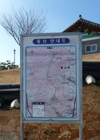
This relief map marks the trail system over Cheonbong Mountain on the north side of Sangju, Korea. The trails start here at the site of the Bukcheon Battlefield where Korean Military and volunteer militia fought one of the first battles of the Imjin War against the invading Japanese force who were ultimately repelled in a decisive naval battle. The trails range from about a mile (1,500m) to a mile and a half (2.341m). One of them leads to a remote Buddhist temple.