
Horseshoe Pond Dam - Wareham, MA
Posted by:  silverquill
N 41° 45.920 W 070° 44.854
19T E 354737 N 4625197
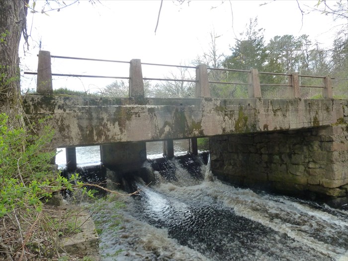
This six-foot high dam on the Weweeantic River was built in 1920.
Waymark Code: WMKPBG
Location: Massachusetts, United States
Date Posted: 05/10/2014
Views: 5
From the
Buzzards Bay National Estuary Program
Beginning in the town of Wareham, the Weweantic River system is one of the Bay areas largest subwatersheds encompassing 55,438 acres in the towns of Wareham, Carver, Rochester, and Middleborough. Land use is dominated by cranberry production and the upper reaches of the Weweantic are intermingled with bog operations. The Weweantic River currently has no significant population of herring.
The major spawning area on the river is Horseshoe Pond which is a relatively short distance from the farthest extent of tidal influence. The entrance into the Pond for migrating herring is obstructed by a dam which prevents the river system from sustaining its maximum herring population. According to estimates performed by the Massachusetts Division of Marine Fisheries, the river has an estimated possible annual production of approximately 100,000 fish per year.
Also from the
Buzzards Bay National Estuary Program
Buzzards Bay Drainage
Weweantic River
Anadromous Species Present: herring, smelt, white perch, tomcod
Obstruction # 1: Horseshoe Pond Dam
Width 44.5 ft
Height 6.0 ft.
Impoundment 59 acres
The Weweantic River has its source in swamplands of Middleborough and Carver. The upper reaches of the system are tied to a complex system of cranberry bogs and their associated reservoirs, obstructing dams
and water withdrawals. The lower section, however, does have potential for anadromous fish development.
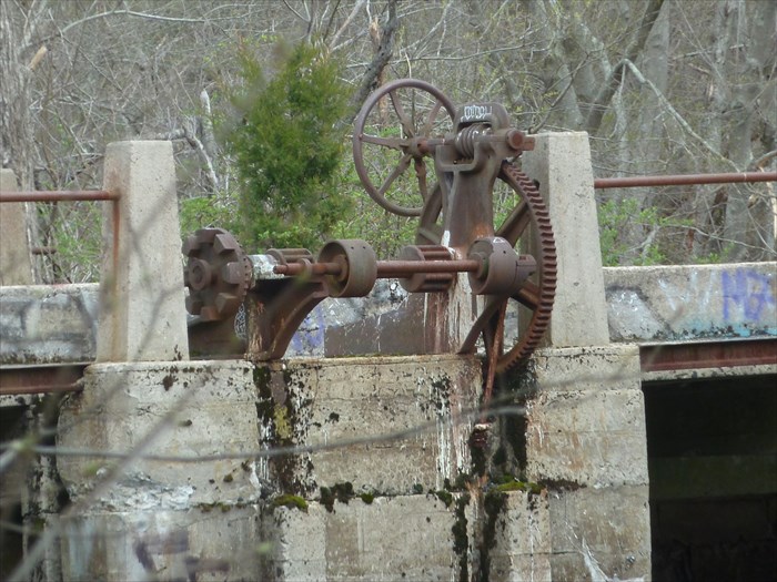
The first obstruction to fish passage is just above the point of tidal influence. This 6 foot dam creates a 59 acre impoundment called Horseshoe Pond. An old millrace is capable of passing fish under ideal flow conditions although its entrance location is too far downstream of the dam.
A Denil fishway has been designed for this location and, until funding for construction is secured, modifications to the millrace could provide improved passage into the pond.