
Lawrenceville-Brunswick Municipal Airport - Lawrenceville, VA
Posted by:  showbizkid
N 36° 46.267 W 077° 47.537
18S E 250782 N 4073119
Lawrenceville/Brunswick Municipal Airport is also known as Pappy Ellis Field.
Waymark Code: WMKFF
Location: Virginia, United States
Date Posted: 08/08/2006
Views: 15
Lawrenceville-Brunswick Airport has a paved, lighted 3,200 foot runway and hangers. Four aircraft are based out of LVL. This is a pretty quiet airport surrounded by woods and farms. The beacon here is a USGS benchmark.
To record your own visit to this waymark, take and post your own photo of the waymark with your log. Logs must contain an original photo as proof of your visit, please. 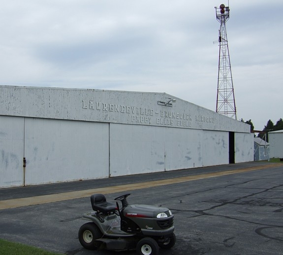
Type: Municipal

ICAO Airport Code: LVL
IATA Airport Code: Not listed
FAA Identifier: Not listed
|
Visit Instructions:
You must post at least one photo with your log. You do not have to enter the airport or go through security to log a waymark, as long as you can prove in your photo that you were actually there. Next, write a little about your visit. What were your travel plans? Where are you flying to and from? ect.
Recent Visits/Logs:
| There are no logs for this waymark yet. |
|
|
|