|
 Nolcovská Mogura (1059m) - Greater Fatra, Slovakia Posted by:  Rikitan Rikitan
N 49° 05.803 E 019° 06.725
34U E 362183 N 5439924
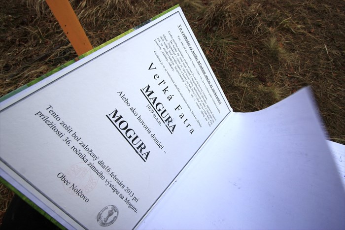
Summit register on the top of grassy hill called Nolcovska Mogura (1,059 metres / 3,474 feet ASL) in Greater Fatra mountains, central Slovakia.
Waymark Code: WMJVGN
Location: Žilinský kraj, Slovakia
Date Posted: 01/03/2014
Views: 17

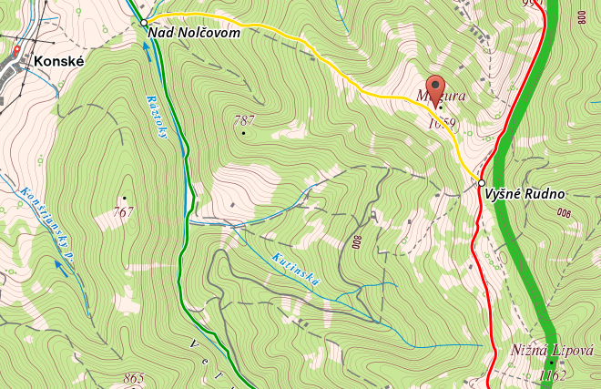
Summit register is placed at the top of Nolcovska Mogura hill (1,059 metres / 3,474 feet ASL), wide grassy meadow in northernmost part of Greater Fatra mountains, central Slovakia.
Book was installed in typical metal box here on 16/Feb/2013 by hikers from nearby village Nolcovo. There's a local tradition to hike this hill every winter - this was 36th anniversary.
Routes:
Looking at the slovak hiking map,
there are basically three options to climb Nolcovska Mogura:
- red trail from north (main ridge of Greater Fatra mountains)
- red trail from south (Lubochnianske saddle) - 3kms, 325m up, 60m down, time: 1:15
- round-hike from village Nolcovo - yellow, red and green trail - 12.2km, 845m up/down, time: 4:50
Sources / More information: own visit and pictures, hiking.sk hikeplanner tool

Vrcholova kniha na Nolcovskej Mogure (1,059m.n.m.) je umiestnena na vrcholovom razcestniku v obvyklej kovovej schranke.
Nolcovska Mogura je vyvyseny pasienok v severnej casti Velkej Fatry s krasnym vyhladom ponad Turiec, oplati sa sem pozriet.
Knihu sem priniesli nolcovski turisti pocas ich tradicneho zimneho vystupu, ktory sa v roku 2013 konal uz 36-ty krat.
Pristup:
Dostanete sa sem v zasade z troch stran, staci si vybrat jednu zo znacenych turistickych tras:
- cervena od severu: klasicky hrebenom Velkej Fatry tu ukoncit hrebenovku
- cervena z juhu: od Lubochnianskeho sedla je to vystup zhruba na hodinu aj nieco (325m hore)
- okruh z dediny Nolcovo po zltej - cervenej - a zelenej: cca 12.2km, 845m hore/dole, cas: 4:50
Viac informácií / zdroj: mapa, vlastna tura a fotky
Visit Instructions:
Up to the Waymark owner
Recent Visits/Logs:
| There are no logs for this waymark yet. |
|
|
|
|