|
 Anchorage Aloft! - Earthquake park - Anchorage, AK Posted by:  Lat34North Lat34North
N 61° 11.858 W 149° 58.752
6V E 339908 N 6788449
This marker is located in Earthquake Park located on W Northern Lights Blvd. It is also accessible from the Tony Knowles Bicycle Trail.
Waymark Code: WMJ28Y
Location: Alaska, United States
Date Posted: 09/11/2013
Views: 7
Anchorage Aloft!
Few places on earth the air transportation more than Alaska. Towns and villages are isolated, with few roads and even fewer places to build them. Since 1913, when the first tractor biplane was brought to the Anchorage area, Alaskans have pioneered northern flying and tied together a geographically diverse and difficult territory.
In 1923, Anchorage boasted its first airport - where Delaney Park is today. Merrill Field was built in 1930, and in 1945 recorded more civilian flights then New York’s LaGuardia airport did in that year.
Today, Merrill Field remains one of the busiest small-plane airports in the United States. Anchorage’s International Airport host 30 air carriers, and the Lake Hood Seaplane Base ranks #1 nationally in float plane takeoffs and landings.
World War II
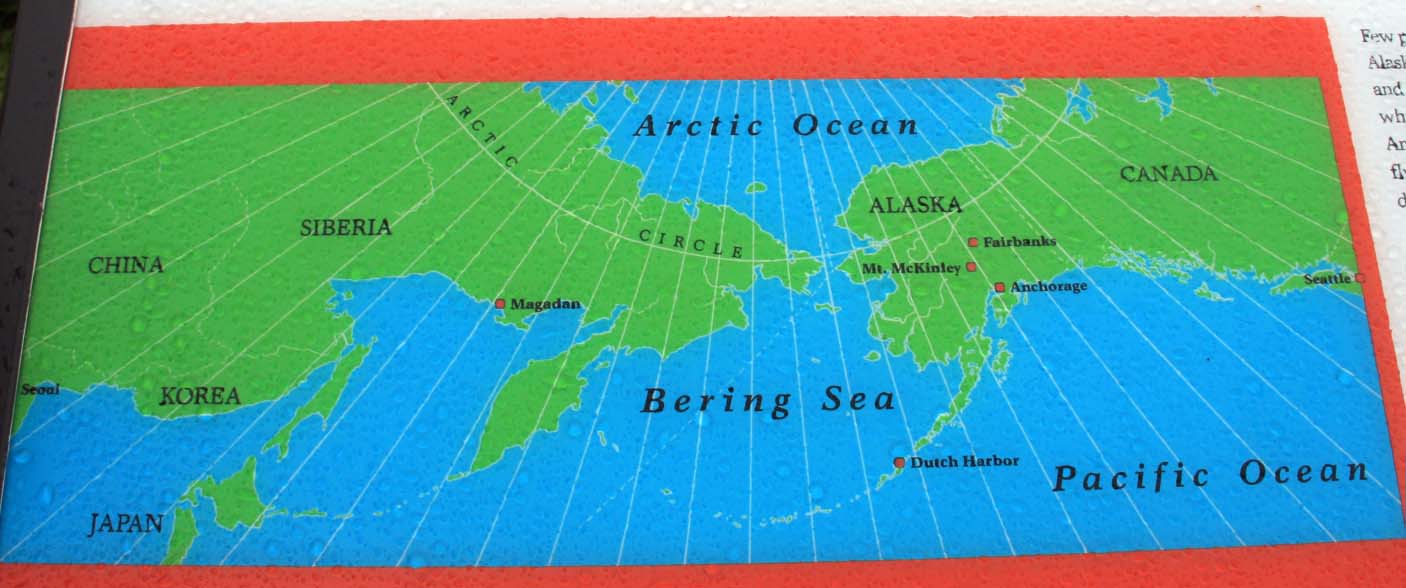
By 1940, it was apparent to the military that Alaska would play a vital role in the defense of the United States. By 1941, two military bases were built on the outskirts of Anchorage - Fort Richardson and Elmendorf Air Force Base. These bases supported the only WW II campaign fought on North American soil - the Aleutian Campaign. The Aleutian Islands stretch for thousands of miles out into the Pacific Ocean. In June, 1942, the Japanese bombed Dutch Harbor and occupied the Western Aleutian Islands. In spite of terrible storms, the two year air war over the isolated islands resulted in American victory over the invading forces.
More Information:
Wikipedia: Ted Stevens Anchorage International Airport
Wikipedia: Battle of Midway - Aleutian invasion
Wikipedia: Aleutian Islands Campaign
Marker Name: Anchorage Aloft!

Marker Type: Roadside
Addtional Information:
The Japanese bombed Dutch Harbor on June 3 and 4 and then invaded Kiska on June 6, and Attu on June 7, 1942. The Japanese plan was to draw the American Navy north from its base in Pearl Harbor while it attacked Midway Island. The Americans had broken the Japanese naval code and positions its fleet NE of Midway. In a decisive air battle the American sunk 4 Japanese Aircraft carriers while only losing one US carrier.
The American retook Attu in the Battle of Attu, which took place from May 11–30, 1943. On August 15, 1943, Canadian and American troops landed on Kiska only to find that the Japanese had withdrawn their forces.
Date Dedicated / Placed: Not listed
Marker Number: Not listed
|
Visit Instructions:
Preferred would be to post a photo of you OR your GPS at the marker location. Also if you know of any additional links not already mentioned about this bit of Alaska history please include that in your log.
|