
Pine Island
Posted by:  StagsRoar
N 53° 12.907 W 109° 04.203
12U E 628868 N 5897939
Pine Island is located on the Saskatchewan River and marks the site of a Fort and Trading Centre in the 1700s.
Waymark Code: WMDNY
Location: Saskatchewan, Canada
Date Posted: 05/28/2006
Views: 122
This site is also the coordinates of a geocache of the same name. It marks the place by which one can see Pine Island and read of it's history as it is written on a plaque embedded into a large rock at these coordinates. Pine Island was a trading post run by the Hudson Bay Company back in the 1780s and around the same time the North West Trading Company built a trading post on the Island as well as a couple of other independants. The trading post first established was that called Cumberland House by the Hudson Bay Company. This was the first inland post of the company, and became the province's first permanent white settlement in 1796. A 1890's stone powder house remains. Nearby are the remains of the Hudson's Bay Co. steamboat Northcote.
The North West Co. built a competing post, same name (1780 - 1821), 100 yards away. It was abandoned after the merger of the two companies.
The key factor in the establishment of Cumberland House was it's location on the Saskatchewan River which was a key route in the fur trade. From Cumberland House, you can travel east to Hudson Bay, via Lake Winnipeg and the Nelson River. You can also travel west as far as the Rocky Mountains. It's location as an island was also important to it's establishment. The island was a meeting place even before the trading post was established here, which provided the settlement with some initial status, along with the fact that as an island, it would have been easier for travellers to locate.The settlement of Cumberland House provided the Hudson's Bay Company with it's first inland trading post. Its establishment was considered by many to be overdue, because of the growing competition between the HBC and independent fur traders, and the different policies between the two. The HBC's policy had been to trade with trappers as they travelled to York Factory, while the independent traders travelled inland, offering greater convenience to the trapper. It's establishment in 1774 offered trappers an option, providing a way to trade with the Hudson's Bay Company without travelling to Hudson Bay. The settlement was later also home to a North West Company trading post, and served as the base of the Hudson's Bay Company's operations
The primary means of travel to here was by boat along the
Saskatchewan
River. The trading post/s main through put was furs and some Pemmican. Trading was also done with local Indian populations consisting of Cree, Souix Black Feet and Gros Ventres tribes. The forts and Posts were all abandonded at various stages after repeated Indian Raids. The history of this Island can be read about on this plaque and attempts to find more history or pictorials of the Island by myself and one or two others I know of have proved quite unfruitful.
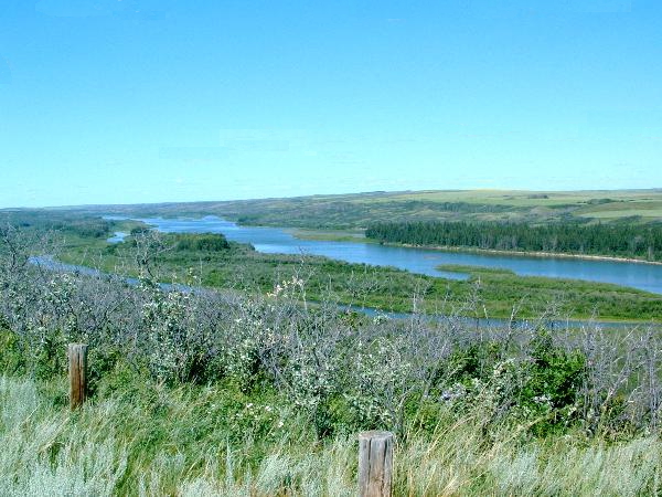
The above pic shows the northern end of Pine Island which is on the opposite side of the river with all the Pine trees growing on it.
I will add more pics to this site when I can find more of the ones I have taken.