
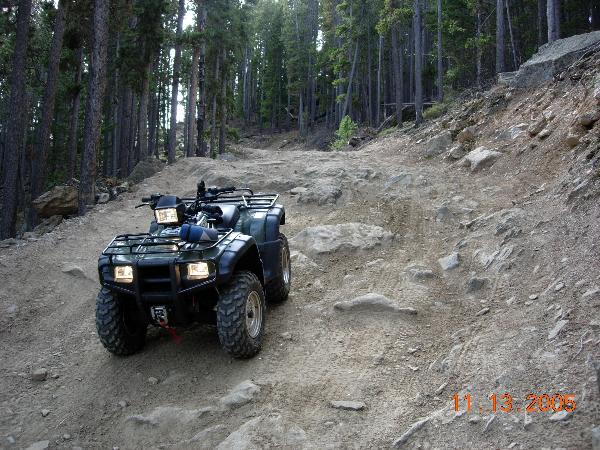
Storm Mountain Trail
Posted by:  KingJR
N 40° 28.699 W 105° 22.563
13T E 468125 N 4480915
Storm Mountain trail area
Waymark Code: WM666
Location: Colorado, United States
Date Posted: 01/17/2006
Views: 138
This is the storm mountain trail. It is located in Larimer County colorado. Only a short drive from town this is only accessible (typically) June through December each year. The forest service controls access to the area depending on snow and mud conditions as to keep people from tearing up the area.
You will find a couple of very pretty meadows and even some camping spots on this trail system.
There are two spur trails which both dead end eventually. There may be geocaches present in the area!
Overall Trail Difficulty: Okay we're getting bumpy

Land Ownership: Public
Popularity: Moderate
Highest Altitude: Approx 9918 feet
Trail Length (approx): 15 miles with all spurs explored
Parking availble?: Yes
Room for Trailers: Yes
Permit required to access area?: No
Camping sites nearby: Yes
Are OHVs permitted: Yes
Additional Trailhead: Not Listed
|
Visit Instructions:
Before posting your log be sure that you have a picture of you, your group, or the wheelin rig on the trail. In your log please post a little bit about your experience on the trail(s). (Would you recommend this to others? Etc...) Optional: If you have a topo map to upload with your track log information that is always welcome!
Recent Visits/Logs:
| There are no logs for this waymark yet. |
|
|
|