Indian Boundary - GHM 006-1
N 34° 24.379 W 083° 29.090
17S E 271603 N 3810008
A history of the spot, as a boundary of the State of Georgia in the 1700s.
Waymark Code: WM5FM
Location: Georgia, United States
Date Posted: 12/30/2005
Views: 29
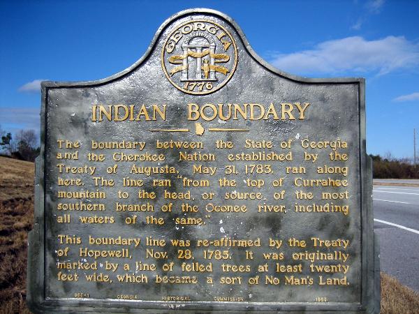
The boudart betewwn the State of Georgia and the Chreokee Nation established by the Treaty of Augusta, May 31, 1783, ran along here. The line ran "from the top of Currahee mountain to the head, or source of the most southern branch of the Oconee river, including all waters of the same."
This boundary line was re-affirmed by the Treaty of Hopewell, Nov. 28, 1785. It was originally marked by a line of felled trees at least twenty feet wide, which became a sort of No Man's Land.