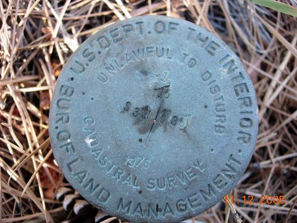
Palasade Mtn Trailhead Survey Disk
Posted by: Groundspeak Regular Member KingJR
N 40° 26.345 W 105° 19.643
13T E 472234 N 4476544
Cadastral Survey disk near the Trailhead to Palasade Mountain.
Waymark Code: WM45K
Location: Colorado, United States
Date Posted: 11/26/2005
Published By:Groundspeak Regular Member KingJR
Views: 31

Once again I have stumbled upon another survey disk. Hey I'm getting good at this. So far none that I have found and submitted to waymarking.com have been listed in the NGS database.

Saw this while parking the truck and just had to get a photo and GPS coordinate of its location.


Condition: Mark found in good condition

Designation: S34 | S35

Benchmark Agency: U.S. Department of Interior Bur. of Land Management

Monumentation type: Cadastral survey Disk

County: Larimer

USGS 7.5' Topographic Quadrangle Name (optional): Drake

Special category (optional): Not listed

Find type: Found by luck/skill/knowledge

Benchmark Agency (if other): Not listed

Monumentation type (if other): Not listed

Special Category (if other): Not listed

Web address of this benchmark's datasheet (optional): Not listed

NGS PID: Not listed

Local database's URL (optional): Not listed

Visit Instructions:
  1. A closeup photo of the mark taken by you is required.
  2. A 'distant' photo including the mark in the view is highly recommended. Include the compass direction you faced when you took the picture.
Search for...
Geocaching.com Google Map
Google Maps
MapQuest
Bing Maps
Nearest Waymarks
Nearest U.S. Benchmarks
Nearest Geocaches
Create a scavenger hunt using this waymark as the center point
Recent Visits/Logs:
There are no logs for this waymark yet.