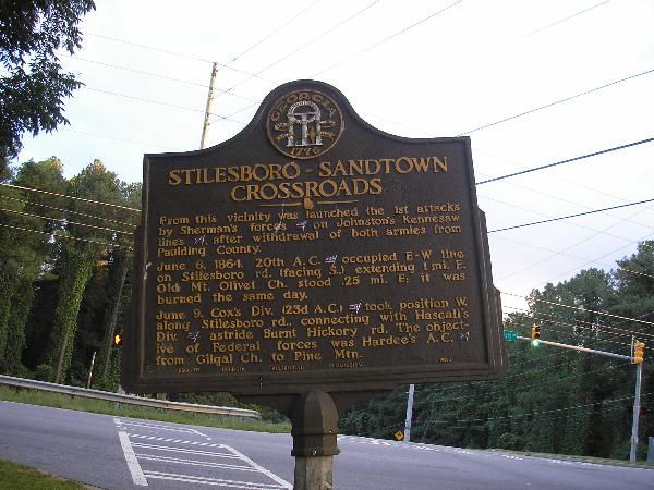
Stilesboro-Sandtown Crossroads GMH 033 - 25
Posted by: Groundspeak Regular Member GA Cacher
N 33° 59.895 W 084° 40.529
16S E 714690 N 3764397
Stilesboro-Sandtown Crossroads State Historical Marker Located on Stilesboro Rd. at Acworth-Due West Rd.
Waymark Code: WM2B45
Location: Georgia, United States
Date Posted: 10/06/2007
Published By:Groundspeak Regular Member Lat34North
Views: 28

STILESBORO-SANDTOWN CROSSROADS

From this vicinity was launched the 1st attacks by Sherman's
forces[US] on Johnston's Kennesaw lines [CS], after
withdrawal of both armies from Paulding County.

June 6, 1864. 20th A. C. [US] occupied E-W line on Stilesboro rd.
(facing S.,) extending 1 mi. E. Old Mt. Olivet Ch.
stood .25 mi. E; it was burned the same day.

June 9. Cox's Div. (23d A. C.) [US] took position W. along Stilesboro
rd., connecting with Hascall's Div. [US] astride
Burnt Hickory rd. the objective of Federal
forces was Hardee's A. C. [CS] from Gilgal Ch. to Pine Mtn.

033-25 GEORGIA HISTORICAL COMMISSION 1953

Type of Marker: Highway

Marker #: 033- 26

Date: 1953

Sponsor: Not listed

Visit Instructions:
Take a picture of the marker, yourself at the marker, your gps at the marker, or anything specific to the text on the marker. And don't forget to enjoy your visit.
Search for...
Geocaching.com Google Map
Google Maps
MapQuest
Bing Maps
Nearest Waymarks
Nearest Georgia Historical Markers
Nearest Geocaches
Create a scavenger hunt using this waymark as the center point
Recent Visits/Logs:
Date Logged Log User Rating  
Jeep02 visited Stilesboro-Sandtown Crossroads GMH 033 - 25 04/13/2009 Jeep02 visited it
Lat34North visited Stilesboro-Sandtown Crossroads GMH 033 - 25 07/16/2008 Lat34North visited it
GA Cacher visited Stilesboro-Sandtown Crossroads GMH 033 - 25 10/06/2007 GA Cacher visited it
Markerman62 visited Stilesboro-Sandtown Crossroads GMH 033 - 25 07/31/2000 Markerman62 visited it

View all visits/logs