A Wonderful Piece of Engineering: The Big Side Cut - Superior, MT
Posted by:  T0SHEA
N 47° 04.559 W 114° 46.028
11T E 669510 N 5216027
At Quartz Creek, or Quartz Hills, along Interstate 90 are a pair of rest area serving eastbound and westbound traffic. This Montana Historical Highway Marker is right in the middle of the eastbound rest area.
Waymark Code: WMWAWN
Location: Montana, United States
Date Posted: 08/04/2017
Views: 2
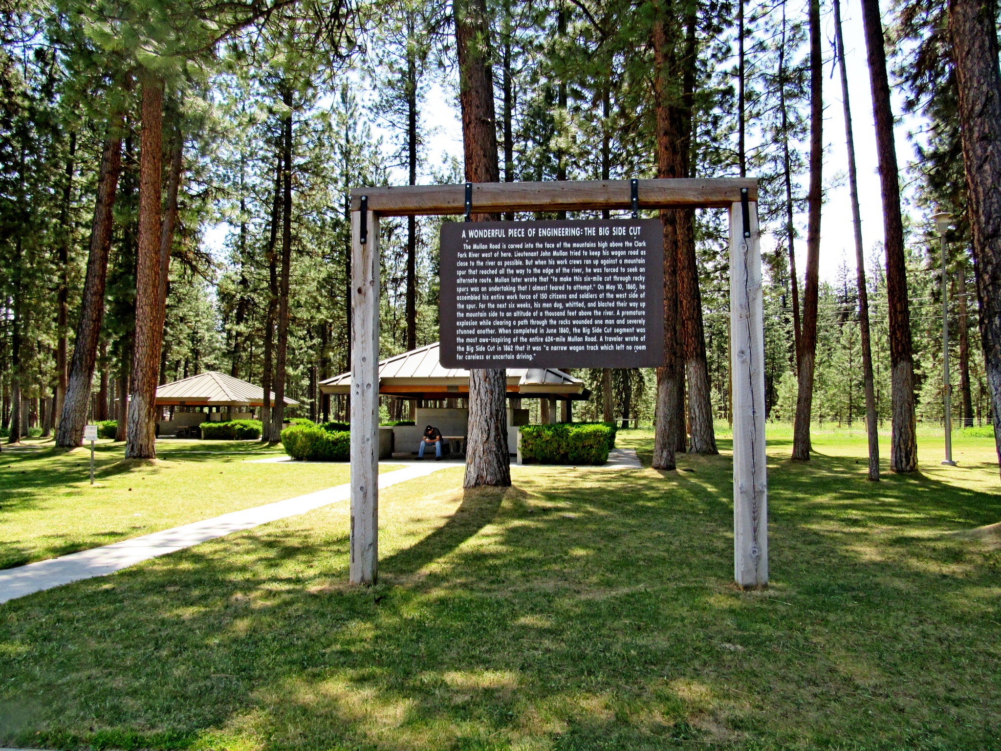
A WONDERFUL PIECE OF ENGINEERING:
THE BIG SIDE CUT
The Mullan Road is carved into the face of the mountains high above the Clark Fork River west of here. Lieutenant John Mullan tried to keep his wagon road as close to the river as possible. But when his work crews ran up against a mountain spur that reached all the way to the edge of the river, he was forced to seek an alternate route. Mullan later wrote that "to make this six-mile cut through rocky spurs was an undertaking that I almost feared to attempt." On May 10,1860, he assembled his entire workforce of 150 citizens and soldiers at the west side of the spur. For the next six weeks, his men dug, whittled, and blasted their way up the mountain side to an altitude of a thousand feet above the river. A premature explosion while clearing a path through the rocks wounded one man and severely stunned another. When completed in June 1860, the Big Side Cut segment was the most awe-inspiring of the entire 624-mile Mullan Road. A traveler wrote of the Big Side Cut in 1862 that it was "a narrow wagon track which left no room for careless or uncertain driving."
From the Montana Historical Highway Marker
The History of the Montana Historical Highway Markers
It was a man named Bob Fletcher whose idea it was, in 1935, to produce roadside signs which imparted knowledge of Montana's history, each sign containing a bit of the story of some local event or site.] The rustic-looking sign boards were mounted on lodgepole pine posts and hung from decorative routed crossbeams. The posts were set in fieldstone bases to make them eye-catching, rustic—and crash resistant. The sign texts were hand-lettered on five-by-eight-foot plywood boards set in log frames. The first marker, "Gates of the Mountains," was installed on U.S. Highway 91, about sixteen miles north of Helena, in early July 1935. It was followed by twenty-nine more signs by the end of the year.
Bob Fletcher's success in promoting and developing the tourist industry in the early 1930s enabled him to pitch a project that he'd been considering since the 1920s: roadside highway markers that described and celebrated Montana's colorful history. This idea allegedly originated after he became bored reading the historical markers installed by the Daughters of the American Revolution along South Dakota's roads in the mid 1920s. He felt he could do better in Montana by making the marker texts big enough to read from a car "and sometimes humorous." Fletcher later recalled that the texts "should not be a lot of stilted copy with dates and all. I wanted them to be like a native standing there and telling you about the place."
By the early 1950s, severe weathering of the signs compelled the department to begin routing the texts onto redwood boards. By 1952, the highway department had installed over one hundred markers along Montana's highways. Although Montana's historical highway marker program was not the first of its kind in the United States, it proved among the most influential. According to one newspaper article, twelve other state highway departments requested copies of the marker plans.
By the early 1980s, the interstates had diverted much of the traffic off the two-lane highways and onto the four-lane superhighways. Although some signs had been reinstalled at interstate rest areas, most had simply been forgotten, vandalized, stored in maintenance shops, or allowed to deteriorate next to bypassed highways. In 1985, the Forty-Ninth State Legislature allocated $200,000 to refurbish the 132 old markers (the original markers cost $400 each—including the support posts and field-stone bases!) and write twenty-four new ones.
Since 1985, over one hundred new historical markers have been added, covering a wide variety of subjects and styles. The markers have been printed on sturdy, weather-resistant plastic since 1999.
From the book Montana's Historical Highway Markers by the Montana Historical Society