
Battery M, First Illinois Light Artillery Plaque - Chickamauga National Battlefield
Posted by:  Lat34North
N 34° 55.649 W 085° 16.518
16S E 657528 N 3866358
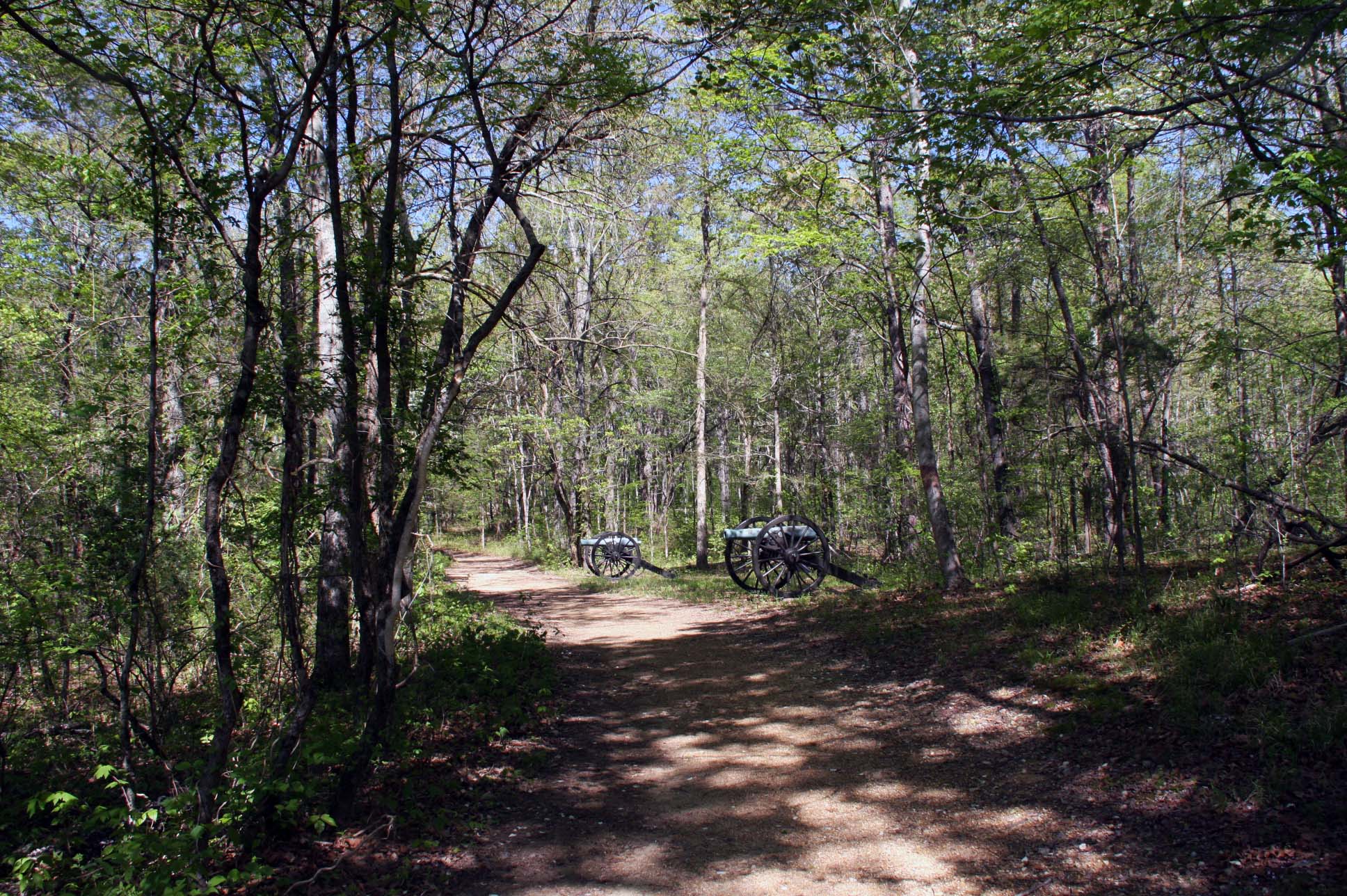
Battery M, First Illinois Light Artillery Plaque is located along a hiking trail at Snodgrass Hill, tour stop 8, at the Chickamauga National Battlefield. Parking is at N 34 55.624 W 85 16.262.
Waymark Code: WMP3JJ
Location: Georgia, United States
Date Posted: 06/24/2015
Views: 2
This plaque is dedicated to the Battery "M", 1st Regiment Illinois Volunteer Light Artillery and is in recognition of their service during the
Battle of Chickamauga, fought September 19–20, 1863.
It marks their location on Sunday 20, 1863 from 2 p.m. until dark. The commander of the battery was 2nd Lieutenant Thomas Burton.
 Text:
Text:
Battery M, 1st Illinois Light Artillery.
4 Napoleons, 2 3” Rifles
Mitchell’s Brigade, Steedman’s Division, Granger’s Corps.
September 20, 1863.
2d Lieut. Lieut. Thomas Burton, Commanding
2d Lieut. 2d Lieut. Bela H Flusky
About noon the battery following its brigade from McAfee’s Church
to this Ridge, came into position on this ground on the right of the brigade
soon after 2 P.M., supported by two companies of the 113th and 121st Ohio
regiments, and was fiercely engaged till sunset, aiding and repulsing repeated
assaults of the enemy. A portion of the time one section of this battery
was engaged on the left of the brigade on this Ridge further to the east
and rendered efficient service. Casualties: enlisted men killed 2; wounded
9; captured or missing 1.
Note: The a’s are missing from Thomas Burton and Bela H Flusky names. See source 3 for the source of this information.
From the NRHP nomination form:
| |
Structure Number: |
MT-1202. |
| |
Structure Number: |
HS-Batch-3. |
| |
LCS ID: |
091615 |
Historical Significance:
| |
National Register Status:
|
Entered - Documented
|
| |
National Register Date:
|
10/26/1998
|
| |
National Historic Landmark?: |
No
|
| |
Significance Level:
|
Contributing
|
| |
Short Significance Description:
|
The metal markers and tablets contribute to the national significance of the park under NR criterion A as part of the War Department's efforts to mark and commemorate places of significant action during the battles.
|
Short Physical Description
Approximately 700 metal position and descriptive markers with raised lettering. Union marker text painted blue; Confederate marker text painted red.
Long Physical Description
Most of these tablets and plaques have integrity of location, design, setting, materials, workmenship, feeling, and association to the historically significant period of Commemorative/Park Developement (1895-1899).
Material(s)
|
|
Structural Component(s)
|
Material(s)
|
1.
|
Superstructure
|
Iron
|
2.
|
Superstructure
|
Bronze
|
|
Construction Period:
|
Historic
|
Chronology:
|
|
Physical Event
|
Begin Year
|
Begin Year AD/BC
|
End Year
|
End Year AD/BC
|
Designer
|
Designer Occupation
|
1.
|
Built
|
1890
|
CE
|
|
|
War Department
|
|
|
My Sources
1. Wikipedia -
Battle of Chickamauga
2. The Civil War Home -
The Chickamauga Campaign - Union Order of Battle
3. Il Gen Web -
Battery "M" 1st Illinois Light Artillery
Note
Trailhead Graphics, Inc. has produced a map of the Chickamauga Battlefield showing the locations of all of the monuments and the markers on the battlefield. Each location on the map has a number associated with it that cross-references to an index on the back of the map that has the name of the marker (called the Chick-Chatt NMP monument numbering system). This number corresponds to the structure Number listed on the NPS List of Classified Structures that is normally prefixed with the letters MT for the Chickamauga Battlefield.