
49th Ohio Infantry Regiment Marker - Chickamauga National Battlefield
Posted by:  Lat34North
N 34° 55.419 W 085° 15.045
16S E 659778 N 3865972
This marker to the 49th Ohio Volunteer Infantry Regiment is located along a wooded path that connects Battleline Road and Alexander Road in the Chickamauga National Battlefield.
Waymark Code: WMDZ60
Location: Georgia, United States
Date Posted: 03/12/2012
Views: 1
This marker is dedicated to the
49th Ohio Volunteer Infantry Regiment, and is in recognition of their service during the
Battle of Chickamauga, fought September 19–20, 1863. The 49th Ohio Volunteer Infantry Regiment was organized at Camp Noble in Tiffin, Ohio, and mustered into Federal service between August and September 1861.
This marker marks their position at 12:30 p.m.on September 19, 1863. This is one of three markers to the 49th Ohio Volunteer Infantry Regiment on the Battlefield.
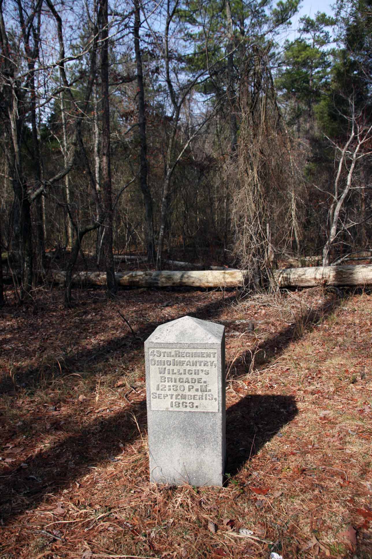 Text on the front of the monument:
49th Regiment
Ohio Infantry
Willich’s
Brigade
12:30 P.M.
September 19,
1863
From the NRHP nomination form:
| |
Structure Number: |
MT-1004(see note) |
| |
LCS ID: |
003087 |
Historical Significance:
| |
National Register Status:
|
Entered - Documented
|
| |
National Register Date:
|
07/25/1986
|
| |
National Historic Landmark?: |
No
|
| |
Significance Level:
|
Contributing
|
| |
Short Significance Description:
|
Marker contributes to national significance of park under NR Criterion A because it represents the national movement among veterans & related groups to commemorate Civil War battlefields. This was the first U.S. national military park.
|
Short Physical Description
A 1'6" x 1'6" x 3' high granite obelisk with a raised letter inscription. Marks regiment's position on September 19, 1863, at 12:30 p.m.
Material(s)
|
|
Structural Component(s)
|
Material(s)
|
1.
|
Superstructure
|
Granite
|
|
Construction Period:
|
Historic
|
Chronology:
|
|
Physical Event
|
Begin Year
|
Begin Year AD/BC
|
End Year
|
End Year AD/BC
|
Designer
|
Designer Occupation
|
1.
|
Built
|
1894
|
AD
|
|
|
|
|
|
My Sources
1.
NRHP
2. Wikipedia -
Battle of Chickamauga
3. The Civil War Home -
The Chickamauga Campaign - Union Order of Battle
4. Wikipedia -
49th Ohio Volunteer Infantry
Note
Trailhead Graphics, Inc. has produced a map of the Chickamauga Battlefield showing the locations of all of the monuments and the markers on the battlefield. Each location on the map has a number associated with it that cross-references to an index on the back of the map that has the name of the marker (called the Chick-Chatt NMP monument numbering system). This number corresponds to the structure Number listed on the NPS List of Classified Structures that is normally prefixed with the letters MT for the Chickamauga Battlefield. This marker is not on the map since it is outside the park.