
Stilesboro-Sandtown Crossroads GMH 033 - 25
Posted by:  GA Cacher
N 33° 59.895 W 084° 40.529
16S E 714690 N 3764397
Stilesboro-Sandtown Crossroads State Historical Marker
Located on Stilesboro Rd. at Acworth-Due West Rd.
Waymark Code: WM2B45
Location: Georgia, United States
Date Posted: 10/06/2007
Views: 28
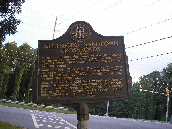
STILESBORO-SANDTOWN CROSSROADS
From this vicinity was launched the 1st attacks by Sherman's
forces[US] on Johnston's Kennesaw lines [CS], after
withdrawal of both armies from Paulding County.
June 6, 1864. 20th A. C. [US] occupied E-W line on Stilesboro rd.
(facing S.,) extending 1 mi. E. Old Mt. Olivet Ch.
stood .25 mi. E; it was burned the same day.
June 9. Cox's Div. (23d A. C.) [US] took position W. along Stilesboro
rd., connecting with Hascall's Div. [US] astride
Burnt Hickory rd. the objective of Federal
forces was Hardee's A. C. [CS] from Gilgal Ch. to Pine Mtn.
033-25 GEORGIA HISTORICAL COMMISSION 1953