 view gallery view gallery NW1.1 km NW1.1 km
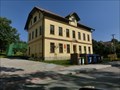
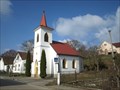
|   Horní Dubenky - 588 52, Horní Dubenky, Czech Republic Horní Dubenky - 588 52, Horní Dubenky, Czech Republic
in European Post Offices Local post office in Horní Dubenky 83 posted by:  ToRo61 ToRo61 location: Kraj Vysočina, Czechia date approved: 07/16/2018 last visited: never |
 view gallery view gallery E1.8 km E1.8 km
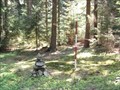
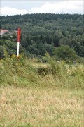
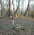
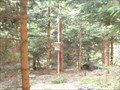
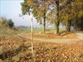
|  TB 3220-5 Skelný vrch TB 3220-5 Skelný vrch
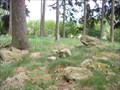
in Czech Geodetic Points Trigonometrický bod na zalesneném kopci. posted by: rys javorice location: Kraj Vysočina, Czechia date approved: 05/03/2009 last visited: 05/15/2011 |
 view gallery view gallery SW2.3 km SW2.3 km
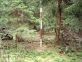
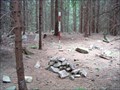
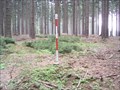
| TB 3225-10 Kremení in Czech Geodetic Points Trigonometrický bod na kopci Stríbrný vrch. posted by: rys javorice location: Kraj Vysočina, Czechia date approved: 09/07/2009 last visited: 11/10/2013 |
 view gallery view gallery NE2.6 km NE2.6 km
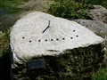
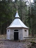
|  Stone Sundial, Janstejn, CZ Stone Sundial, Janstejn, CZ
in Sundials Sundial on the stone nearby edge of the quarry. posted by: HaLuMa location: Kraj Vysočina, Czechia date approved: 01/29/2010 last visited: 11/10/2013 |
 view gallery view gallery W2.7 km W2.7 km
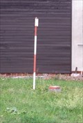
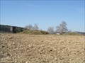
| TB 3225-7 Na Kredline in Czech Geodetic Points Trigonometrický bod na poli mezi Jihlávkou a Horní Vilímcí. posted by: rys javorice location: Kraj Vysočina, Czechia date approved: 08/24/2008 last visited: never |
 view gallery view gallery N2.9 km N2.9 km
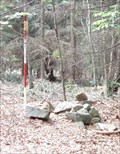
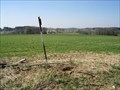
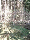
| TB 3220-2 Ještenice in Czech Geodetic Points Trigonometrický bod na zalesneném kopci. posted by: rys javorice location: Kraj Vysočina, Czechia date approved: 06/28/2009 last visited: never |
 view gallery view gallery S3.4 km S3.4 km
| TB 3220-12 Javorice in Czech Geodetic Points Trigonometrický bod na nejvyšším vrcholu Ceskomoravské vrchoviny Javorice. posted by: rys javorice location: Kraj Vysočina, Czechia date approved: 09/03/2008 last visited: 05/23/2010 |
 view gallery view galleryE3.5 km | TB 3220-6 Skalka in Czech Geodetic Points Trigonometrický bod na vrcholu zalesneného kopce "Kozí hrbet". posted by: rys javorice location: Kraj Vysočina, Czechia date approved: 09/03/2008 last visited: never |
 view gallery view galleryW3.5 km | TB 3225-4 Strážný kopec in Czech Geodetic Points Trigonometrický bod na vrcholu zalesneného kopce. posted by: rys javorice location: Kraj Vysočina, Czechia date approved: 04/17/2009 last visited: 12/29/2013 |
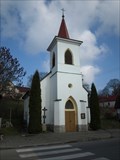
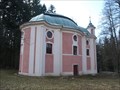 view gallery view galleryNW4 km |  Kostel sv. Kateriny - Lázne Sv. Kateriny, Pocátky, CZ Kostel sv. Kateriny - Lázne Sv. Kateriny, Pocátky, CZ
in Baroque Architecture The pilgrimage church of St. Catherine, probably designed by famous architect Kilian Ignac Dientzenhofer. posted by:  Noe1 Noe1 location: Kraj Vysočina, Czechia date approved: 12/03/2014 last visited: 07/09/2016 |
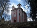 view gallery view galleryNW4 km |  Kostel sv. Kateriny - Lázne Sv. Kateriny, okres Pelhrimov, CZ Kostel sv. Kateriny - Lázne Sv. Kateriny, okres Pelhrimov, CZ
in Roman Catholic Churches The pilgrimage church of St. Catherine, probably designed by famous architect Kilian Ignac Dientzenhofer. posted by: Noe1 location: Kraj Vysočina, Czechia date approved: 12/03/2014 last visited: 07/09/2016 |
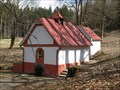 view gallery view galleryNW4 km |  Kaple sv. Kateriny - Lázne sv. Kateriny, Pocátky, CZ Kaple sv. Kateriny - Lázne sv. Kateriny, Pocátky, CZ
in Waychapels The chapel stands above the eponymous healing spring near the church of St.Catherine. posted by: Noe1 location: Kraj Vysočina, Czechia date approved: 12/03/2014 last visited: 07/09/2016 |
 view gallery view galleryNW4.2 km | TB 3225-2 Lísek in Czech Geodetic Points TB na vrcholu zalesneného kopce. posted by: rys javorice location: Kraj Vysočina, Czechia date approved: 05/03/2009 last visited: 12/08/2013 |
 view gallery view galleryNW4.2 km | Kaple sv. Markéty - Lázne sv. Kateriny, Pocátky, CZ in Waychapels Small chapels near Lazne Svaté Kateryny stands above the spring of St. Margaret. posted by: Noe1 location: Kraj Vysočina, Czechia date approved: 12/03/2014 last visited: 07/05/2020 |
 view gallery view galleryN4.2 km | TB 3219-18 Na ctvrtích in Czech Geodetic Points Trigonometrický bod na návrší nad obcí Horní Ves. posted by: rys javorice location: Kraj Vysočina, Czechia date approved: 04/12/2009 last visited: never |
 view gallery view galleryW4.5 km | TB 3225-9 Na vrchovnici in Czech Geodetic Points TB je na vyvýšeném míste v poli nad obcí Horní Vilímec. posted by: rys javorice location: Kraj Vysočina, Czechia date approved: 04/21/2011 last visited: never |
 view gallery view galleryN4.5 km | TB 3224-16 Kaz in Czech Geodetic Points Bod nad obcí Horní Ves na zalesneném kopci. posted by: rys javorice location: Kraj Vysočina, Czechia date approved: 05/12/2011 last visited: never |
 view gallery view galleryE4.7 km | TB 3220-7 Rídelovský kopec in Czech Geodetic Points Trigonometrický bod v Rásenském polesí. posted by: rys javorice location: Kraj Vysočina, Czechia date approved: 05/08/2009 last visited: 05/04/2013 |
 view gallery view gallerySW5 km | TB 3225-11 Kocicí vršek in Czech Geodetic Points Bod je na vrcholu zalesneného vršku nad obcí Panské Dubenky. posted by: rys javorice location: Kraj Vysočina, Czechia date approved: 04/21/2011 last visited: never |
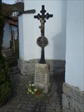 view gallery view galleryN5 km |  Kríž u kaple sv. Václava - Horní Ves, okres Pelhrimov, CZ Kríž u kaple sv. Václava - Horní Ves, okres Pelhrimov, CZ
in Churchyard Crosses The iron cross near the chapel of St. Václav. posted by: Noe1 location: Kraj Vysočina, Czechia date approved: 12/04/2014 last visited: never |
 view gallery view galleryW5 km | TB 3225-52 Hejmánky in Czech Geodetic Points Trigonometrický bod s výhledem na mesto Pocátky. posted by: rys javorice location: Kraj Vysočina, Czechia date approved: 10/28/2008 last visited: 12/29/2013 |
 view gallery view galleryN5 km | Kaple sv. Václava - Horní Ves, okres Pelhrimov, CZ in Waychapels The rectangular chapel in the village center, perhaps from the 19th century. posted by: Noe1 location: Kraj Vysočina, Czechia date approved: 12/03/2014 last visited: never |
 view gallery view galleryN5 km | Kaple sv. Václava - Horní Ves, okres Pelhrimov, CZ in Roman Catholic Churches The rectangular chapel in the village center, perhaps from the 19th century. posted by: Noe1 location: Kraj Vysočina, Czechia date approved: 12/03/2014 last visited: never |
 view gallery view galleryS5.1 km | TB 3225-14 Za vrškem in Czech Geodetic Points Trigonometrický bod na úpatí jihozápadního svahu Javorice, na zalesneném návrší u obce Svetlá. posted by: rys javorice location: Jihočeský kraj, Czechia date approved: 06/19/2011 last visited: never |
 view gallery view galleryN5.3 km | TB 3224-31 Ctvrte in Czech Geodetic Points Trigonometrický bod na holém kopci. posted by: rys javorice location: Kraj Vysočina, Czechia date approved: 05/03/2009 last visited: never |
|