 view gallery view gallery SE0.3 km SE0.3 km
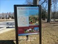
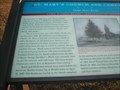
|   No Match for British Might Star-Spangled Banner National Historic Trail - Charlotte Hall, MD No Match for British Might Star-Spangled Banner National Historic Trail - Charlotte Hall, MD
in War of 1812 Bounded by the Patuxent and the Potomac, St. Mary’s County felt the squeeze as British invaders attacked along both rivers, plundering towns and plantations at will. posted by:  Don.Morfe Don.Morfe location: Maryland date approved: 02/15/2020 last visited: 11/02/2021 |
 view gallery view gallerySE0.3 km |  No Match for British Might Star-Spangled Banner National Historic Trail - Charlotte Hall, MD No Match for British Might Star-Spangled Banner National Historic Trail - Charlotte Hall, MD
in Signs of History Bounded by the Patuxent and the Potomac, St. Mary’s County felt the squeeze as British invaders attacked along both rivers, plundering towns and plantations at will. posted by: Don.Morfe location: Maryland date approved: 08/27/2022 last visited: 08/27/2022 |
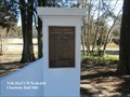
 view gallery view gallerySE0.3 km |  Charlotte Hall School-Charlotte Hall, MD Charlotte Hall School-Charlotte Hall, MD
in Maryland Historical Markers Charlotte Hall School is an outgrowth of the “Free Schools” established in Maryland in 1723. posted by: Don.Morfe location: Maryland date approved: 10/07/2019 last visited: 09/28/2021 |
 view gallery view gallery S0.3 km S0.3 km
| Rear Admiral Raphael Semmes C.S.N.-Charlotte Hall, MD in Signs of History Read Admiral Raphael Semmes C.S.N.-Born Charles County. Attended Charlotte Hall Mil. Academy. US Navy – Mexican War. posted by: Don.Morfe location: Maryland date approved: 10/07/2019 last visited: 09/28/2021 |
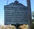 view gallery view galleryS0.3 km | Coole Springs of Saint Marie’s-Charlotte Hall, Maryland in Maryland Historical Markers Coole Springs of Saint Marie’s Charlotte Hall, Maryland-Waters of exceptional purity and reputed healing quality led to the establishment of a hospital here. posted by: Don.Morfe location: Maryland date approved: 10/07/2019 last visited: 09/28/2021 |
 view gallery view gallery NW8.4 km NW8.4 km
|  St. Mary's Catholic Church - Bryantown, Md St. Mary's Catholic Church - Bryantown, Md
in Roman Catholic Churches The congregation of this historic church was founded in 1793. posted by:  Sneakin Deacon Sneakin Deacon location: Maryland date approved: 11/16/2016 last visited: never |
 view gallery view galleryNW8.4 km |  Dr. Samuel A. Mudd - Bryantown, Md. Dr. Samuel A. Mudd - Bryantown, Md.
in Grave of a Famous Person Dr. Samuel A. Mudd, treated Lincoln Assassin John Wilkes Booth for a broken leg in the early morning hours of April 15, 1865. posted by: Sneakin Deacon location: Maryland date approved: 11/16/2016 last visited: 11/28/2021 |
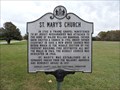
 view gallery view galleryNW8.4 km |  St. Mary’s Church and Cemetery Mudd Meets Booth - Bryantown, MD St. Mary’s Church and Cemetery Mudd Meets Booth - Bryantown, MD
in Civil War Discovery Trail Sites On November 13, 1864, here at St. Mary’s Catholic Church, Dr. Samuel A. Mudd was introduced to John Wilkes Booth, the future assassin of President Abraham Lincoln. posted by: Don.Morfe location: Maryland date approved: 03/10/2020 last visited: 10/08/2021 |
 view gallery view galleryNW8.5 km | St. Mary's Church - Bryantown, Md. in Maryland Historical Markers St. Mary's Church Historical Marker Stand on Oliver Shop Road near the entrance to this historic Church. posted by: Sneakin Deacon location: Maryland date approved: 11/18/2016 last visited: 08/21/2021 |
 view gallery view gallery NE8.5 km NE8.5 km
| Solid Ground Star-Spangled Banner National Historic Trail - Hughesville, MD in Signs of History More than 4,000 British troops camped here August 20, 1814, awaiting orders. posted by: Don.Morfe location: Maryland date approved: 08/30/2022 last visited: 08/30/2022 |
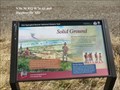 view gallery view galleryNE8.5 km | Solid Ground Star-Spangled Banner National Historic Trail - Hughesville, MD in War of 1812 More than 4,000 British troops camped here August 20, 1814, awaiting orders. posted by: Don.Morfe location: Maryland date approved: 02/23/2020 last visited: 11/02/2021 |
 view gallery view galleryNE8.7 km | Enemy Camp Star-Spangled Banner National Historic Trail - Hughesville, MD in War of 1812 More than 4,000 British troops camped in this valley and surrounding hills August 19, 1814. posted by: Don.Morfe location: Maryland date approved: 02/21/2020 last visited: 11/02/2021 |
 view gallery view galleryNE8.7 km | Enemy Camp Star-Spangled Banner National Historic Trail - Hughesville, MD in Signs of History More than 4,000 British troops camped in this valley and surrounding hills August 19, 1814. posted by: Don.Morfe location: Maryland date approved: 08/30/2022 last visited: 08/30/2022 |
 view gallery view gallery E9.3 km E9.3 km
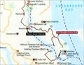
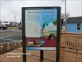
|  'You Are Here' Maps-The British are Coming - Benedict MD 'You Are Here' Maps-The British are Coming - Benedict MD
in 'You Are Here' Maps 'You Are Here' Map shows that you are in Benedict, MD United States 20612 posted by: Don.Morfe location: Maryland date approved: 09/13/2023 last visited: 09/13/2023 |
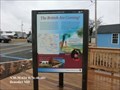
 view gallery view galleryE9.3 km |  The British are Coming - Benedict MD The British are Coming - Benedict MD
in Battlefields The marker is at the intersection of Benedict Avenue and Potomac Avenue
Benedict, MD United States 20612 posted by: Don.Morfe location: Maryland date approved: 09/15/2023 last visited: 09/15/2023 |
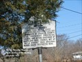
 view gallery view galleryE9.3 km | The British are Coming-Star-Spangled Banner National Historic Trail - Benedict MD in Signs of History Residents along the Patuxent watched nervously as wave after wave of British warships approached the tiny town of Benedict. For months enemy raiders had terrorized Southern Maryland. Benedict felt their sting twice in June 1814. posted by: Don.Morfe location: Maryland date approved: 08/26/2022 last visited: 08/26/2022 |
 view gallery view galleryE9.3 km | The British are Coming-Star-Spangled Banner National Historic Trail - Benedict MD in War of 1812 Residents along the Patuxent watched nervously as wave after wave of British warships approached the tiny town of Benedict. For months enemy raiders had terrorized Southern Maryland. Benedict felt their sting twice in June 1814. posted by: Don.Morfe location: Maryland date approved: 08/28/2022 last visited: 08/26/2022 |
 view gallery view gallerySE9.8 km | De La Brooke Manor - Oraville MD in Maryland Historical Markers De La Brooke Manor Surveyed July 28, 1630-Robert Brooke
First Lord of the Manor Born London 1602; died Brooke Place, 1655 posted by: Don.Morfe location: Maryland date approved: 08/27/2021 last visited: 08/24/2021 |
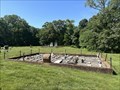
 view gallery view galleryE10.5 km |  Hollowing Point Boat Ramp - Prince Frederick MD Hollowing Point Boat Ramp - Prince Frederick MD
in Boat Ramps The Hollowing Pont Boat Ramp is located a Hollowing Point at the eastern side of the Benedict Bridge. The boat ramp is on the Patuxent River. posted by: Don.Morfe location: Maryland date approved: 09/10/2022 last visited: 08/31/2022 |
 view gallery view galleryE10.5 km | British Vengeance Star-Spangled Banner National Historic Trail - Prince Frederick MD in War of 1812 British forces landed at Hallowing Point July 21, 1814. They took 21 slaves and destroyed the home and barn of Colonel Benjamin Mackall. This was perhaps retaliation for the house being used by Calvert County militia. posted by: Don.Morfe location: Maryland date approved: 03/13/2020 last visited: 11/02/2021 |
 view gallery view galleryE10.5 km | British Vengeance Star-Spangled Banner National Historic Trail - Prince Frederick MD in Signs of History British forces landed at Hallowing Point July 21, 1814. They took 21 slaves and destroyed the home and barn of Colonel Benjamin Mackall. This was perhaps retaliation for the house being used by Calvert County militia. posted by: Don.Morfe location: Maryland date approved: 10/24/2022 last visited: 08/31/2022 |
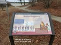
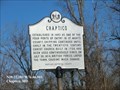 view gallery view galleryS12.6 km | Chaptico in Maryland Historical Markers Chaptico-Established in 1683 as one of the four ports of entry in St. Mary's County. posted by: Don.Morfe location: Maryland date approved: 10/25/2019 last visited: 09/28/2021 |
 view gallery view gallery SW12.6 km SW12.6 km
|  Saint Mary’s Church - Newport, Maryland Saint Mary’s Church - Newport, Maryland
in Graves of the Unknown Located within the St. Mary's churchyard. posted by: flyingmoose location: Maryland date approved: 08/01/2023 last visited: never |
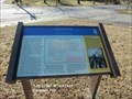 view gallery view galleryS12.6 km | Chaptico-A History of Rebellion - Chaptico MD in Signs of History Marker is located at the intersection of Maddox Road (Maryland Route 238) and Chaptico Hurry Road, Chaptico , MD, United States 20621. posted by: Don.Morfe location: Maryland date approved: 09/12/2023 last visited: 09/12/2023 |
 view gallery view galleryS12.6 km | Chaptico-A History of Rebellion - Chaptico MD in U.S. Civil War Sites Tiny Chaptico was home to many daring men, beginning with John Coode who led Maryland's 1689 Protestant Rebellion. During the Civil War, Chaptico's blockade runners carried medicine and other supplies at night across the Potomac River. posted by: Don.Morfe location: Maryland date approved: 04/04/2023 last visited: 04/04/2023 |
|