 view gallery view gallery NE0.2 km NE0.2 km
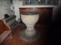
|   Baptism Font, Holy & Undivided Trinity - Edale, Derbyshire Baptism Font, Holy & Undivided Trinity - Edale, Derbyshire
in Stone Church Artefacts Baptism font inside the church of The Holy & Undivided Trinity, Edale posted by:  SMacB SMacB location: East Midlands, United Kingdom date approved: 02/15/2015 last visited: 05/07/2015 |
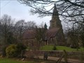 view gallery view galleryNE0.2 km |  Holy & Undivided Trinity - Edale, Derbyshire Holy & Undivided Trinity - Edale, Derbyshire
in This Old Church The church at Edale is dedicated to the Holy and Undivided Trinity and was built in 1885-86 to a design by William Dawes of Manchester. posted by: SMacB location: East Midlands, United Kingdom date approved: 02/15/2015 last visited: 05/07/2015 |
 view gallery view gallery S0.3 km S0.3 km
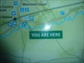
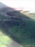
|  Pair of You Are Here maps - Edale, Derbyshire Pair of You Are Here maps - Edale, Derbyshire
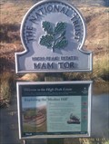
in 'You Are Here' Maps A pair of 'You Are Here' maps at the car park in Edale. posted by: SMacB location: East Midlands, United Kingdom date approved: 02/16/2015 last visited: never |
 view gallery view gallery SE1.9 km SE1.9 km
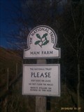
|  Mam Farm Mam Farm
in National Trust U.K. National Trust marker for Mam Farm posted by: SMacB location: East Midlands, United Kingdom date approved: 02/03/2013 last visited: never |
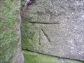
 view gallery view gallery W1.9 km W1.9 km
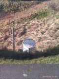
|  Benchmark - Upper Booth, Derbyshire Benchmark - Upper Booth, Derbyshire
in U.K. and Ireland Trigpoints Cut benchmark on side of farm building, Pennine Way, Upper Booth, Derbyshire. posted by: SMacB location: East Midlands, United Kingdom date approved: 02/16/2015 last visited: never |
 view gallery view galleryW1.9 km |  Benchmark - Upper Booth, Derbyshire Benchmark - Upper Booth, Derbyshire
in European Historic Survey Stones, Monuments and Benchmarks Cut benchmark on side of farm building, Pennine Way, Upper Booth, Derbyshire. posted by: SMacB location: East Midlands, United Kingdom date approved: 02/17/2015 last visited: never |
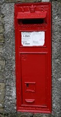 view gallery view gallery E1.9 km E1.9 km
|  Nether Booth Derbyshire Nether Booth Derbyshire
in Victorian Post Boxes Wall mounted box in good condition posted by: ebbandflo location: United Kingdom date approved: 06/25/2009 last visited: 02/03/2010 |
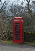 view gallery view galleryW1.9 km |  Red Telephone Box - Upper Booth, Derbyshire Red Telephone Box - Upper Booth, Derbyshire
in Red Telephone Boxes Red telephone box on the Pennine Way, Upper Brook, at the entrance to Upper Brook farm. posted by: SMacB location: East Midlands, United Kingdom date approved: 02/16/2015 last visited: never |
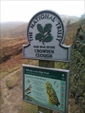 view gallery view galleryW2.1 km | Crowden Clough - Edale, Derbyshire in National Trust U.K. NT marker at ther boundary to Crowden Clough, Edale, in the Peak District. posted by: SMacB location: East Midlands, United Kingdom date approved: 02/25/2015 last visited: never |
 view gallery view gallerySE2.1 km |  Mam Tor Landslip, Castleton, Derbyshire, UK Mam Tor Landslip, Castleton, Derbyshire, UK
in Places of Geologic Significance A fine example of a rotational landslip on the side of Mam Tor with attendant road destruction posted by:  hillhiker1 hillhiker1 location: North West England, United Kingdom date approved: 01/20/2010 last visited: 10/07/2009 |
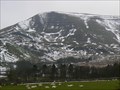
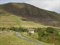
 view gallery view galleryS2.1 km | Mam Tor, Derbyshire in National Trust U.K. Mam Tor is a famous viewpoint and landmark, rearing up above the valleys of Hope and Edale. Known as the 'shivering mountain', it is comprised of shale and the East face is a dramatic and loose expanse of crumbling rock. posted by: GeoRams location: United Kingdom date approved: 10/14/2007 last visited: 04/06/2024 |
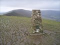 view gallery view galleryS2.1 km | Mam Tor in U.K. and Ireland Trigpoints Mam Tor Trigpoint above Edale in the Peak District. posted by: theblack location: United Kingdom date approved: 12/29/2007 last visited: 04/06/2024 |
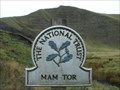
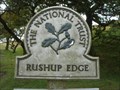 view gallery view galleryS2.3 km | Rushop Edge, Derbyshire, England in National Trust U.K. Open Moorland and spectacular views of Mam Tor. posted by: GeoRams location: United Kingdom date approved: 10/21/2007 last visited: 12/24/2007 |
 view gallery view gallerySE2.3 km |  Mam Tor, old road Mam Tor, old road
in Milestones Metal milestone on the old road to Mam Tor, now disused. posted by: SMacB location: East Midlands, United Kingdom date approved: 02/03/2013 last visited: never |
 view gallery view gallerySE2.4 km |  Mam Tor - Derbyshire, UK Mam Tor - Derbyshire, UK
in Satellite Imagery Oddities Mam Tor known as the 'shivering mountain' is a hill located near Castleton in the High Peak of Derbyshire. posted by: Poole/Freeman location: East Midlands, United Kingdom date approved: 03/03/2022 last visited: never |
 view gallery view gallerySE2.4 km | Mam Tor - Castleton, Derbyshire in National Trust U.K. On the way to Mam Tor, just beyond the turning circle at the end of Mam Farm Road on the now disused road built in 1819 by the Sheffield Turnpike Company using spoil from the nearby Odin mine. posted by: SMacB location: East Midlands, United Kingdom date approved: 07/12/2013 last visited: never |
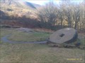 view gallery view gallerySE2.4 km |  Crushing Circle, Odin Mine - Castleton, Derbyshire Crushing Circle, Odin Mine - Castleton, Derbyshire
in Millstones Odin Mine is a disused lead mine in the Peak District National Park It lies on a site of 25 hectares near the village of Castleton. It is the oldest documented mine in Derbyshire and is thought to be one of the oldest lead mines in England. posted by: SMacB location: East Midlands, United Kingdom date approved: 04/03/2015 last visited: 02/22/2017 |
 view gallery view gallerySE2.6 km | Crushing Circle, Odin Mine, Castleton in National Trust U.K. On Mam Farm Road, at the entrance to Odin Mine and the Crushing Stone which can be seen from the sign. posted by: SMacB location: East Midlands, United Kingdom date approved: 02/03/2013 last visited: 02/22/2017 |
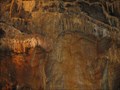
 view gallery view galleryS2.6 km | ") Blue John Cavern, Derbyshire, England, UK Blue John Cavern, Derbyshire, England, UK
in Cave Entrances (Artificial) The Blue John Cavern is one of the four show caves in Castleton, Derbyshire, England.
posted by: GeoRams location: United Kingdom date approved: 02/07/2012 last visited: 08/12/2009 |
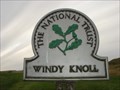 view gallery view galleryS2.7 km | Windy Knoll, Derbyshire, UK in National Trust U.K. Open moorland in the Derbyshire Peak District posted by: GeoRams location: United Kingdom date approved: 10/21/2007 last visited: 03/20/2010 |
 view gallery view gallerySE2.9 km | Treak Cliff Cavern. Derbyshire, England, UK in Cave Entrances (Artificial) Treak Cliff Cavern is a show cave near Castleton in Derbyshire. posted by: GeoRams location: United Kingdom date approved: 10/13/2007 last visited: 10/07/2009 |
 view gallery view gallerySE2.9 km |  Treak Cliff Cavern - Castleton, Derbyshire, UK Treak Cliff Cavern - Castleton, Derbyshire, UK
in Mines Treak Cliff Cavern is where Blue John stone is mined in the Peak District. posted by: Dragontree location: East Midlands, United Kingdom date approved: 04/16/2013 last visited: 10/07/2009 |
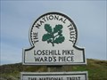 view gallery view galleryE2.9 km | Losehill Pike, Derbyshire in National Trust U.K. Lose Hill lies in the Derbyshire Peak District. Also known as Ward's Piece, it is the south-west corner of the parish of Edale and the end of the Great Ridge that runs from Rushup Edge to the west (over Mam Tor, Hollins Cross and Back Tor).
posted by: GeoRams location: United Kingdom date approved: 02/07/2012 last visited: 10/09/2016 |
 view gallery view gallerySE2.9 km | Treak Cliff Bus Stop in 'You Are Here' Maps Opposite the Treak Cliff Cavern on the Mam Farm Road posted by: SMacB location: East Midlands, United Kingdom date approved: 02/03/2013 last visited: never |
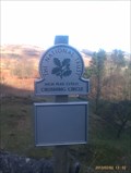
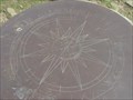 view gallery view galleryE3.1 km |  Losehill Pike Summit, Derbyshire, UK Losehill Pike Summit, Derbyshire, UK
in Compass Roses Compass rose on a plinth on the summit of Lose Hill in Derbyshire Peak district. Disk points out and names other summits on view. posted by: GeoRams location: United Kingdom date approved: 10/14/2007 last visited: 10/09/2016 |
|