 view gallery view gallery SE2.9 km SE2.9 km
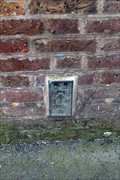
|   Cut Bench Mark - North Street, Romford, London, UK Cut Bench Mark - North Street, Romford, London, UK
in U.K. and Ireland Trigpoints This mark is cut into the heavily painted brickwork of a building on the north east side of North Street. The mark is on the south west face of the building close to its west angle. posted by:  Master Mariner Master Mariner location: London, United Kingdom date approved: 05/02/2017 last visited: never |
 view gallery view gallery SE3.1 km SE3.1 km
|   You Are Here - Romford High Street, Romford, UK You Are Here - Romford High Street, Romford, UK
in 'You Are Here' Maps This "you are here" map is located on the north west side of Romford High Street at the junction with St Edward's Way. posted by:  Master Mariner Master Mariner location: London, United Kingdom date approved: 10/09/2017 last visited: never |
 view gallery view gallery SE3.1 km SE3.1 km
|   Cut Bench Mark - High Street, Romford, London, UK Cut Bench Mark - High Street, Romford, London, UK
in U.K. and Ireland Trigpoints This mark is cut into the brickwork of a building located on the south east side of the High Street in Romford. The mark is on the north west face of the building at the building's west corner. posted by:  Master Mariner Master Mariner location: London, United Kingdom date approved: 05/02/2017 last visited: never |
 view gallery view gallery SE3.1 km SE3.1 km
|   You Are Here - Romford High Street, Romford, UK You Are Here - Romford High Street, Romford, UK
in 'You Are Here' Maps This "you are here" map is located on the north west side of Romford High Street opposite the former Romford Brewery. posted by:  Master Mariner Master Mariner location: London, United Kingdom date approved: 10/09/2017 last visited: never |
 view gallery view gallery SE3.1 km SE3.1 km
|   Flush Bracket - High Street, Romford, London, UK Flush Bracket - High Street, Romford, London, UK
in U.K. and Ireland Trigpoints The flush bracket is attached a building on the south east side of the High Street in Romford. The bracket is on the north west side of the building close to the entrance to a former brewery. posted by:  Master Mariner Master Mariner location: London, United Kingdom date approved: 04/30/2017 last visited: 04/17/2021 |
 view gallery view gallery SE3.1 km SE3.1 km
|   Romford Brewery Company (closed) - East London Romford Brewery Company (closed) - East London
in Breweries Ind Coope & Co's old brewery building. posted by:  Master Mariner Master Mariner location: London, United Kingdom date approved: 04/29/2011 last visited: 04/17/2021 |
 view gallery view gallery SE3.2 km SE3.2 km
|   You Are Here - South Street, Romford, UK You Are Here - South Street, Romford, UK
in 'You Are Here' Maps This "you are here" map is on the south west side of South Street at the junction with Romford High Street and immediately opposite the Golden Lion public house. posted by:  Master Mariner Master Mariner location: London, United Kingdom date approved: 10/09/2017 last visited: never |
 view gallery view gallery SE3.2 km SE3.2 km
|   Cut Bench Mark - Cotleigh Road, Romford, London, UK Cut Bench Mark - Cotleigh Road, Romford, London, UK
in U.K. and Ireland Trigpoints This mark is cut into a stone wall on the east side of Cotleigh Road. The mark is cut into the northern gatepost of the entrance to St Andrew's Church. posted by:  Master Mariner Master Mariner location: London, United Kingdom date approved: 05/02/2017 last visited: never |
 view gallery view gallery SE3.2 km SE3.2 km
|   Cut Bench Mark - St Andrew's Road, Romford, London, UK Cut Bench Mark - St Andrew's Road, Romford, London, UK
in U.K. and Ireland Trigpoints This mark is cut into a stone gatepost of St Andrew's church located on the south west side of St Andrew's Road at the junction with Queen Street. The mark is on the south east gatepost on its north west face. posted by:  Master Mariner Master Mariner location: London, United Kingdom date approved: 05/02/2017 last visited: never |
 view gallery view gallery SE3.2 km SE3.2 km
|   You Are Here - South Street, Romford, UK You Are Here - South Street, Romford, UK
in 'You Are Here' Maps This "you are here" map is in the centre of Romford's pedestrianised section of South Street at the junction with Brewery Walk. posted by:  Master Mariner Master Mariner location: London, United Kingdom date approved: 10/09/2017 last visited: never |
 view gallery view gallery SE3.2 km SE3.2 km
|   You Are Here - Town Hall Underpass, Romford, UK You Are Here - Town Hall Underpass, Romford, UK
in 'You Are Here' Maps This "you are here" is located at the centre of the junction of three pedestrian underpasses to the south of Havering Town Hall. posted by:  Master Mariner Master Mariner location: London, United Kingdom date approved: 10/09/2017 last visited: never |
 view gallery view gallery SE3.4 km SE3.4 km
|   You Are Here - South Street, Romford, UK You Are Here - South Street, Romford, UK
in 'You Are Here' Maps This "you are here" map is in the centre of Romford's pedestrianised section of South Street at the junction with Arcade Place. posted by:  Master Mariner Master Mariner location: London, United Kingdom date approved: 10/09/2017 last visited: never |
 view gallery view gallery SE3.4 km SE3.4 km
|   Cut Bench Mark - Waterloo Road, Romford, London, UK Cut Bench Mark - Waterloo Road, Romford, London, UK
in U.K. and Ireland Trigpoints The mark is cut into brickwork of a wing of a railway bridge on the north east side of Waterloo Road. The mark is on the north west side of the bridge. posted by:  Master Mariner Master Mariner location: London, United Kingdom date approved: 05/02/2017 last visited: never |
 view gallery view gallery SE3.5 km SE3.5 km
|   You Are Here - South Street, Romford, UK You Are Here - South Street, Romford, UK
in 'You Are Here' Maps This "you are here" map is located on the south west side of South Street, outside Romford railway station, in Romford. posted by:  Master Mariner Master Mariner location: London, United Kingdom date approved: 10/09/2017 last visited: never |
 view gallery view gallery SE3.5 km SE3.5 km
|   Romford Railway Station - South Street, Romford, UK Romford Railway Station - South Street, Romford, UK
in Wikipedia Entries Romford railway station handles services operated by London Overground and Greater Anglia. The station entrance is located beneath a rail bridge and is on the south west side of South Street in Romford. posted by:  Master Mariner Master Mariner location: London, United Kingdom date approved: 10/09/2017 last visited: never |
 view gallery view gallery SE3.5 km SE3.5 km
|   Romford Railway Station - South Street, Romford, UK Romford Railway Station - South Street, Romford, UK
in Train Stations/Depots Romford railway station handles services operated by London Overground and Greater Anglia. The station entrance is located beneath a rail bridge and is on the south west side of South Street in Romford. posted by:  Master Mariner Master Mariner location: London, United Kingdom date approved: 10/09/2017 last visited: 04/06/2021 |
 view gallery view gallery W3.5 km W3.5 km
|   Fairlop Underground Station - Forest Road, Fullwell Cross, Essex, UK Fairlop Underground Station - Forest Road, Fullwell Cross, Essex, UK
in Wikipedia Entries Fairlop is on the London underground Central Line and is located between Hainault and Barkingside stations. The entrance and ticket hall are at street level with the platforms being above street level. posted by:  Master Mariner Master Mariner location: London, United Kingdom date approved: 07/03/2014 last visited: never |
 view gallery view gallery W3.5 km W3.5 km
|   Fairlop Underground Station - Forest Road, Fulwell Cross, Essex, UK Fairlop Underground Station - Forest Road, Fulwell Cross, Essex, UK
in The Underground Fairlop is on the London underground Central Line and is located between Hainault and Barkingside stations. The entrance and ticket hall are at street level with the platforms being above street level. posted by:  Master Mariner Master Mariner location: London, United Kingdom date approved: 07/06/2014 last visited: 03/06/2021 |
 view gallery view gallery W3.5 km W3.5 km
|   Hainault Underground Station - New North Road, Hainault, Essex, UK Hainault Underground Station - New North Road, Hainault, Essex, UK
in Wikipedia Entries The entrance and ticket hall for Hainault tube station run under the tracks. The platforms, on the outside of the tracks are accessed by stairs. The station is home to one of the three Central Line depots. posted by:  Master Mariner Master Mariner location: London, United Kingdom date approved: 07/03/2014 last visited: never |
 view gallery view gallery W3.5 km W3.5 km
|   Hainault Underground Station - New North Road, Hainault, Essex, UK Hainault Underground Station - New North Road, Hainault, Essex, UK
in The Underground The entrance and ticket hall for Hainault tube station run under the tracks. The platforms, on the outside of the tracks are accessed by stairs. The station is home to one of the three Central Line depots. posted by:  Master Mariner Master Mariner location: London, United Kingdom date approved: 07/01/2014 last visited: never |
 view gallery view gallery W3.9 km W3.9 km
|   Barkingside Underground Station - Station Road, Barkingside, London, UK Barkingside Underground Station - Station Road, Barkingside, London, UK
in Wikipedia Entries Barkingside station is on London Underground's Central Line and is between Fairlop and Newbury Park stations. The station is at street level and the two platforms are connected by a footbridge. posted by:  Master Mariner Master Mariner location: London, United Kingdom date approved: 07/03/2014 last visited: never |
 view gallery view gallery W3.9 km W3.9 km
|   Barkingside Underground Station - Station Road, Barkingside, London, UK Barkingside Underground Station - Station Road, Barkingside, London, UK
in The Underground Barkingside station is on London Underground's Central Line and is between Fairlop and Newbury Park stations. The station is at street level and the two platforms are connected by a footbridge. posted by:  Master Mariner Master Mariner location: London, United Kingdom date approved: 07/06/2014 last visited: never |
 view gallery view gallery SE4 km SE4 km
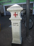
|   Coal Tax Post 1 - Dagenham Road, Romford Coal Tax Post 1 - Dagenham Road, Romford
in London Coal Tax Posts This post is located on the west side of Dagenham Road, 80 meters south of Rush Green Road in the Romford area of London. posted by:  Marine Biologist Marine Biologist location: London, United Kingdom date approved: 05/28/2012 last visited: 03/19/2024 |
 view gallery view gallery NW4.2 km NW4.2 km
|   Grange Hill Underground Station - Manor Road, Grange Hill, Essex, UK Grange Hill Underground Station - Manor Road, Grange Hill, Essex, UK
in Wikipedia Entries The entrance and ticket hall for Grange Hill tube station straddle the tracks and have a a flight of stairs leading down to the two platforms that have the tracks between them. The station is between Hainault and Chigwell on the Central Line loop. posted by:  Master Mariner Master Mariner location: Eastern England, United Kingdom date approved: 07/01/2014 last visited: never |
 view gallery view gallery NW4.2 km NW4.2 km
|   Grange Hill Underground Station - Manor Road, Grange Hill, Essex, UK Grange Hill Underground Station - Manor Road, Grange Hill, Essex, UK
in The Underground The entrance and ticket hall for Grange Hill tube station straddle the tracks and have a a flight of stairs leading down to the two platforms that have the tracks between them. The station is between Hainault and Chigwell on the Central Line loop. posted by:  Master Mariner Master Mariner location: Eastern England, United Kingdom date approved: 07/01/2014 last visited: 01/19/2021 |
|