 view gallery view gallery E17.2 km E17.2 km
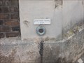
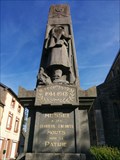
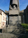
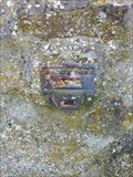
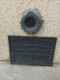
|   Benchmarks Tour Marguerite à Argentan Benchmarks Tour Marguerite à Argentan
in French Benchmarks Sur le mur posted by:  lulu_et_compagnie lulu_et_compagnie location: Normandie, France date approved: 08/20/2013 last visited: 11/28/2014 |
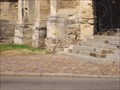
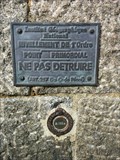
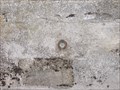 view gallery view galleryE17.2 km | Benchmarks Eglise d'Argentan. in French Benchmarks Sur l'église posted by: lulu_et_compagnie location: Normandie, France date approved: 08/20/2013 last visited: 11/28/2014 |
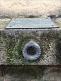
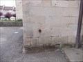 view gallery view galleryE17.2 km | Benchmarks palais de Justice d'Argentan in French Benchmarks Sur le Palais de Justice posted by: lulu_et_compagnie location: Normandie, France date approved: 08/20/2013 last visited: 11/28/2014 |
 view gallery view gallery N17.5 km N17.5 km
|  Le château de Falaise - Falaise, France Le château de Falaise - Falaise, France
in Wikipedia Entries FR - château Guillaume-le-Conquérant est un château fort formé d'une enceinte, situé sur un éperon rocheux.
EN - The castle Guillaume-le-Conquérant is a fortified castle formed by an enclosure, located on a rocky spur. posted by: geotrouvtou59 location: Normandie, France date approved: 04/05/2020 last visited: 03/18/2021 |
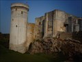 view gallery view galleryN17.5 km |  Le château de Falaise - Falaise, France Le château de Falaise - Falaise, France
in Monuments Historiques Français FR - château Guillaume-le-Conquérant est un château fort formé d'une enceinte, situé sur un éperon rocheux.
EN - The castle Guillaume-le-Conquérant is a fortified castle formed by an enclosure, located on a rocky spur. posted by: geotrouvtou59 location: Normandie, France date approved: 04/05/2020 last visited: 03/18/2021 |
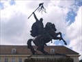 view gallery view galleryN17.7 km |  Guillaume le Conquerant. Falaise. France Guillaume le Conquerant. Falaise. France
in Monarchs of the World Statue de Guillaume le Conquerant posted by: lulu_et_compagnie location: Normandie, France date approved: 10/14/2015 last visited: 03/18/2021 |
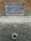
 view gallery view galleryN17.7 km | Benchmarks N-D de Guibray à Falaise in French Benchmarks Sur l'église posted by: lulu_et_compagnie location: Normandie, France date approved: 08/20/2013 last visited: 06/17/2015 |
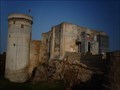 view gallery view galleryN18 km |  Le château de Falaise - Falaise, France Le château de Falaise - Falaise, France
in Castles FR - château Guillaume-le-Conquérant est un château fort formé d'une enceinte, situé sur un éperon rocheux.
EN - The castle Guillaume-le-Conquérant is a fortified castle formed by an enclosure, located on a rocky spur. posted by: geotrouvtou59 location: Normandie, France date approved: 04/10/2020 last visited: 03/18/2021 |
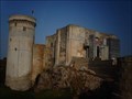 view gallery view galleryN18 km |  Le château de Falaise - Falaise, France Le château de Falaise - Falaise, France
in Satellite Imagery Oddities FR - château Guillaume-le-Conquérant est un château fort formé d'une enceinte, situé sur un éperon rocheux.
EN - The castle Guillaume-le-Conquérant is a fortified castle formed by an enclosure, located on a rocky spur. posted by: geotrouvtou59 location: Normandie, France date approved: 04/23/2020 last visited: 03/18/2021 |
 view gallery view galleryN18.2 km | benchmarks Eglise de Falaise in French Benchmarks Sur l'église posted by: lulu_et_compagnie location: Normandie, France date approved: 08/20/2013 last visited: 03/09/2019 |
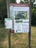 view gallery view gallery NE18.3 km NE18.3 km
|  Camp de Bierre - Merri, France Camp de Bierre - Merri, France
in In Search of the Celts Remains of the Celtic fortress Camp de Bierre. Marked routes throughout the area. posted by: Walking Boots location: Normandie, France date approved: 07/14/2022 last visited: 10/26/2022 |
 view gallery view galleryE18.7 km |  La méridienne de Cayenne, Argentan, France La méridienne de Cayenne, Argentan, France
in Greenwich Meridian Markers [FR] Le méridien de Greenwich passe à Argentan où il est marqué par une borne.
[EN] A stone marker of the meridian of Greenwich at Argentan. posted by: junkys location: Normandie, France date approved: 08/22/2017 last visited: never |
 view gallery view gallery W21.1 km W21.1 km
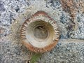
| Eglise de Messei Benchmark, mur - Messei, France in French Benchmarks Repère de nivellement sur le mur de l'église de Messei, dans l'Orne. posted by:  AlexEmilie AlexEmilie location: Normandie, France date approved: 10/08/2016 last visited: never |
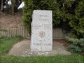
 view gallery view galleryW21.1 km |  World War I - Messei, France World War I - Messei, France
in World War I Memorials and Monuments Monument en l'honneur des habitants du village décédés lors de la première Guerre Mondiale, Messei, Orne.
Monument in honor of the villagers died during the First World War, Messei, Orne. posted by: AlexEmilie location: Normandie, France date approved: 10/08/2016 last visited: 03/27/2021 |
 view gallery view galleryW21.1 km |  World War II - Messei, France World War II - Messei, France
in World War II Memorials / Monuments Monument en l'honneur des habitants du village décédés lors de la seconde Guerre Mondiale, Messei, Orne. Monument in honor of the villagers died during the second World War, Messei, Orne. posted by: AlexEmilie location: Normandie, France date approved: 10/09/2016 last visited: 03/27/2021 |
 view gallery view gallery SW21.2 km SW21.2 km
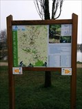
|  Circuit rando "La Ferrière" - La ferrière aux Etangs, France Circuit rando "La Ferrière" - La ferrière aux Etangs, France
in Hiking and walking trailheads [FR] Panneau d'informations illustrant différents circuits à faire en randonnée ou à vélo.
[EN] Information sign illustrating different circuits to be made in hiking or cycling. posted by: AlexEmilie location: Normandie, France date approved: 01/23/2017 last visited: 03/24/2021 |
 view gallery view gallery NW21.2 km NW21.2 km
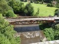
| Mulberry Whale, St Denis de Méré, Normandie, FR in World War II Sites This bridge "Le Pont des Bordeaux" over the Noireau near St Denis de Méré once formed part of the temporary "Mulberry" harbour at Arromanches. The original bridge was destroyed by the French Resistance shortly after D-Day. posted by: Team Sieni location: Normandie, France date approved: 09/13/2013 last visited: 03/18/2021 |
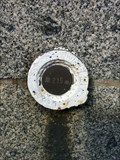
 view gallery view galleryW21.9 km | Repère de nivellement, voie verte, 182 in French Benchmarks Repère de nivellement sur la façade de l'ancienne gare de Messei. posted by: AlexEmilie location: Normandie, France date approved: 03/04/2016 last visited: never |
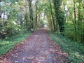 view gallery view galleryW22 km |  Voie Verte Flers-Domfront - Orne, France Voie Verte Flers-Domfront - Orne, France
in Rails to Trails Voie verte entre Flers et Domfront dans l'Orne.
Greenway between Flers and Domfront in the Orne. posted by: AlexEmilie location: Normandie, France date approved: 02/08/2017 last visited: 03/27/2021 |
 view gallery view galleryW22.7 km | Eglise Saint Jean, Benchmark - Flers, France in French Benchmarks Repère de nivellement sur l'église St Jean à Flers, Orne. posted by: AlexEmilie location: Normandie, France date approved: 11/01/2016 last visited: never |
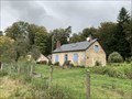 view gallery view gallerySW22.9 km |  Maison forestière - Champsecret - France Maison forestière - Champsecret - France
in Ranger Stations Une maison forestière dans la forêt domaniale des Andaines où les agents de l'Office National des forêts gère son exploitation.
A forest house in the Andaines state forest where agents of the National Forestry Office manage its exploitation. posted by: Alfouine location: Normandie, France date approved: 11/11/2020 last visited: 03/27/2021 |
 view gallery view galleryW23 km | Rue de la Boule, Benchmark - Flers, France in French Benchmarks Repère de nivellement rue de la Boule à Flers, Orne. posted by: AlexEmilie location: Normandie, France date approved: 10/27/2016 last visited: never |
 view gallery view galleryW23.2 km | Eglise St Germain, Benchmark - Flers, France in French Benchmarks Repère de nivellement sur l'église St Germain à Flers, Orne. posted by: AlexEmilie location: Normandie, France date approved: 10/27/2016 last visited: never |
 view gallery view galleryW23.2 km | Marché couvert, Benchmark - Flers, France in French Benchmarks Repère de nivellement sur le mur du marché couvert, centre ville de Flers, Orne. posted by: AlexEmilie location: Normandie, France date approved: 10/27/2016 last visited: never |
 view gallery view galleryW23.2 km | Square Delaunay, Benchmark - Flers, France in French Benchmarks Repère de nivellement sur le soubassement d'un bâtiment, face au square Delaunay à Flers, Orne. posted by: AlexEmilie location: Normandie, France date approved: 10/27/2016 last visited: never |
|