 view gallery view gallery SE8 km SE8 km
|   Crue du Tarn - 3 mars 1930 - Rue Pierre Delours, Barry-d'Islemade - Tarn et Garonne - Occitanie, FRA Crue du Tarn - 3 mars 1930 - Rue Pierre Delours, Barry-d'Islemade - Tarn et Garonne - Occitanie, FRA
in High Level Marks Repère de la crue du Tarn du 3 mars 1930. posted by:  PitiChuc PitiChuc location: Occitanie, France date approved: 08/26/2022 last visited: never |
 view gallery view gallery SE27 km SE27 km
|   Les crues du Tarn - Pont de Reynies Les crues du Tarn - Pont de Reynies
in High Level Marks L'échelle de crue sur le pont de Reynies qui rappelle les spectaculaires inondations du Tarn, notamment celles meurtrières de 1930 posted by:  niko_kristyn niko_kristyn location: Occitanie, France date approved: 12/03/2017 last visited: never |
 view gallery view gallery W27 km W27 km
|   centrale nucleaire - Golfech,Fr centrale nucleaire - Golfech,Fr
in Nuclear Power Plants la centrale nucleaire est toujours en activité. posted by:  sara et gege sara et gege location: Occitanie, France date approved: 07/20/2015 last visited: 07/05/2023 |
 view gallery view gallery S28.3 km S28.3 km
|   Benchmark Hotel de ville de VERDUN-SUR-GARONNE Benchmark Hotel de ville de VERDUN-SUR-GARONNE
in French Benchmarks Benchmark Languedoc-Roussillon posted by:  geotrouvtou59 geotrouvtou59 location: Occitanie, France date approved: 08/04/2016 last visited: 07/31/2016 |
 view gallery view gallery E33.6 km E33.6 km
|   Les dolmens de Septfonds Les dolmens de Septfonds
in Megalithic Monuments [EN] There are reputed to be 15 dolmens (mostly ruinous) around Septfonds. This is but one of those. [FR] Il y aurait 15 dolmens (pour la plupart ruineux) autour de Septfonds. Ce n’est qu’un de ceux-là. posted by:  SMacB SMacB location: Occitanie, France date approved: 01/05/2013 last visited: 04/02/2023 |
 view gallery view gallery N34.4 km N34.4 km
|   Notre Dame de l’Assomption - Carnac Rouffiac (Lot), France Notre Dame de l’Assomption - Carnac Rouffiac (Lot), France
in Legacy of Medieval Spiritual Warriors [FR] Ce monument est une ancienne dépendance des Templiers puis des Hospitaliers de Saint Jean de Jérusalem. [EN] This monument is a former posession of the Templars and subsequently the Knights of Saint John of Jerusalem. posted by:  RakeInTheCache RakeInTheCache location: Occitanie, France date approved: 10/25/2020 last visited: never |
 view gallery view gallery N34.6 km N34.6 km
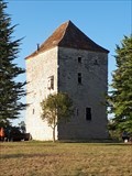
|   Tour de Trébaïx - Trébaïx (Lot), France Tour de Trébaïx - Trébaïx (Lot), France
in Legacy of Medieval Spiritual Warriors [FR] Ce serait à la fin du xiiie siècle que les Templiers se sont installés à Trébaïx. [EN] The Templars took residence in Trébaïx at the end of the 13th century. posted by:  RakeInTheCache RakeInTheCache location: Occitanie, France date approved: 10/26/2020 last visited: never |
 view gallery view gallery W38.8 km W38.8 km
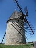
|   Le moulin à vent de Cuq Le moulin à vent de Cuq
in Windmills Le moulin à vent de Cuq posted by:  D-S 33 D-S 33 location: France date approved: 05/23/2010 last visited: never |
 view gallery view gallery W39.1 km W39.1 km
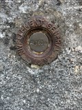
|   Repère de nivellement - Eglise Saint-Caprais de Cuq - Lot-et-Garonne - Nouvelle-Aquitaine, FRA Repère de nivellement - Eglise Saint-Caprais de Cuq - Lot-et-Garonne - Nouvelle-Aquitaine, FRA
in French Benchmarks Repère de nivellement de l'église Saint-Caprais de Cuq posted by:  PitiChuc PitiChuc location: Nouvelle-Aquitaine, France date approved: 08/26/2022 last visited: never |
 view gallery view gallery NE39.6 km NE39.6 km
|   Cahors, France Cahors, France
in In Search of the Celts [FR] Le nom Cahors provient de l'expression latine Civitas Cadurcorum qui signifie la cité des Cadurques, un peuple gaulois. [EN] Cahors derives from Cadurcorum. The original name of the town was Divona or Divona Cadurcorum. posted by:  RakeInTheCache RakeInTheCache location: Occitanie, France date approved: 10/27/2020 last visited: 08/24/2022 |
 view gallery view gallery NE42.2 km NE42.2 km
|   La fontaine des Chartreux - Cahors, France La fontaine des Chartreux - Cahors, France
in In Search of the Celts [FR] Elle est une résurgence calcaire, autrefois lieu de culte de la déesse Divona, déesse des eaux d'origine celtique. [EN] It is a limestone resurgence, once a place of worship of the goddess Divona, goddess of waters of Celtic origin. posted by:  RakeInTheCache RakeInTheCache location: Occitanie, France date approved: 11/01/2020 last visited: never |
 view gallery view gallery NE42.2 km NE42.2 km
|   La fontaine des Chartreux - Cahors, France La fontaine des Chartreux - Cahors, France
in Natural Springs [FR] Elle est une résurgence calcaire, autrefois lieu de culte de la déesse Divona, qui donna son nom à Cahors (Divona Cadurcorum). [EN] The fontaine is a limestone resurgence, once a place of worship of the goddess Divona. posted by:  RakeInTheCache RakeInTheCache location: Occitanie, France date approved: 11/01/2020 last visited: never |
 view gallery view gallery SW42.3 km SW42.3 km
|   Benchmark Mairie de SARRANT Benchmark Mairie de SARRANT
in French Benchmarks Benchmark Languedoc-Roussillon posted by:  geotrouvtou59 geotrouvtou59 location: Occitanie, France date approved: 08/04/2016 last visited: 07/31/2016 |
 view gallery view gallery NE42.3 km NE42.3 km
|   Way Marker GR 65 La via Podiensis - Cahors, France Way Marker GR 65 La via Podiensis - Cahors, France
in Way of St. James [FR] La via Podiensis, la "Route du Puy" est la plus célèbre et la plus populaire, car au plus près de la réalité historique. [EN] The French name for this GR route is the Chemin de Saint-Jacques. posted by:  RakeInTheCache RakeInTheCache location: Occitanie, France date approved: 11/01/2020 last visited: never |
 view gallery view gallery NE42.3 km NE42.3 km
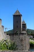
|   Pont Valentré - Cahors, Midi-Pyrénées, France Pont Valentré - Cahors, Midi-Pyrénées, France
in Gothic Architecture Pont Valentré took over 70 years to build in the 14th century. // Pont Valentré a pris plus de 70 ans pour construire au 14ème siècle. posted by:  Trail Blaisers Trail Blaisers location: Occitanie, France date approved: 09/06/2017 last visited: 08/24/2022 |
 view gallery view gallery NE42.5 km NE42.5 km
|   Pont Valentré - Cahors, Midi-Pyrénées, France Pont Valentré - Cahors, Midi-Pyrénées, France
in Urban Legends and Superstitions Legend has it that the bridge's builder made a deal with the devil to speed up the pace of construction. // Selon la légende, le constructeur de ponts a fait un accord avec le diable pour accélérer le rythme de la construction. posted by:  Trail Blaisers Trail Blaisers location: Occitanie, France date approved: 09/08/2017 last visited: 08/24/2022 |
 view gallery view gallery NE42.5 km NE42.5 km
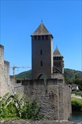
|   Devil's Tower- Cahors, Midi-Pyrénées, France Devil's Tower- Cahors, Midi-Pyrénées, France
in Man-made Devilish Locations The bridge's central tower is named Devil's Tower for the apparent role that the devil played in getting the bridge finished. // La tour centrale du pont s'appelle Devil's Tower pour le rôle apparent que le diable a joué dans la fin du pont. posted by:  Trail Blaisers Trail Blaisers location: Occitanie, France date approved: 09/03/2017 last visited: 04/03/2023 |
 view gallery view gallery NE42.5 km NE42.5 km
|   Pont Valentré - Cahors, France Pont Valentré - Cahors, France
in Monuments Historiques Français The iconic Pont Valentré is the signature for the city of Cahors and the surrounding vineyards. This stone arched bridge, fortified with three towers, is classic example of medieval French military architecture, a National Historical Monument. posted by:  arby101ca arby101ca location: Occitanie, France date approved: 08/11/2015 last visited: 08/24/2022 |
 view gallery view gallery NE42.5 km NE42.5 km
|   Pont Valentré, Cahors Pont Valentré, Cahors
in Arch Bridges The iconic Pont Valentré is the signature for the city of Cahors and the surrounding vineyards. This stone arched bridge, fortified with three towers, is classic example of medieval French military architecture, a National Historical Monument. posted by:  arby101ca arby101ca location: France date approved: 08/11/2015 last visited: 08/24/2022 |
 view gallery view gallery NE42.5 km NE42.5 km
|   Chemins de Saint-Jacques-de-Compostelle en France -Pont Valentré, Cahors Chemins de Saint-Jacques-de-Compostelle en France -Pont Valentré, Cahors
in World Heritage Sites The iconic Pont Valentré is the signature for the city of Cahors and the surrounding vineyards. This stone arched bridge, fortified with three towers, is classic example of medieval French military architecture and UNESCO world heritage site,868-052. posted by:  arby101ca arby101ca location: Occitanie, France date approved: 08/10/2015 last visited: 08/24/2022 |
 view gallery view gallery NE42.5 km NE42.5 km
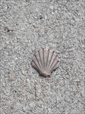
|   Way Marker Pont Valentré - Cahors, France Way Marker Pont Valentré - Cahors, France
in Way of St. James [FR] Cahors est une étape incontournable sur la voie principale du chemin de Saint-Jacques de Compostelle, la Via Podiensis. [EN] Cahors is crossed by the Via Podiensis, the route from Puy en Velay, today called the Grande Randonnée route GR65. posted by:  RakeInTheCache RakeInTheCache location: Occitanie, France date approved: 10/28/2020 last visited: never |
 view gallery view gallery NE42.8 km NE42.8 km
|   The Blues Trail: Mississipi to France. Cahors. France The Blues Trail: Mississipi to France. Cahors. France
in Blues Legends The Blues Trail: Mississipi to France posted by:  lulu_et_compagnie lulu_et_compagnie location: Occitanie, France date approved: 12/10/2018 last visited: 12/10/2018 |
 view gallery view gallery E43 km E43 km
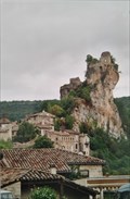
|   Château de Penne, Penne, France Château de Penne, Penne, France
in Wikipedia Entries FR - Le château de Penne est un château fort du XIIe siècle situé dans la commune de Penne dans le Tarn en Occitanie.
EN - The Château de Penne is a 12th century fortified castle located in the town of Penne in the Tarn region of Occitanie. posted by:  geotrouvtou59 geotrouvtou59 location: Occitanie, France date approved: 04/30/2021 last visited: 08/10/2007 |
 view gallery view gallery E43 km E43 km
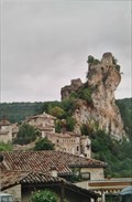
|   Château de Penne - Penne, France Château de Penne - Penne, France
in Monuments Historiques Français FR - Le château de Penne est un château fort du XIIe siècle situé dans la commune de Penne dans le Tarn en Occitanie.
EN - The Château de Penne is a 12th century fortified castle located in the town of Penne in the Tarn region of Occitanie. posted by:  geotrouvtou59 geotrouvtou59 location: Occitanie, France date approved: 04/30/2021 last visited: 08/10/2007 |
 view gallery view gallery NE43 km NE43 km
|   Cahors - Jean-Jacques CHAPOU - Héros de la résistance 1944 Cahors - Jean-Jacques CHAPOU - Héros de la résistance 1944
in World War II Memorials / Monuments Statue de Jean Jacques CHAPOU par Serge LORQUIN posted by:  Gulliver D. Gulliver D. location: Occitanie, France date approved: 09/06/2017 last visited: never |
|