 view gallery view gallery SW5 km SW5 km
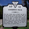
|   Goodwin Neck Goodwin Neck
in Virginia Historical Markers Erected 1989 by Department of Historic Resources. (Marker Number NP 12.) posted by:  turnersrugs turnersrugs location: Virginia date approved: 03/01/2013 last visited: 03/04/2013 |
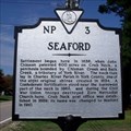 view gallery view gallerySW6.1 km | Seaford in Virginia Historical Markers Erected 1992 by Department of Historic Resources. (Marker Number NP 3.) posted by: turnersrugs location: Virginia date approved: 03/01/2013 last visited: 07/23/2014 |
 view gallery view gallery NW6.9 km NW6.9 km
|  Achilles, VA. 23001 Achilles, VA. 23001
in U.S. Post Offices A rural VA post office posted by: pud & pop location: Virginia date approved: 02/08/2008 last visited: 07/04/2012 |
 view gallery view galleryNW7.4 km | Bena, VA. 23108 in U.S. Post Offices A rural VA Post Office posted by: pud & pop location: Virginia date approved: 02/08/2008 last visited: never |
 view gallery view gallerySW9 km |  Matt Hill and Andrew Roithmayr Eagle Scout Projects Matt Hill and Andrew Roithmayr Eagle Scout Projects
in Eagle Scout Project Sites Labyrinth at Providence United Methodist Church, Rt 17 and Dare Rd. posted by: Team Roberson location: Virginia date approved: 03/24/2008 last visited: 03/24/2008 |
 view gallery view gallerySW9 km | Frank Baxter Eagle Scout Project in Eagle Scout Project Sites Meditation Garden at Providence United Methodist Church, Rt 17 and Dare Rd. posted by: Team Roberson location: Virginia date approved: 03/24/2008 last visited: 03/24/2008 |
 view gallery view gallery W9 km W9 km
|  Moore Property - Hamiton Rd in Virginia Moore Property - Hamiton Rd in Virginia
in U.S. Benchmarks US Geological Survey Disk Boundary Marker encased in concrete, surface scratched making it difficult to read. posted by: Arizona Desert Brew location: Virginia date approved: 12/09/2008 last visited: never |
 view gallery view galleryW9 km |  Moore House Cemetery - Yorktown, VA Moore House Cemetery - Yorktown, VA
in Worldwide Cemeteries Cemetery near a historic home posted by: stinger503 location: Virginia date approved: 08/14/2017 last visited: 01/17/2019 |
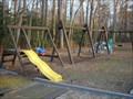 view gallery view gallerySW9 km | Andy Peterson Eagle Scout Project in Eagle Scout Project Sites Playground repair and landscaping at Providence United Methodist Church, Rt 17 and Dare Rd. posted by: Team Roberson location: Virginia date approved: 03/24/2008 last visited: 03/24/2008 |
 view gallery view galleryW9.7 km |  The Deposit - Yorktown VA The Deposit - Yorktown VA
in Signs of History Eighteenth century siege warfare meant weeks of labor for the soldiers, not only on the trenches, but in the rear areas where special siege materials were made and stored. posted by:  Don.Morfe Don.Morfe location: Virginia date approved: 09/08/2020 last visited: 09/26/2021 |
 view gallery view galleryW9.7 km | Wormley Creek Crossing - Yorktown VA in Signs of History The earth dam in front of you creates Wormley Pond which existed in 1781 when Augustine Moore operated a grist mill here. posted by: Don.Morfe location: Virginia date approved: 09/09/2020 last visited: 09/26/2021 |
 view gallery view galleryW9.8 km | American Encampment-1781 Siege of Yorktown - Yorktown VA in Signs of History On September 28, 1781, as General Washington’s army marched within a mile of Yorktown, the various brigades were assigned locations for their camps, hospitals, and artillery parks. posted by: Don.Morfe location: Virginia date approved: 09/09/2020 last visited: 09/26/2021 |
 view gallery view galleryW9.8 km | Time, Tide and Erosion - Yorktown VA in Signs of History On your left is British Redoubt No. 10 partly reconstructed where a fragment of its moat was found in 1956. posted by: Don.Morfe location: Virginia date approved: 09/07/2020 last visited: 09/26/2021 |
 view gallery view galleryW9.8 km | The First Siege Line - Yorktown, VA, USA in Signs of History Washington’s troops built works like these when they opened the Siege of Yorktown. posted by: Don.Morfe location: Virginia date approved: 04/01/2020 last visited: 09/27/2021 |
 view gallery view galleryW10 km | Redoubts 9 and 10 1781-Siege of Yorktown - Yorktown VA in Signs of History The completion of the Allied Second Siege Line was blocked by a portion of the British outer works – two detached earthen forts called Redoubts 9 and 10, located 400 yards in advance of the British Inner Defense Line. posted by: Don.Morfe location: Virginia date approved: 09/07/2020 last visited: 09/26/2021 |
 view gallery view galleryW10 km | Redoubt 10-1781 Siege of Yorktown - Yorktown VA in Signs of History The Marquis de Lafayette selected the light infantry companies from his Continental Army division to carry out the American attack on Redoubt 10. Lieutenant-Colonel Alexander Hamilton led the assaulting force of 400 Americans. posted by: Don.Morfe location: Virginia date approved: 09/08/2020 last visited: 09/26/2021 |
 view gallery view galleryW10 km | The Second Siege Line - Yorktown, VA in Signs of History The low earthworks on either side are part of the French and American advance line. Construction was started when allied artillery fire had sufficiently weakened the British defenses. posted by: Don.Morfe location: Virginia date approved: 04/02/2020 last visited: 09/27/2021 |
 view gallery view galleryW10 km | Redoubt 9-1781 Siege of Yorktown - Yorktown VA in Signs of History On October 14, 1781, Baron Antoine de Vioménil had overall command of the French attack on Redoubt 9, which was defended by approximately 120 British and German forces. posted by: Don.Morfe location: Virginia date approved: 09/08/2020 last visited: 09/26/2021 |
 view gallery view galleryW10 km | Grand American Battery - Yorktown, VA, USA in Signs of History The capture of British Redoubts 9 and 10 enabled the Americans to quickly finish the Allied Second Siege Line, constructing the Grand American Battery within point blank artillery range of the British Inner Defensive Line. posted by: Don.Morfe location: Virginia date approved: 04/01/2020 last visited: 09/27/2021 |
 view gallery view galleryW10 km | Major General Benjamin Lincoln and His Division-1781 Siege of Yorktown - Yorktown VA in Signs of History On May 12, 1780, Major General Benjamin Lincoln surrendered Charleston, South Carolina, and his army of 5,000 soldiers to the British. That fall, he rejoined the Continental Army when he was exchanged for a British and a German general. posted by: Don.Morfe location: Virginia date approved: 09/09/2020 last visited: 09/26/2021 |
 view gallery view galleryW10.1 km |  1681 Mortar - Yorktown Historic Battlefield, VA 1681 Mortar - Yorktown Historic Battlefield, VA
in Static Artillery Displays This mortar, cast in 1681 was still in use one hundred years later at the Battle of Yorktown. It is now on display at the Yorktown National Historic Battlefield. posted by: Hikenutty location: Virginia date approved: 07/19/2008 last visited: 03/09/2013 |
 view gallery view galleryW10.1 km | "Le Renard" - Yorktown Historical Battlefield, VA in Static Artillery Displays This french 6 pounder was nicknamed "Le Renard" or "The Fox". It was cast in bronze in Strasbourg in 1762. The cannon could throw a 6 pound ball of iron as far as a mile. posted by: Hikenutty location: Virginia date approved: 07/19/2008 last visited: 03/09/2013 |
 view gallery view galleryW10.1 km | Gloucester Pt., VA. 23062 in U.S. Post Offices A rural VA post office posted by: pud & pop location: Virginia date approved: 02/08/2008 last visited: 07/04/2012 |
 view gallery view galleryW10.3 km | Virginia Militia-1781 Siege of Yorktown - Yorktown VA in Signs of History Nearly 40 percent of the American forces at Yorktown were Virginia Militia troops. Brigadier General Thomas Nelson, Jr., who was also Virginia’s governor, commanded the militia. posted by: Don.Morfe location: Virginia date approved: 09/09/2020 last visited: 09/26/2021 |
 view gallery view galleryW10.3 km | Brown Wheel Canon - Yorktown, VA in Static Artillery Displays This is one of many cannons at the Yorktown Visitor Center. posted by: bluesnote location: Virginia date approved: 12/27/2014 last visited: 01/24/2024 |
|