 view gallery view gallery NE2.7 km NE2.7 km
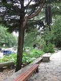
|   Vogel State Park Campground Vogel State Park Campground
in Campgrounds Wonderful site. Highly accessable to all. Many additional opportunities in area. posted by:  ChapterhouseInc ChapterhouseInc location: Georgia date approved: 10/30/2005 last visited: 04/15/2018 |
 view gallery view gallery SE3.2 km SE3.2 km
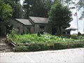
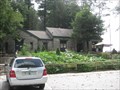
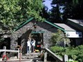
|  Walasi-Yi Interpretive Center - Neels Gap - Georgia Walasi-Yi Interpretive Center - Neels Gap - Georgia
in Wikipedia Entries Walasi-Yi (pronounced: Wa La See Yee) was built by the Civilian Conservation Corps beginning in 1934 and completed in 1937 and is located on US 19 in the mountains of North Georgia. posted by:  Lat34North Lat34North location: Georgia date approved: 10/14/2007 last visited: 08/01/2020 |
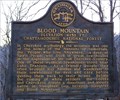 view gallery view gallerySE3.2 km |  Blood Mountain Blood Mountain
in Georgia Historical Markers A marker at Neel's Gap on highway 19 between Blairsville and Cleveland, Georgia. posted by:  NevaP NevaP location: Georgia date approved: 02/13/2007 last visited: 08/01/2020 |
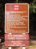
 view gallery view gallerySE3.2 km |  Walasi-Yi Inn - Blairsville, GA Walasi-Yi Inn - Blairsville, GA
in U.S. National Register of Historic Places Located conviently along the Appalichian Trail, they provide any gear you might need for your hike. Also serves as a information booth and hostel (yes, they have showers). Mke sure to check out the 'shoe collection'. posted by: ChapterhouseInc location: Georgia date approved: 08/24/2010 last visited: 08/01/2020 |
 view gallery view gallerySE3.2 km |  Mountain Crossings at Walasi-yi Mountain Crossings at Walasi-yi
in Outdoor Recreation Stores Located conviently along the Appalichian Trail, they provide any gear you might need for your hike. Also serves as a information booth and hostel (yes, they have showers). Mke sure to check out the 'shoe collection'. posted by: ChapterhouseInc location: Georgia date approved: 08/27/2010 last visited: 08/01/2020 |
 view gallery view gallerySE3.2 km |  Walasi-Yi - Neels Gap - North Georgia Walasi-Yi - Neels Gap - North Georgia
in Civilian Conservation Corps Walasi-Yi (pronounced: Wa La See Yee) was built by the Civilian Conservation Corps beginning in 1934 and completed in 1937 and is located on US 19 in the mountains of North Georgia. posted by: Lat34North location: Georgia date approved: 10/14/2007 last visited: 08/01/2020 |
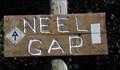
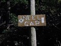 view gallery view gallerySE3.2 km |  Neels Gap - Georgia Neels Gap - Georgia
in Named Mountain Gaps Neels Gap is located in the Southern Appalachian Mountains of North Georgia. posted by: Lat34North location: Georgia date approved: 10/13/2007 last visited: 08/01/2020 |
 view gallery view gallerySE3.2 km |  AT at Walasi-Yi - Neel's Gap, North GA AT at Walasi-Yi - Neel's Gap, North GA
in Appalachian Trail Neel's Gap is located in the Southern Appalachian Mountains of North Georgia. The Walasi-yi Center, a stone building built in the 1930's by the Civilian Conservation Corps (CCC) is located at Neels Gap. posted by: Lat34North location: Georgia date approved: 11/09/2007 last visited: 08/01/2020 |
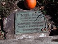 view gallery view gallerySE3.2 km |  Neel's Gap, North GA - 3108 Neel's Gap, North GA - 3108
in Elevation Signs Mounted to a bolder at the entrance to the Walasi-yi Center, a stone building built in the 1930's by the Civilian Conservation Corps (CCC) at Neels Gap posted by: Lat34North location: Georgia date approved: 08/13/2010 last visited: 08/01/2020 |
 view gallery view gallerySE3.2 km |  Walasi-Yi Shoe Tree Walasi-Yi Shoe Tree
in Shoe Trees Located conviently along the Appalichian Trail, they provide any gear you might need for your hike. Make sure to check out the 'shoe collection' donated by AT hikers. posted by: ChapterhouseInc location: Georgia date approved: 09/01/2010 last visited: 08/01/2020 |
 view gallery view gallery SW3.9 km SW3.9 km
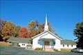
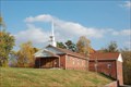
|  Mt. Zion Baptist Church - Suches, Georgia Mt. Zion Baptist Church - Suches, Georgia
in Country Churches Mt Zion Baptist Church, a north Georgia mountain church, is located 4-miles east of Suches on Highway 180, Wolf Pen Gap Road. posted by: misfitt location: Georgia date approved: 02/03/2008 last visited: 05/29/2011 |
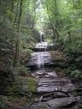 view gallery view gallerySE4.5 km |  DeSoto Falls - Cleveland, GA DeSoto Falls - Cleveland, GA
in Waterfalls Quick hike to a nice fall viewing platform posted by: huntinkat location: Georgia date approved: 05/11/2009 last visited: 04/21/2018 |
 view gallery view gallery E5.1 km E5.1 km
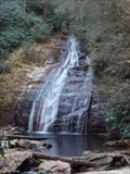
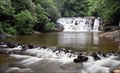
| Helton Creek Falls in Waterfalls A set of two waterfalls in the Chattahoochee National Forest. posted by: GatoRx location: Georgia date approved: 11/22/2008 last visited: 04/21/2018 |
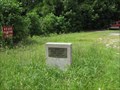
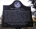 view gallery view galleryNE5.1 km | Byron Herbert Reece in Georgia Historical Markers A marker along highway 19, south of Blairsville,Georgia, commemorating the life of poet Byron Herbert Reece. posted by: NevaP location: Georgia date approved: 02/13/2007 last visited: 04/15/2018 |
 view gallery view gallerySW6.8 km | Harmony Church - Suches, Georgia in Country Churches Harmony Church, a north Georgia mountain church, is located 2-miles east of Suches on highway 180, Wolf Pen Gap Road. posted by: misfitt location: Georgia date approved: 02/11/2008 last visited: 05/29/2011 |
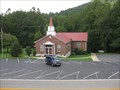
 view gallery view galleryE7.1 km | Union Baptist Church - Blairsville, GA in Country Churches Located along the Richard B Russell Scenic Highway in the Chattahoochee National Forest, a few graves are near the church, moat are atop the hill opposite the building. It was established in 1897. posted by: ChapterhouseInc location: Georgia date approved: 08/24/2010 last visited: 08/18/2010 |
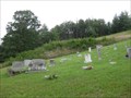 view gallery view galleryE7.1 km |  Union Baptist Cemetery - Blairsville, GA Union Baptist Cemetery - Blairsville, GA
in Worldwide Cemeteries Located along the Richard B Russell Scenic Highway in the Chattahoochee National Forest, a few graves are near the church, moat are atop the hill opposite the building. It was established in 1897. posted by: ChapterhouseInc location: Georgia date approved: 08/25/2010 last visited: 08/19/2010 |
 view gallery view galleryE7.1 km |  Union Baptist Church Cemetery - GA Union Baptist Church Cemetery - GA
in Churchyard Cemeteries Located along the Richard B Russell Scenic Highway, a few graves are near the church, moat are atop the hill opposite the building. posted by: ChapterhouseInc location: Georgia date approved: 08/24/2010 last visited: 08/18/2010 |
 view gallery view gallerySW7.7 km | Mt Lebanon Baptist Church- Suches Georgia in Country Churches Mt Lebanon Baptist Church, a north Georgia mountain church, is located on highway 180 about 1.25 miles east of Suches posted by: misfitt location: Georgia date approved: 02/03/2008 last visited: 05/29/2011 |
 view gallery view gallery S7.7 km S7.7 km
| Dicks Creek Falls - Dahlonega, Georgia in Waterfalls Dick's Creek Falls and the shoals above it are popular for wading and sunning in the summer posted by: Atlanta Highland Bagpiper location: Georgia date approved: 09/01/2016 last visited: never |
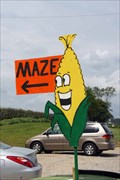 view gallery view galleryNE8 km |  Choestoe Valley Produce Corn Maze – Blairsville, GA Choestoe Valley Produce Corn Maze – Blairsville, GA
in Outdoor Mazes Choestoe Valley Produce Corn Maze is located on US 19/129 south of Blaresville, GA. posted by: Lat34North location: Georgia date approved: 09/26/2009 last visited: 04/21/2018 |
 view gallery view galleryNE8.4 km |  Richard B Russell Scenic Highway - Blairsville, GA Richard B Russell Scenic Highway - Blairsville, GA
in Citizen Memorials The northern end of the scenic route is notated with this marker. posted by: ChapterhouseInc location: Georgia date approved: 08/24/2010 last visited: 08/21/2011 |
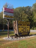 view gallery view gallerySE9.2 km | Mountain View Campground in Campgrounds "Home of the White Bat"
Small campground surrounded by more than one could do in a lifetime. Has a modest store.
706-865-3877 posted by: ChapterhouseInc location: Georgia date approved: 10/30/2005 last visited: 05/29/2011 |
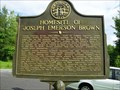 view gallery view gallerySW9.2 km | Homesite of Joseph Emerson Brown-GHM 144-6-Union Co in Georgia Historical Markers Ga 60 at the Woody Gap School, Suches posted by: Sprinterman location: Georgia date approved: 09/06/2009 last visited: 05/29/2011 |
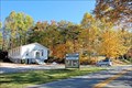
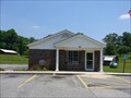 view gallery view gallerySW9.2 km |  Suches, GA 30572 Suches, GA 30572
in U.S. Post Offices Small town Post Office. posted by: CM-14 location: Georgia date approved: 06/18/2007 last visited: 05/29/2011 |
|