
Bowsher Ford Bridge
Posted by:  NoLemon
N 39° 55.789 W 087° 21.139
16S E 469895 N 4420027
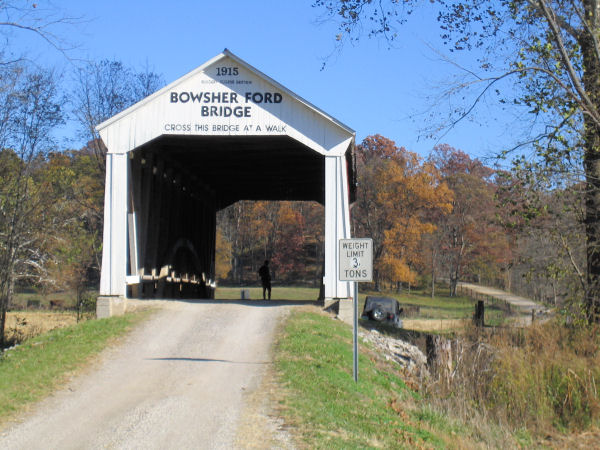
About a mile northeast of the town of Howard, Bowsher Ford Bridge carries county road 1125N over Mill Creek in Northern Parke County, Indiana.
Waymark Code: WMX4C
Location: Indiana, United States
Date Posted: 11/01/2006
Views: 25
Built in 1915, this covered bridge is a single span Burr Arch truss design. It is 72 feet long and 16 feet wide. The bridge was placed on the National Register of Historic Places in 1978.
Web Address: [Web Link]

Description of Covered Bridge:
The bridge looks to be in fairly decent condition with the usual vandalism/graffiti found on these old rural bridges.
Year Built: 1915/01/01
Current Condition of Bridge: Not listed
Parking (If not at the bridge):: Not listed
Location (Road - City - State - Country): Not listed
|
Visit Instructions:
To log a Visit, please make every effort to supply an image of yourself at the site. The standard GPS photo may be used as well, or even just an image that you took when you visited the location. If you do not have the option to provide an image, please provide a detailed description of your visit so we can form a 'mental image'