
Lownsdale Square, Portland, Oregon
Posted by:  Rose Red
N 45° 30.950 W 122° 40.617
10T E 525231 N 5040306
Lownsdale Square (to the north) is located between SW Third & Fourth Avenues and Salmon & Main Streets.
Waymark Code: WMMDT
Location: Oregon, United States
Date Posted: 08/17/2006
Views: 56
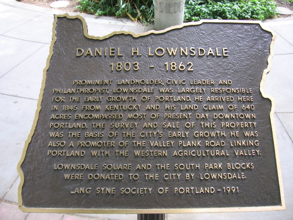
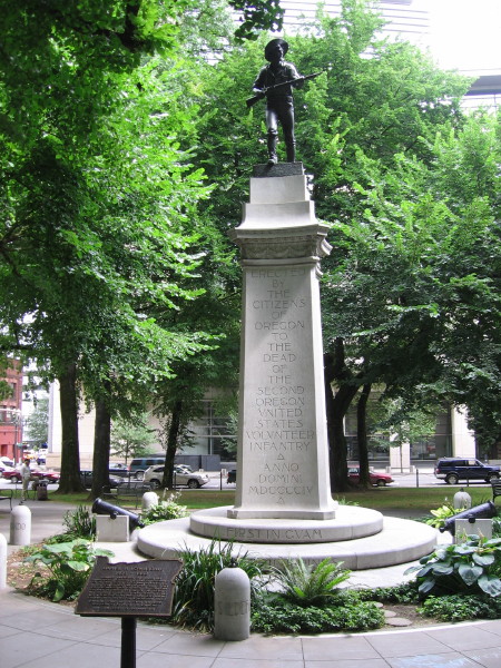
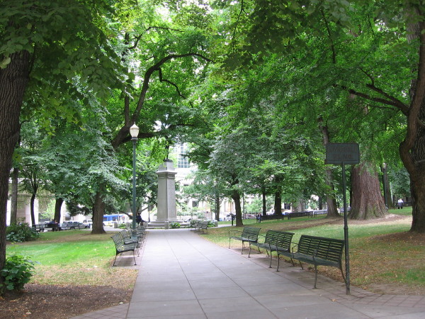
Chapman Square and Lownsdale Square--These two blocks were set aside as parks in Portland's original plat map of 1852. In the 1880's, anti-Chinese riots took place here amidst the ginkos, cedars, elms, and pines. The squares were separated by sex in the '20's to protect women from "undesirable male elements."Lownsdale Square (to the north), between SW Third & Fourth Avenues and Salmon & Main Streets, is a park used originally only by men. It was named for Daniel Lownsdale, a tanner who became a legislator in early Oregon government. Lownsdale gained fame for building the Great Plank Road which linked the city and its waterfront to neighboring farm communities, making it possible to send lumber and produce from Oregon farms to San Francisco, where the gold rush created a huge market for supplies. "Soldiers' Monument," Douglas Tilden and H.D. Wright, 1906.
Instructions for logging waymark: A photograph is required of you (or your GPS receiver, if you are waymarking solo) and the historic plaque.