|
 Olson Observation Tower - Monongahela National Forest - Black Fork, WV
N 39° 06.402 W 079° 36.198
17S E 620763 N 4329546
The Olson Observation Tower of Monongahela National Forest is located the end of Forest Road 717 in Tucker County, West Virginia
Waymark Code: WMER4Z
Location: West Virginia, United States
Date Posted: 06/30/2012
Views: 5
Olson Observation Tower - Monongahela National Forest - Black Fork, West Virginia
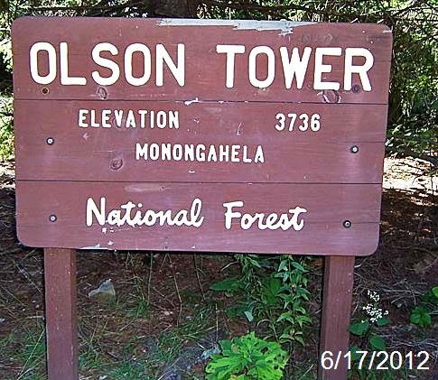
Olson Tower Observation Site is a small site that has the Olson Observation Tower, the second one on this site. The tower, which has 133 steps to the top viewing platform, was built in 1963 and named in honor of Ernst B. Olson, a forest firefighter with 28 years of service. The tower, accessible to the top, provides 360-degree views of the surrounding area including the Cheat River watershed, Parsons, Blackwater Canyon, Canaan Mountain, Backbone Mountain and the Otter Creek Wilderness. a few picnic tables are located on the road to the access tower
Estimated size of the public land (in regional measurement standard: hectares, acres, kms, etc.): 3

Is there a trail system?: Yes
If there is a trail system, please describe length, terrain, etc.:
Canyon Rim Trail # 117 - 3 miles in length and begins 0.1 miles below the picnic area.
Limerock Trail # 142 - 4.1 miles in length and located along FR 18.
Moderate Terrain on both trails
What points of interest are there?:
Vistas / Overlook, Picnic Tables, Hiking Trails
What activities are available?:
Nature Viewing
Wildlife Viewing
Picnicking
Hours of accessibility?: Sunrise-Sunset
List of known hazards (cliffs, snakes, poison plants, etc.):
Cliffs, unstable ground
Dogs Allowed?: Yes
Is a permit/fee required?: No
Please supply the website of the land if available: [Web Link]
If a permit/fee is required please describe in detail how to get one, how much, etc.: Not listed
|
Visit Instructions:
Visitors are encouraged to supply a picture of either themselves or their GPS at the trailhead and/or signage of the public access lands - describe your experience there and what you saw - tell us why other folks should come visit!
Recent Visits/Logs:
| There are no logs for this waymark yet. |
|
|
|
|