
N 37º 46.222' W 122º 26.473' - Buena Vista Park - San Francisco, CA
Posted by:  DougK
DougK
N 37° 46.222 W 122° 26.473
10S E 549212 N 4180484
This is the southernmost of only two accessible coordinate palindromes in San Francisco.
Waymark Code: WM908Q
Location: California, United States
Date Posted: 06/07/2010
Views: 9
This is one of only two accessible 15-digit coordinate palindromes in San Francisco.
While researching full coordinate palindrome possibilities, I discovered that all palindromes lie on a series of diagonal lines running NW to SE. A line of palindromes crosses the city of San Francisco, starting just off the Golden Gate Bridge, slicing across the city and exiting into the bay.
This Google map shows the possible palindromes.
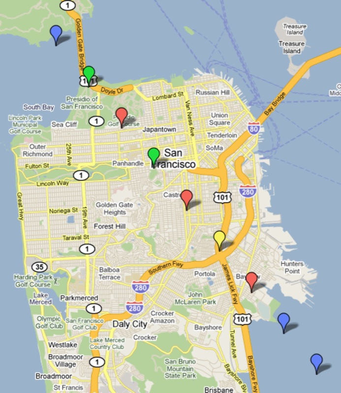
Blue bubbles are palindromes over water.
Red bubbles are palindromes that appear to be on inaccessible, building rooftops.
Yellow bubble is a palindrome that look dangerous to access at a freeway interchange.
Green bubbles are palindromes that are accessible and have been visited.
This is the southern most palindrome in San Francisco and is located in Buena Vista Park. The other palindrome is located near 3rd base on a baseball diamond in the Presidio.