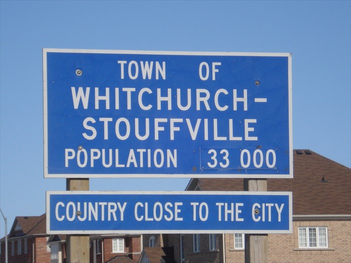
This sign is located on 9th Line (York Rd 69) south of Stouffville.
Whitchurch-Stouffville
Whitchurch-Stouffville (2006 population 24,390) is a municipality in the Greater Toronto Area of Ontario, Canada. Situated in the mid-eastern area of the Regional Municipality of York, Whitchurch-Stouffville primarily functions as a bedroom community for the City of Toronto and its environs. Though the municipal government is styled as a singular "town," Whitchurch-Stouffville in fact consists of several detached communities and the intermediary countryside; the largest urban area is Stouffville, while other settlements include Gormley, Ballantrae and Musselman Lake.
Whitchurch-Stouffville is located approximately 24 kilometres north of the City of Toronto. It is bounded by Davis Drive in the north, Regional Road 30 in the east, and Highway 404 in the west. The southern boundary conforms with a position approximately 200 metres north of 19th Avenue, and is irregular due to the annexation of lands formerly part of Markham Township in 1971.
History
Whitchurch Township was created in 1792 as one of ten townships in York County. It was named in honour of the village of Whitchurch, Herefordshire in, England, where Elizabeth Simcoe (wife of Upper Canada Lieutenant Governor Sir John Graves Simcoe) was born. Between 1800 and 1802, John Stegman completed a survey of the township which created a system of land concessions. This allowed for the organized distribution of land to settlers, with each concession containing five, 200-acre (0.81 km2) lots. This layout remains visible today, as the road network in the area reflects the locations of the boundaries between concession blocks.
Early settlers of this period included Quakers and Mennonites, from the nearby American states of Pennsylvania, Vermont and New York. They also included Hessian soldiers, who had been granted land in Upper Canada by Britain in exchange for their service the American Revolution against the 13 colonies. Several settlers also established mill sites to process the timber that was cleared from the land, which led to the creation of hamlets at travel intersections throughout the township. Stoufferville was one such hamlet, which grew around the saw and grist mills of Mennonite settler Abraham Stouffer. When a post office was established there in 1832, the name was shortened to Stouffville.
In 1877, the Village of Stouffville was separated from the township. Stouffville's growth was aided by the establishment of the Toronto and Nipissing Railway, built in 1871, which connected Stouffville with Toronto. This connection was created in large part to provide a reliable and efficient means of exporting timber harvested and milled there. Forestry led to large-scale deforestation, eroding the thin soils of northern Whitchurch into sand deserts. Reforestation efforts were begun locally, and with the passage of the Reforestation Act (1911), the process of reclaiming these areas began. Vivian forest, a large conservation area in northern Whitchurch-Stouffville that remains in existence today, was established in 1924 for this purpose. There are currently around 5,000 acres (20 km²) of reforested land, managed by York Region, in Whitchurch-Stouffville.
The suburban expansion of Toronto in the mid-20th century led to a reexamination at the provincial level of municipal governance. On January 1, 1971, Whitchurch Township and the Village of Stouffville were merged to create the Town of Whitchurch-Stouffville. In addition to the merger, the southern boundary of the town was moved four farm lots south of the original southern boundary of Main Street. This land was formerly a part of Markham Township, and meant that for the first time, residents along the south side on Main Street were legally a part of the town.
Information taken from
Wikipedia