B.C Legal Survey No. 4 - Grand Forks, BC
Posted by:  T0SHEA
N 49° 02.056 W 118° 26.190
11U E 395004 N 5432258
Along Highway 3 at the east end of town, this survey disc shall becoma an "unknown"
Waymark Code: WM14DV7
Location: British Columbia, Canada
Date Posted: 06/19/2021
Views: 1
Not to be found in either the MASCOT nor the NRCAN database, this survey disc must be presented in the total absence of supporting data.
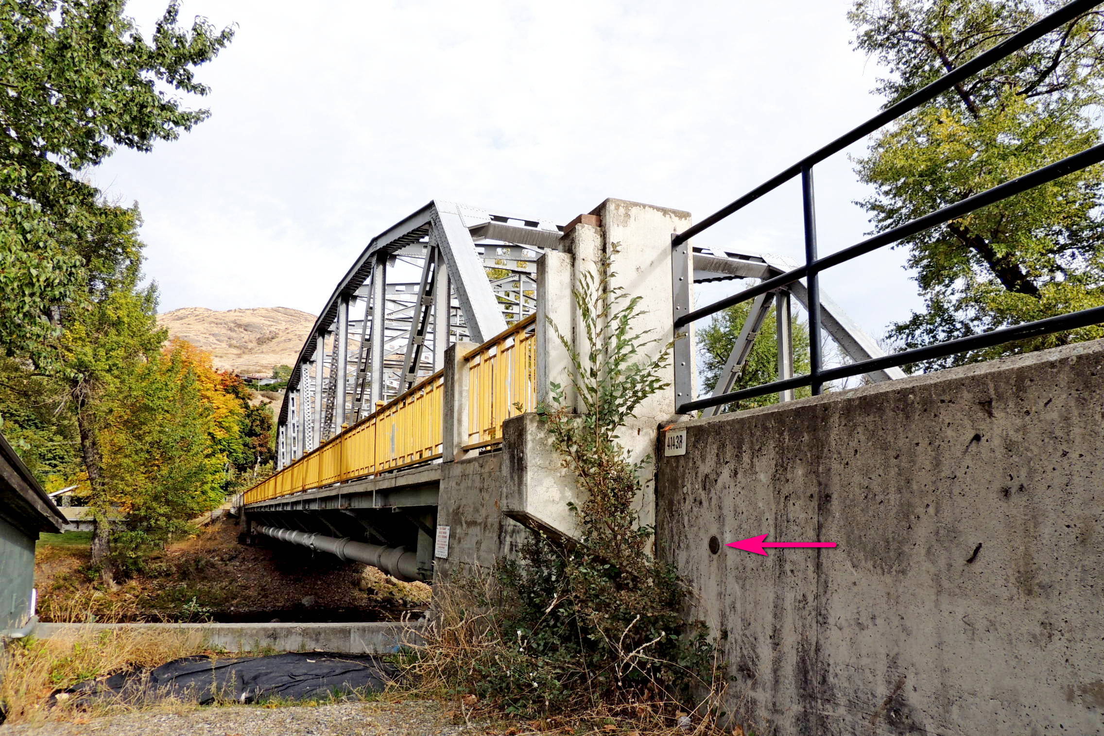
Inscribed "British Columbia Legal Survey No. 04" about the perimeter and "2006" and "D.C.L." within, this brass disc appears to be a survey marker, but not one which demarcates a specific plot of land.
Mounted about 2 feet below the top of a vertical concrete retaining wall along the north side of Highway 3, AKA the Crowsnest Highway, the marker is about 2 feet west of the concrete post marking the northwest corner of the Yale Bridge, which spans the Granby River at the eastern edge of downtown Grand Forks.
At one time the Granby was known as the North Fork of the Kettle River, its name being changed in honor of the Granby Consolidated Mining, Smelting & Power, Co. Ltd. copper smelter, which came into operation in 1900, the first train load of ore reaching the smelter on July 11 of that year. The smelter operated along the Granby River less than 2 miles north of this point until its closure, primarily due to falling copper prices, in 1919. The bridge immediately east of this retaining wall, and this survey marker, was at least the third road bridge to be built across the Granby at Grand Forks. The first, built prior to 1900, was a wooden truss bridge a block south of this bridge. Known as the Yale Bridge, this steel truss bridge was completed in 1957.