36U2321 - Gogama, ON
Posted by: Groundspeak Regular Member 13acres
N 47° 40.200 W 081° 42.662
17T E 446622 N 5279868
A bronze disk stamped 36U2321 mounted in a rock mass.
Waymark Code: WM12WQQ
Location: Ontario, Canada
Date Posted: 07/27/2020
Published By:Groundspeak Regular Member Bon Echo
Views: 2

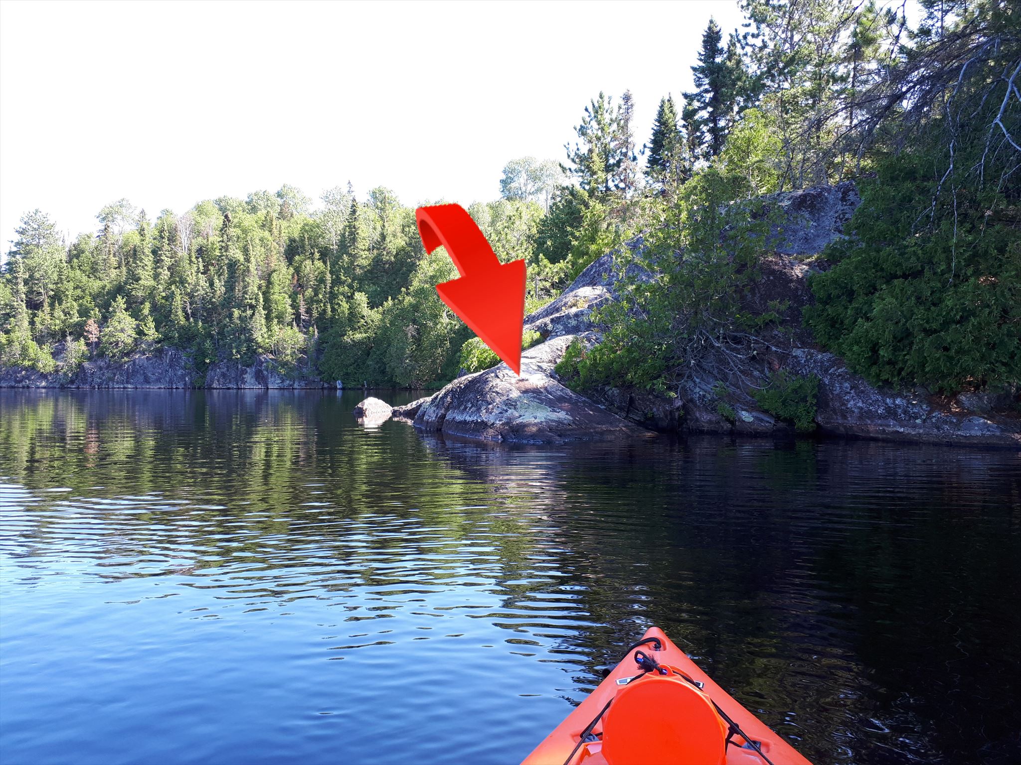
A Geodetic Survey of Canada Marker from 1936 mounted in the rock shoreline of Lake Minisinakwa. The stone cairn that the description mentions is long gone but the monument remains. This is one of the largest disks I have come across so far and measures in at approximatly 75mm in diameter.

Access

Make your way to the end of Poupore Street in the town of Gogama, Ontario. At the end of the road there is a public boat launch and parking at N47° 40.242 W081° 43.170. A quick 700m paddle will get you to the location of the monument.

Report

The latest vertical data has the elevation at 349.576m

Click here for the report

Unique Designation: 0011936U2321

Marker Type: Vertical Control Disk

Condition: Slightly Damaged

Visit Instructions:
To post a log for any benchmark, a photo will be required. When visiting any site please respect any private property rights that may exist. Given the number and age of the benchmarks, they may not be all accessible or even exist at this time.
Search for...
Geocaching.com Google Map
Google Maps
MapQuest
Bing Maps
Nearest Waymarks
Nearest Canadian Benchmarks
Nearest Geocaches
Create a scavenger hunt using this waymark as the center point
Recent Visits/Logs:
There are no logs for this waymark yet.