Bridge Street Bridge - 1940 - Sackville, NB
Posted by:  T0SHEA
N 45° 53.532 W 064° 20.837
20T E 395474 N 5082952
It was likely the construction of the Trans Canada Highway which but this bridge out of business.
Waymark Code: WMZT9H
Location: New Brunswick, Canada
Date Posted: 01/01/2019
Views: 0
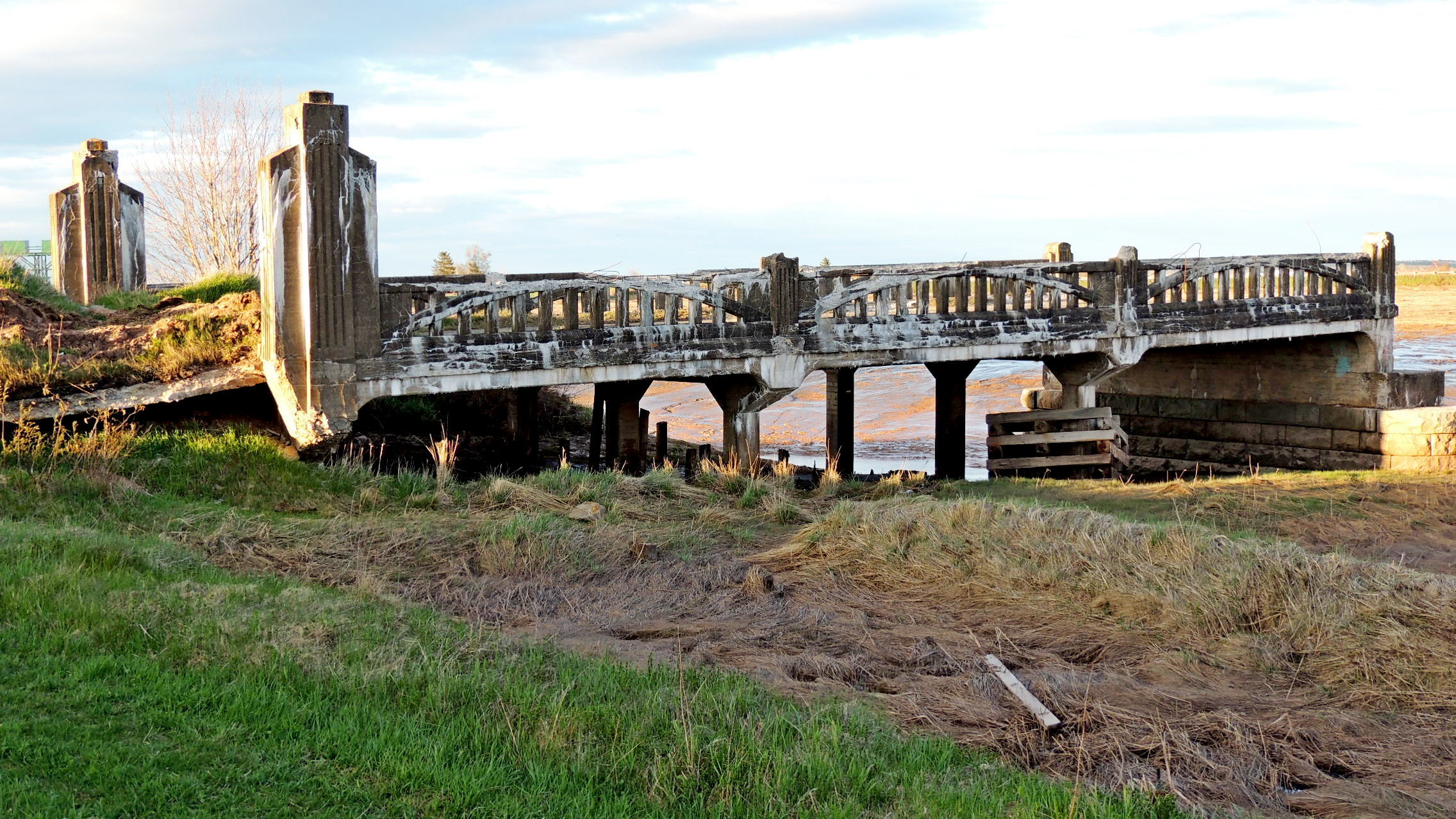
Beginning in 1940 this bridge carried highway traffic over the Tantramar River just south of Sackville. In November of 1968 the Nova Scotia portion of the Trans Canada Highway was officially opened and this route, Highway 106, was no longer necessary. The New Brunswick-Nova Scotia border is about 10 kilometres south of the bridge.
The two ends of the bridge remain in place, but the centre section is now long gone. Dated 1940, the bridge ends, at least, were built of reinforced concrete, with concrete railings and end posts, which exhibit a bit of Art Deco styling. To prevent wayward motorists from driving off the remaining bit of bridge into the river, earth has been piled at the bridge, making passage pretty difficult, but we suspect not impossible for the truly determined.
Prior to the 1940 bridge three covered bridges stood on this spot, built in 1840, 1856 and 1902-03.