Hiwassee Culvert - Arcadia, OK
Posted by:  hamquilter
N 35° 40.274 W 097° 18.039
14S E 653798 N 3948814
This culvert transports low point run-off of water across Hiwassee Road.
Waymark Code: WMXR1T
Location: Oklahoma, United States
Date Posted: 02/17/2018
Views: 0
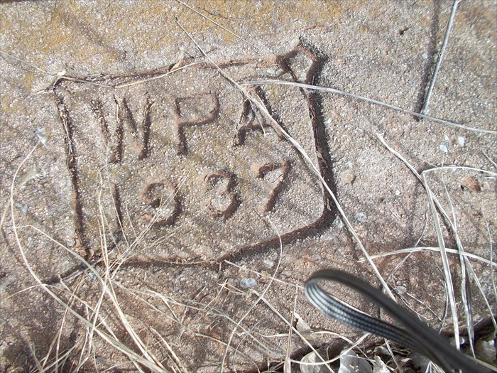
The word Hiwassee is a Cherokee word for "savanna" or "large meadow". The area east of the town of Arcadia is such a place. This culvert is located about one-quarter mile north of Route 66 on Hiwassee Road, at the crossing of a small unnamed creek.
The culvert flows east-west and is constructed of reinforced concrete, with the tunnel being approximately three feet by five feet. On each side of the road above the culvert opening a concrete curbing is stamped "WPA 1937". At the time of our visit, this area of Oklahoma has been in a five-month drought and there is no water to be seen near this culvert today. The website shown below contains a full report of New Deal road work in Oklahoma.