
Mount Warning, NSW, Australia
S 28° 23.876 E 153° 16.300
56J E 526612 N 6858685
This is a very iconic and recognisable peak in the Murwillumbah Caldera.
While it is 'only' a 4.4 km walk from the car park to the peak, and even though there is formed track for 98% of the walk, expect to take a couple of hours up.
Waymark Code: WMTQ8E
Location: New South Wales, Australia
Date Posted: 12/28/2016
Views: 4
The signposted times is 5 hours for the return trip. Personally I have done it in 1 hour and 10 minutes when I was in my late twenties, but was able to still do it in 1 hour and 25 minutes in my fifties (last year) - but that does involve some jogging on the downhill 'run'.
Don't expect great scenic views on the ascent, but rather, enjoy the rainforest environment. The views, that people have died for, are AT THE TOP.
WARNING: ABC News Report
Be aware that camping at the top (just so as to watch a sunrise, eg) is verboten! As even in December 2016 a couple were illegally camping there when they were struck by lightning in their tent! Only one survived.
For a good, and concise description of: the best timing for your walk, what to Bring (or NOT), weather, and cautions, see the following link: Mt. Warning Network, it also has links for nearby accommodation.
Picture 1 Top of Mount Warning.
1a From News Report
Picture 2 Wollumbin National Park car park
Picture 3 "Permanent Geographical Coordinates" Emergency helicopter point 1

Picture 1: Mount Warning, NSW: S28º 23.868' E153º 16.290'

1a, Spectacular, but potentially DEADLY lightning strike of Mount Warning

The entrance to the 4.4 km walk, Wollumbin National Park: S28º 23.886' E153º 17.102'
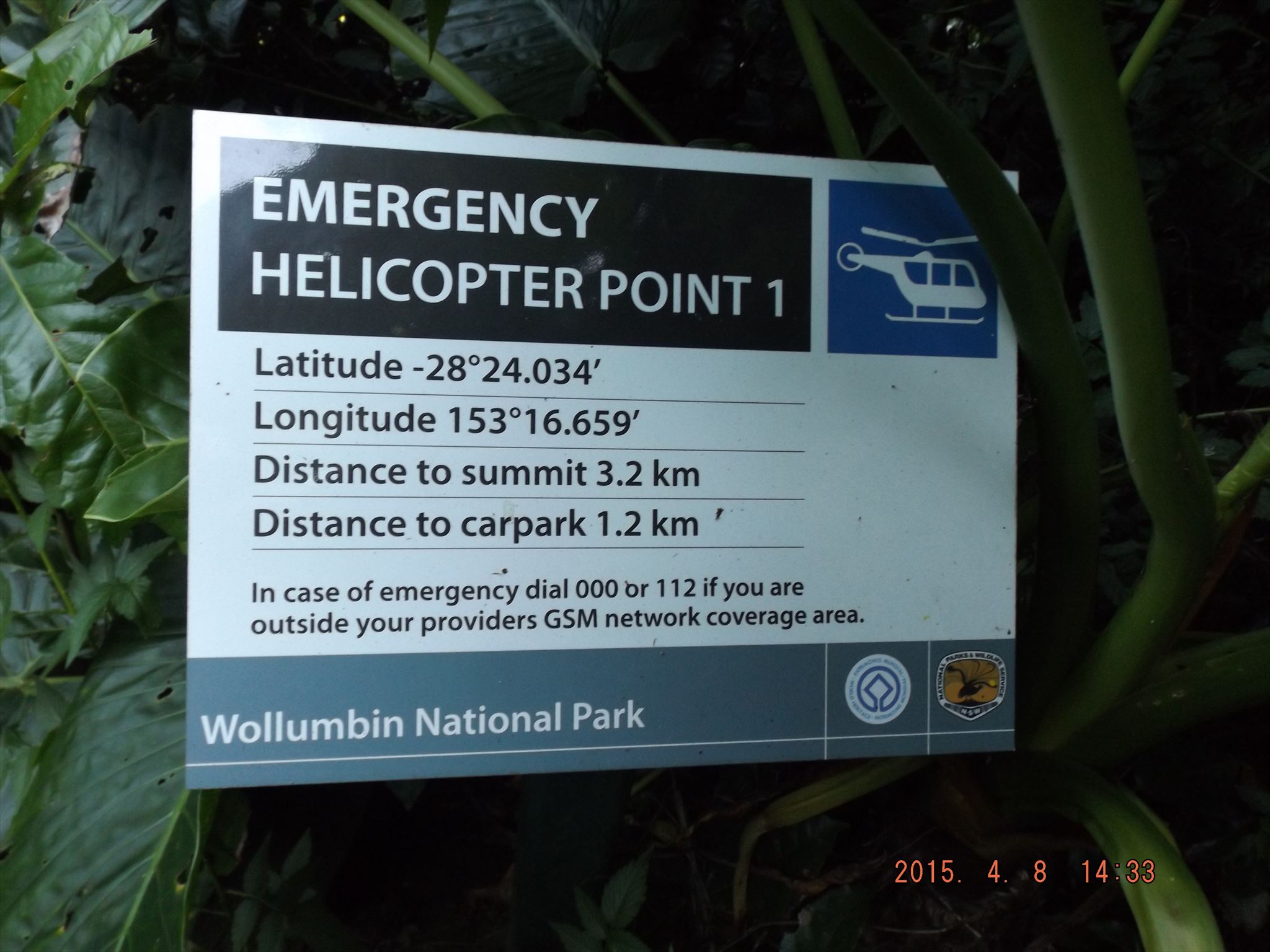
The first of the Emergency Evacuation Helicopter Extraction Points: S28º 24.034' E153º 16.659';
but don't rely on that, make sure that YOU are fit enough to climb a thousand metres of elevation difference!
At the top you will be able to look around for a "Public Land Survey Marker", a "Orientation Table", and plenty of GREAT views if it is a clear day!