|
 Midway, Come to Play, Plan to Stay - Midway, BC Posted by:  T0SHEA T0SHEA
N 49° 00.511 W 118° 46.682
11U E 369975 N 5429925
Midway between what, I can't say, but Midway is the name.
Waymark Code: WMT2TX
Location: British Columbia, Canada
Date Posted: 09/15/2016
Views: 0
Initially burdened with the somewhat unimaginative moniker of Boundary City, its name was, thankfully, changed to Midway in 1894. There was another Boundary by then, with the railway construction town of Boundary springing up on the left bank of the Columbia River, just south of the border, in 1893. It's difficult to believe that this little town once was home to 6,000 souls, but at the turn of the 20th century such was the case, with a huge mining boom being accompanied by a railway construction boom which temporarily left Midway with three railways entering the town from every direction but north.
The Town of Midway has a nice historical article about itself at its website - to whit:
In the 1800s, fur traders, prospectors and white settlers began moving through this sun-drenched valley. Until then, it had been a traditional hunting ground and place for gathering the medicinal rock rose roots.
The U.S. claimed this area and all of B.C. north to 54 degrees until the treaty of 1846 set the 49th parallel as the border. But traffic and trade followed the river valleys north and south. When gold was discovered at Rock Creek in 1859, and U.S. miners came swarming into the region, Governor Douglas saw that an east-west route through the interior was vital for maintaining British control. He dispatched an energetic young engineer named Edgar Dewdney who hacked out a four-foot-wide road from Hope to Rock Creek in 1860; then with the discovery of gold at Wild Horse Creek in the Kootenays, Dewdney again tackled the task and pushed the Dewdney Trail on through the Midway valley in the spring of 1865.
By 1884, Midway had its first resident, a Mr. Henry Nicholson, and by 1889 Louis Eholt owned a thriving ranch on what is now the townsite of Midway, known then as the Eholts. A Montreal-based company bought this site for a smelter in 1892, but that plan fell through, and a year later the townsite was plotted. The new town's original name, Boundary City, was changed in 1894 to Midway.
In 1895, the first provincial policeman was posted here and in 1897 Canada Customs arrived. In 1900, Midway became the western terminus of the Columbia and Western Railway, (a subsidiary of the CPR). A copy of the Midway Advance Newspaper of June 17, 1901 carries advertising for five hotels, a meat market, dry goods store, pharmacy, bakery, wagon and carriage builder, stationery shop, sawmill, and a stagecoach company in the burgeoning little town.
The decade following, saw feuding railroad companies, litigation, a series of railroad plans, short lived railroad ventures, and violence all centered in Midway. In November 1905, a pitched battle with shots fired was waged between CPR workers and a crew of the Vancouver, Victoria, and Eastern Railway (known as the Washington and Great Northern Railway in the U.S.) which was determined to run a line north from Spokane into Midway. Expropriation was granted the V.V. & E., and in 1905 Midway had it's second railroad. Then on July 5, 1910, the sod was turned on yet another railroad venture - the Kettle Valley Line - to link Midway to the west coast, with Andrew McCulloch as chief engineer. The first eastbound passenger train left Midway on May 31, 1915; the last passenger train on the Kettle Valley Line passed through Midway on January 17, 1964.
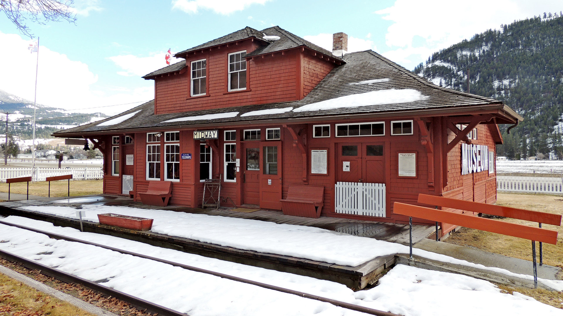
Today, although the tracks have been removed, you can still catch a glimpse of a bygone era. Stand on the original platform and imagine the hustle and bustle of the old train station, now converted into the Kettle Valley Museum.
Gold and the railroads shaped Midway's past; service industries, the lumber industry and tourism shape Midway today.
Type of community: Town

|
Visit Instructions:
More pictures of the sign would be great. Try and take a picture of yourself with it if you can!
Recent Visits/Logs:
| There are no logs for this waymark yet. |
|
|
|
|