|
 St. Croix River - St. Andrews, NB Posted by:  T0SHEA T0SHEA
N 45° 04.386 W 067° 03.183
19T E 653254 N 4992914
The historic town of St. Andrews lies at the mouth of the St. Croix River, as it empties into the Passamaquoddy Bay near the mouth of the Bay of Fundy.
Waymark Code: WMRXPW
Location: New Brunswick, Canada
Date Posted: 08/18/2016
Views: 5
Rising at the Chiputneticook Lakes (North Lake, Grand Lake, Mud Lake, and Spednic Lake), the St. Croix River forms the Canadian-U.S. border between New Brunswick and Maine. It flows for 71 miles (114 km) south, southeast into Passamaquoddy Bay. Draining an area of approximately 1,500 square miles (3,900 km2), the river has been substantially developed for hydroelectric power which has greatly reduced the population of Atlantic salmon in the river. Due to the high tides of the Bay of Fundy, the river experiences a tidal bore in its lower 16 miles (26 km). Once navigable for many miles upstream, the river was once an important transportation route into the interiors of both New Brunswick and Maine. Today it is navigable only to Calais, ME-St. Stephens, NB, as that is the location of the first hydro dam one will encounter when traveling upstream.
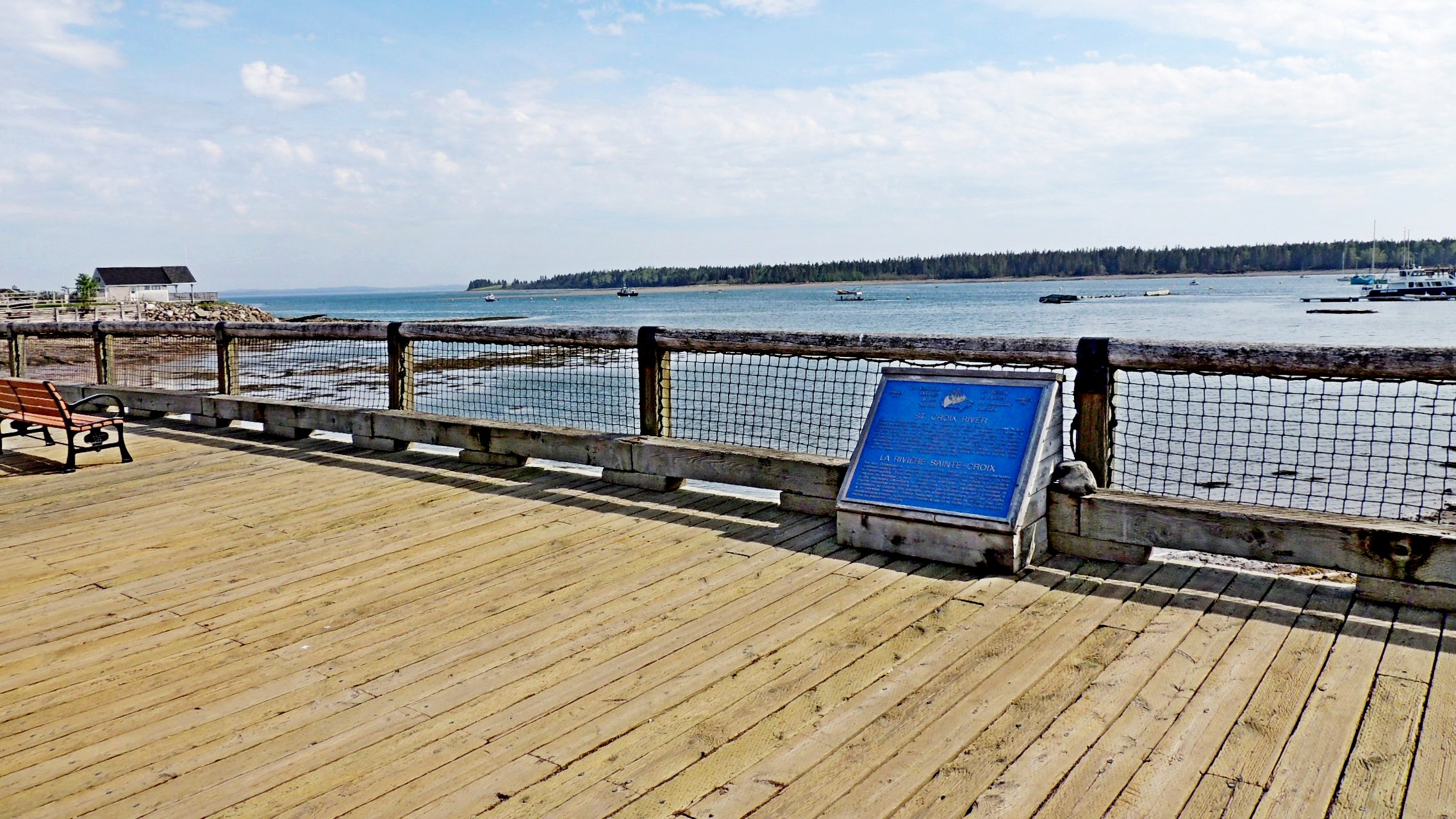
In 1993, the St. Croix became the first Canadian Heritage River in Atlantic Canada. This plaque was placed in January of 1991, in the town of St. Andrews, at the end of King Street, on a boardwalk on the waterfront.
ST. CROIX RIVER
From the Chiputneticook Lakes, the waters of the St. Croix River tumble through rolling Appalachian scenery to one of the most historic estuaries in Canada, at Passamaquoddy Bay. Here, French colonization in North America began in 1604 on St. Croix Island. The river was travelled for millennia by native fishermen and traders and as an international border, British Loyalist and others later crossed these waters to contribute to the founding of Canada. Today, the St. Croix’s scenery, historic communities and traditional recreational fishing and canoeing continue to attract many to the region. For these unique features the New Brunswick side of the St. Croix River has been proclaimed a Canadian Heritage River.
LA RIVIÈRE SAINTE-CROIX
Des lacs Chiputneticook, la rivière Sainte-Croix dévale une contrée appalachienne onduleuse jusqu’á un des estuaires les plus charges d’histoire au Canada, à la baie de Passamoquoddy. C’est dans l’ile Sainte Croix, en 1604, que débuta la colonisation française en Amérique du Nord. Pendant des millénaires, des pêcheurs autochtones et des marchands sillonnèrent la Saint-Croix. Puis,, des loyalistes britanniques et d’autres personnes traversèrent cette frontière internationale pour venir contribuer à la fondation du Canada. Ses paysage, ses villages historiques ains que la pêche et le canotage continuent d’attirer beaucoup de gens dans la région. Pour ces caractéristiques unique, la partie néo-brunswickoise de la Sainte-Croix a été désignée Rivière du patrimoine canadien.
From the Canadian Heritage Rivers Plaque
St. Croix River
Natural Heritage
The designation recognizes the St. Croix River’s representation of Atlantic Canada’s geology, its rare plant species, its bald eagle and osprey habitat, and its provincially significant fossil deposits.
Cultural Heritage
The St. Croix’s connection to thousands of years of First Nations history contributed to its designation as a Canadian Heritage River. The Passamaquoddy and other First Peoples have lived along the river for more than 4000 years.
The river’s remarkable history includes the site of the first European settlement in North America, established in 1604 on Ile de St. Croix (at the mouth of the river) by Samuel de Champlain.
The designation also recognizes the river’s association with the 19th and early 20th century lumber industry and with the development of the railways in the region.
Recreational Heritage
The St. Croix River is known as an easily accessible backcountry recreational experience for paddlers and fishermen of all abilities. Campsites are found all along the length of the river.
The river marks the international boundary between New Brunswick and the State of Maine in the USA. Since 2001, the one-country camping system has been in place, requiring paddlers to make landfall only in the country in which they will begin and end their journey. Paddlers are advised to familiarize themselves with Canadian and US marine reporting requirements prior to beginning a trip.
Who Manages the River?
The river is managed by the St. Croix International Waterway Commission (SCIWC) (LINK), which receives support from the Province of New Brunswick. The SCIWC manages the waterway via an internationally agreed management plan.
Fun Fact:
The rich history of the lumber industry on the river is told in the names of campsites and the “rips” – logs and rings that still linger on the riverbed. Keen-eyed travellers can spot the original surveyor’s posts that mark the Canadian-American boundary.
From Canadian Heritage River Systems
WILD: no

Number of WILD miles: 0
SCENIC: yes
Number of SCENIC miles: All
RECREATIONAL: yes
Number of RECREATIONAL miles: All
River Link: [Web Link]
Support documentation: Not listed
|
Visit Instructions:
To log a visit to a Waymark in this category, please provide at least one additional original photograph and tell us about your visit.
|