Vaseux Creek Bridge, Highway 97 - 1955 - Oliver, BC
Posted by:  T0SHEA
N 49° 14.720 W 119° 31.491
11U E 316243 N 5457796
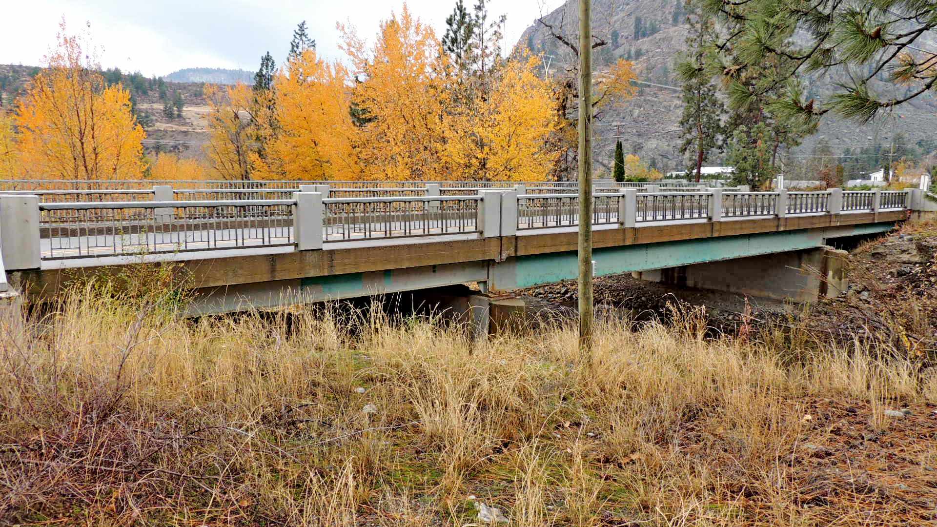
This bridge crosses Vaseux Creek north of Oliver and about 3 kilometres south of Vaseux Lake.
Waymark Code: WMQ3J3
Location: British Columbia, Canada
Date Posted: 12/12/2015
Views: 2
The steel girder bridge was built in 1955 at the time that the highway was being upgraded. As with many of the bridges built by the British Columbia Department of Highways, the date is stamped in the right hand wing wall on each end of the bridge. Just behind the southeast wing wall on this bridge is a benchmark, 82C818, monumented on the bridge seat below.
Two lanes wide, the bridge is about 150 feet long, supported by a pair of concrete piers, one on each bank of the creek.
It's possible to park just off the southeast corner of the bridge.