|
 Pilgrim Creek Park - Noxon, MT Posted by:  T0SHEA T0SHEA
N 47° 59.554 W 115° 46.061
11T E 591937 N 5316208
A joint project of Avista Utilities and the village of Noxon, this is the larger of a pair of parks in Noxon.
Waymark Code: WMMWY3
Location: Montana, United States
Date Posted: 11/16/2014
Views: 2
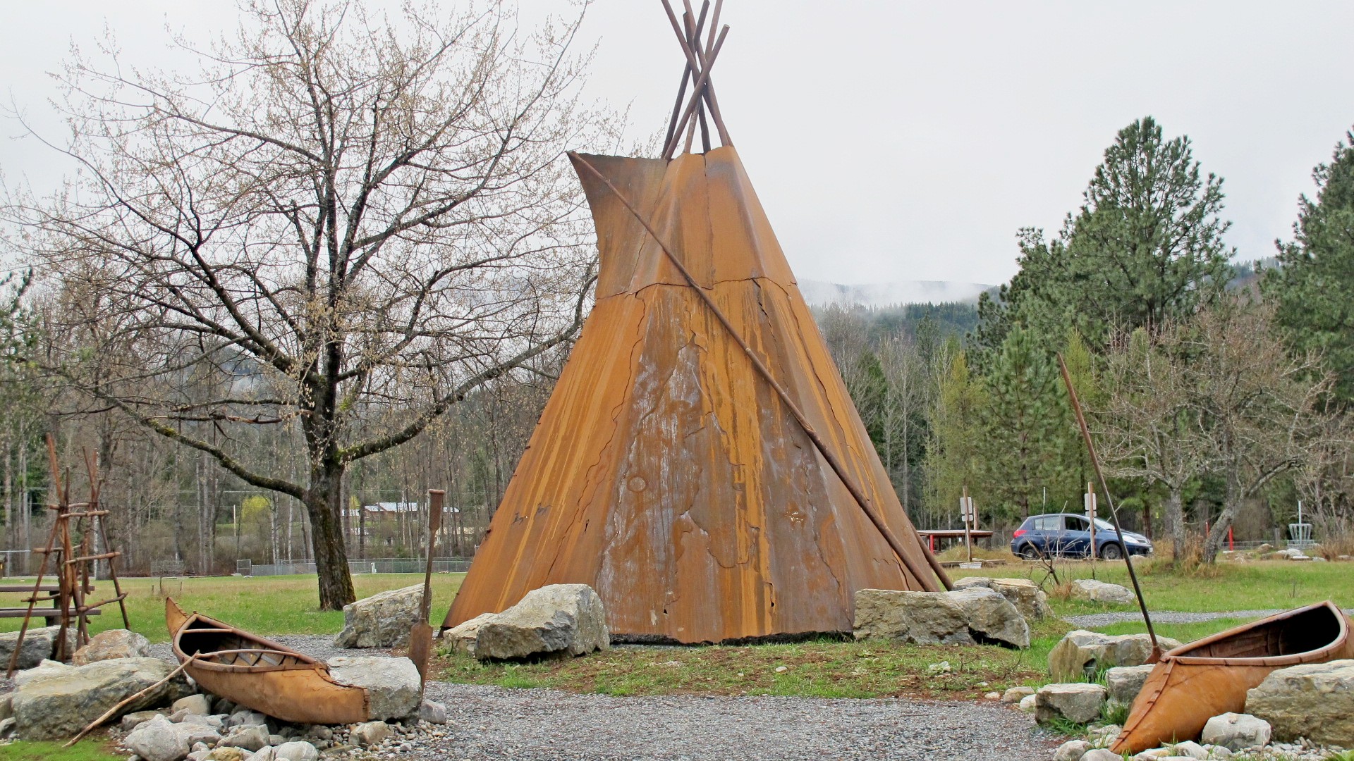
This is a nice, well developed park on the south (left) bank of the Clark Fork River at the eastern edge of the village. It has many mature trees, a pair of baseball diamonds, open grassed areas, picnic areas, washrooms in the centre of the park, a picnic pavilion, a children's playground, benches, picnic tables and a simulated Indian encampment by the river bank.
This display is made of sheet steel and is comprised of a teepee, a pair of canoes and a meat/fish drying rack near the teepee. It's intended to appear as a single family's encampment by the river, sojourning to catch and dry fish for the winter ahead.
Name: Pilgrim Creek Park

Street Location: Klakken Road, Noxon, MT
Local Municipality: Village if Noxon
State/Province, etc.: Montana
Country: USA
Picnic Facilities: tables, pavillion
Recreational Facilities:
Fishing. baseball
Art (murals/sculpture, etc.): Indian Encanpment
Ponds/Lakes/Streams/Rivers/Beach: Clark Fork River
Web Site: Not listed
Memorial/Commemoration: Not listed
Date Established: Not listed
Monuments/Statues: Not listed
Fountains: Not listed
Special Events: Not listed
Traditional Geocaches: Not listed
|
Visit Instructions:
One photo of the park that is a different view from the one on the page, and give the date and description your visit.
Add any additional information that you may have about this park. A GPSr photo is NOT required.
Recent Visits/Logs:
| There are no logs for this waymark yet. |
|
|
|
|