 Watford is the terminus of the Watford branch of London Underground's Metropolitan line in the north-western part of the network in Zone 7, previously Zone A. The station opened in 1925. It is scheduled to close in 2016.
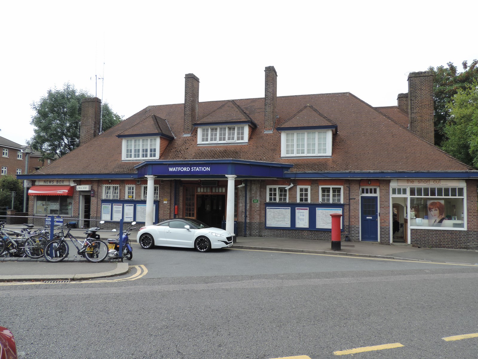
The station is on Cassiobury Park Avenue at the junction with Metropolitan Station Approach, in the Cassiobury area, close to two of the entrances to Cassiobury Park. It is approximately 1 mile (1.6 km) from the town centre, which is more immediately served by Watford High Street and Watford Junction stations. It is known locally as "Watford Met" to distinguish it from the other Watford stations.
The station building was designed by the Metropolitan Railway's architect Charles Walter Clark in an Arts and Crafts vernacular style. It is in red brick with a clay-tiled hipped roof, tall brick chimney stacks, and timber sash and casement windows. The main entrance is covered by a polygonal metal canopy supported by twin Doric columns, and the interior, mostly unaltered from the original, is decorated with period tiling and hardwood panelling.
On 2010 data it is the 25th most lightly-used station on the London Underground.
 In the early 20th century, the Metropolitan Railway (MR) penetrated Hertfordshire and Buckinghamshire with its suburban railway, enticing Londoners with its "Metro-Land" advertising campaign promoting the new railway as an opportunity to live in a rural location with easy transport to central London. The MR was also intent on providing a connection from Watford and planned a branch line from Moor Park via Croxley. The MR purchased a swathe of land from Gonville and Caius College, Cambridge along the planned route and Parliamentary approval for the branch was granted in 1912. The project was hampered by disagreements with the Watford Borough Council and by the outbreak of World War I in 1914, and construction of the 2.5-mile (4.0 km) branch did not begin until 1923. The MR experienced difficulties running the line across the River Gade and the Grand Junction Canal, and this pushed costs up to £300,000.
Watford Met station opened on 4 November 1925, with MR electric trains to Baker Street and LNER steam trains to Marylebone for the first few months. The Watford Observer commented on the opening that the new station was "likely to have a much greater effect on the town than is at present realised. Just as trade follows the flag, so population follows the railway". Posters published by the MR in 1925 promoting the new route "by Metro to Watford" depicted Watford High Street on market day, belying the remote location of the station.
 The station suffered from its distance from the town centre. For many years, the MR operated a bus service from the High Street in an effort to gain more passengers, but contrary to the Watford Observer's predictions patronage remained low. MR passenger numbers compared unfavourably with services into central London offered by the LMS and the UERL Bakerloo line from Watford Junction and Watford High Street, and after the General Strike of 1926 the LNER pulled out of the venture with the MR.
Watford tube station was not originally planned to be the terminus of the Watford branch. The MR had intended to drive the railway across Watford to terminate at Watford Central, and to facilitate this project purchased a property at 44 Watford High Street in 1927 with the intention of converting it into a station. Their ambition to drive a tunnel under Cassiobury Park, recently purchased by the borough council from the Earl of Essex, was opposed by local politicians. The scheme fell through and today Watford Met station remains the terminus of the line, approximately 1 mile (1.6 km) from the town centre.
 When Travelcard zones were introduced in 1984 by London Regional Transport, the station was in Zone B; in 2004 it moved to Zone A, in 2008 to Zone 7.
The ambition to extend the Metropolitan line into Watford town centre was revived around 1994 by London Regional Transport (LRT) when proposals were put forward to run the line to Watford Junction. The projected route is shown on an adapted version of the Tube map for internal planning purposes printed in that year. The Croxley Rail Link involves connecting the Metropolitan line to the disused Watford and Rickmansworth Railway line and reinstating the Croxley Green branch to Watford High Street. The line, opened in 1912, had been closed by British Rail in 1996 due to low passenger numbers. Although it ran very close to the Metropolitan line (at its closest point about 200 metres away), the two lines were never linked. The Croxley Rail Link includes a short viaduct linking the two lines.
On 14 December 2011 the project was given approval by the Department for Transport at an expected cost of £115.9m and with a completion date of January 2016. On 24 July 2013 the Secretary of State for Transport issued a Transport and Works Act Order granting the necessary planning permissions, access rights and land transfers.
 As a result of the Croxley Rail Link project, Watford Met station will close to passengers but may remain operational as a siding. The plan to close the station has been the subject of some local opposition, and campaigners have argued for the station to remain open with a reduced shuttle service operating on the branch. In 2012 the transport watchdog London TravelWatch compiled a report on the closure plans which concluded that inconvenience to passengers would be alleviated by the new stations being opened in the area, and that a small number of existing passengers would experience an increase in journey times of more than 15 minutes. It recommended that a shuttle train service should be trialled, and that in the event of closure a bus service should be provided from Cassiobury to one of the new stations to mitigate any inconvenience.
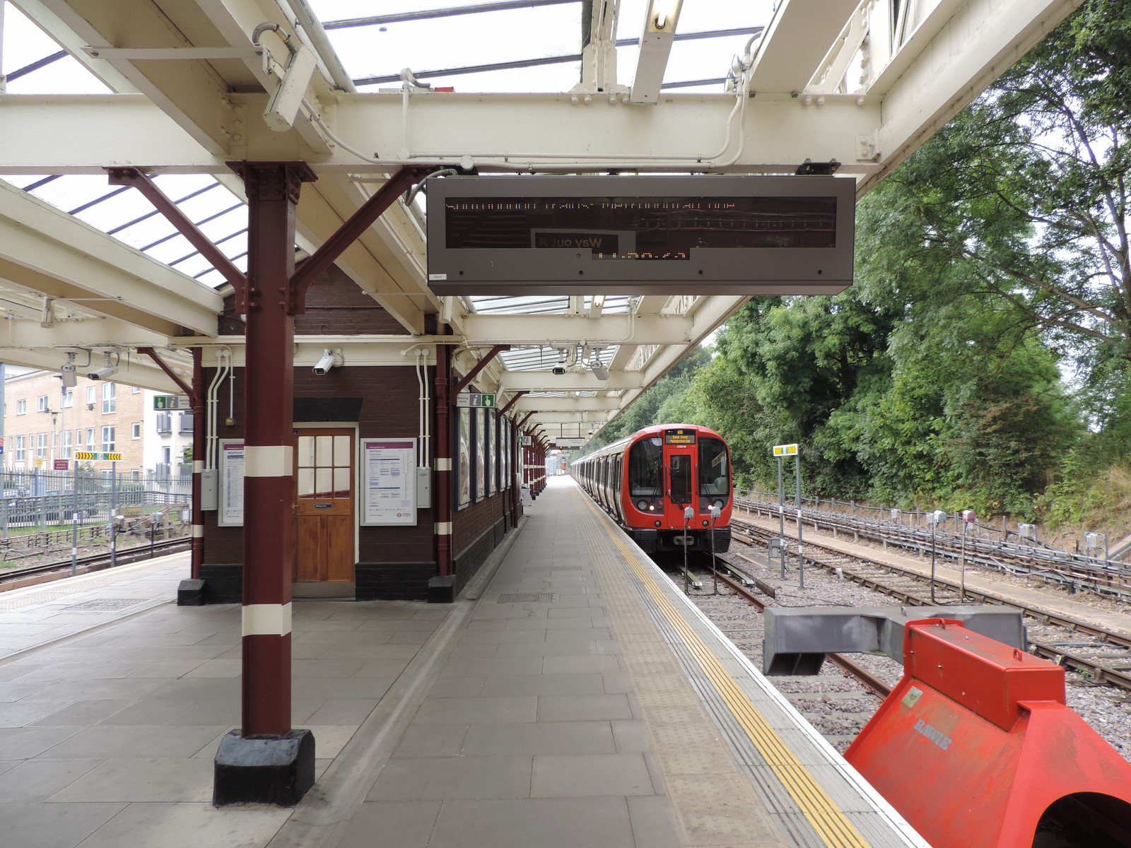
As of December 2011 the typical off-peak service is four trains per hour to Baker Street off-peak, with a limited service to Aldgate at peak times.